
When accompanied by a considerable amount of rainfall, ignition of wildfire by lightning over forested land may not be detected until days later.
remote sensing
Posted inEditors' Vox
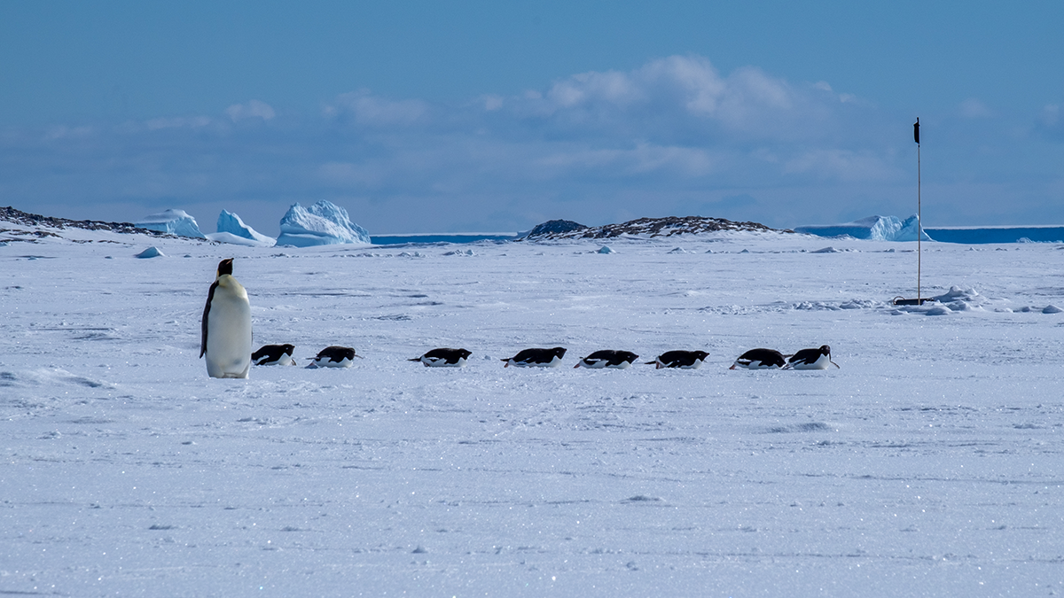
Landfast Sea Ice: The Most Important Ice You’ve Never Heard Of
Landfast sea ice, sea ice that is held stationary against the Antarctic continent, links firmly with many key climate processes, but its importance is only being fully realized as its extent dwindles.

Posted inNews
Rare Granite Body Discovered on Moon’s Farside
The granite couldn’t have formed the same way that it does on Earth—with liquid water and plate tectonics. So how did it get there?
Posted inEditors' Highlights
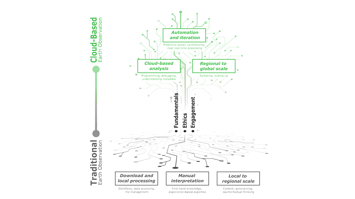
Education Lies Beneath the Clouds of Earth Observation
Cloud-based Earth Observation offers unique opportunities for education, but leveraging this requires new teaching methods that emphasize technical fundamentals, ethics, and stakeholder engagement.

Posted inNews
Where Does Fire Retardant Fall in a Forest? Ask a Satellite
Knowing where fire retardant lands once it’s dropped from a plane is hard to pin down. A new remote sensing approach offers clues.

Posted inFeatures
Hunting Hurricanes
NOAA’s Hurricane Hunters risk their lives each time they fly into the eye of a storm to collect crucial data for forecasting, hurricane modeling, and research.

Posted inOpinions
We Need a Better Way to Share Earth Observations
A more accessible, open data-sharing infrastructure will engage a broader community of contributors, helping to develop satellite data products that benefit Earth science research and applications.
Posted inEditors' Highlights
Updated Reference Standard for Total Solar Irradiance
Version 2 of the Total and Spectral Solar Irradiance Sensor-1 Hybrid Solar Reference Spectrum captures a spectral resolution spanning 0.115-200 micrometers and integrates nearly 100% of the TSI energy.
Posted inEditors' Highlights
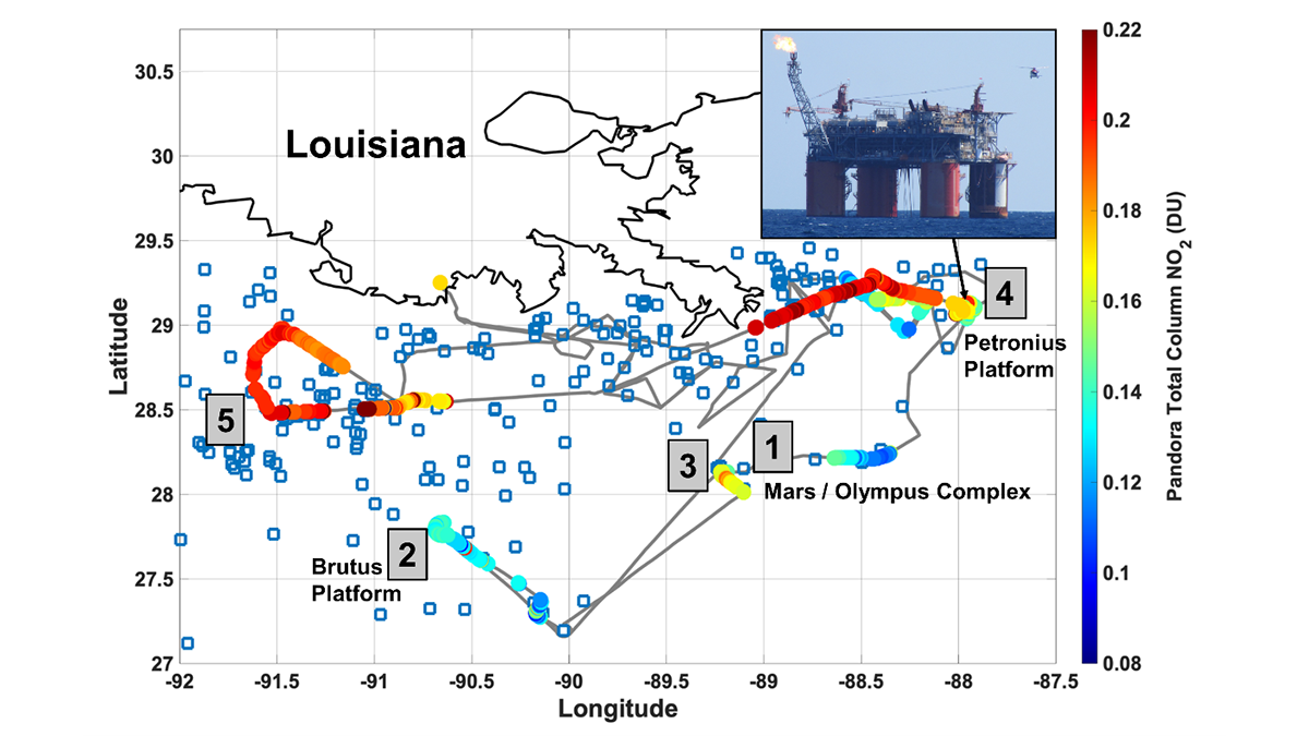
Remote Sensors See NO2 ‘Hot Spots’ from Offshore Oil Activity
Satellites can see NO2 pollution from space, but can they detect individual oil and natural gas operations, and are the measurements accurate?
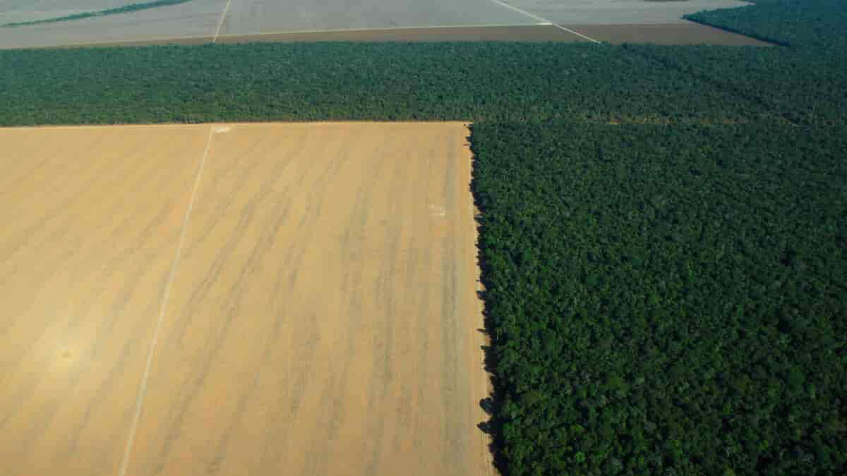
Posted inNews
Tracking Land Use and Deforestation in the Amazon
A new study mapped 2 decades of deforestation in the Amazon and concluded that some types of land management are more effective than others.