
The AI-based monitoring method may unlock data that could improve shipping safety and climate predictions.
remote sensing

Posted inNews
Monitoring Moisture from Afar
Undisturbed tropical rain forests are experiencing more frequent droughts, but the ecosystems are isolated and difficult to assess. Scientists are using remote sensing to expand the depth and scope of monitoring efforts.
Posted inNews
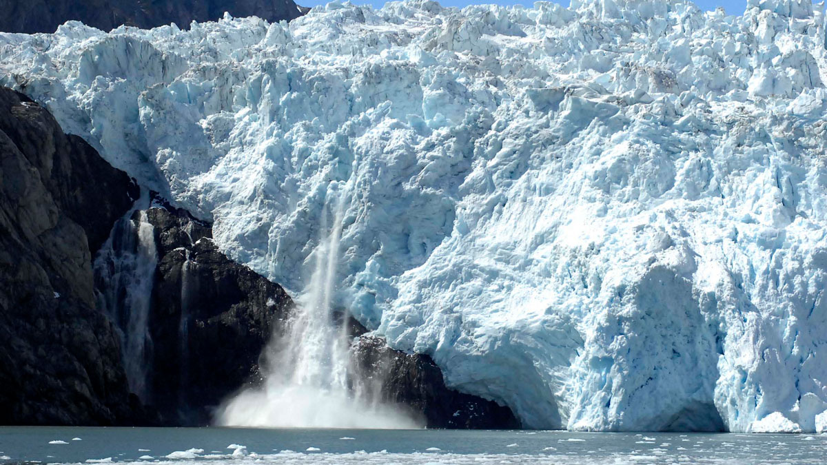
Alaskan Glaciers Advance and Retreat in Satellite Imagery
Researchers tracked 19 maritime glaciers in Kenai Fjords National Park over several decades and found that tidewater glaciers tended to experience less ice loss than other types of glaciers.

Posted inFeatures
Seeing Through Turbulence to Track Oil Spills in the Ocean
After oil and tar washed up on eastern Mediterranean beaches in 2021, scientists devised a way to trace the pollution back to its sources using satellite imagery and mathematics.

Posted inFeatures
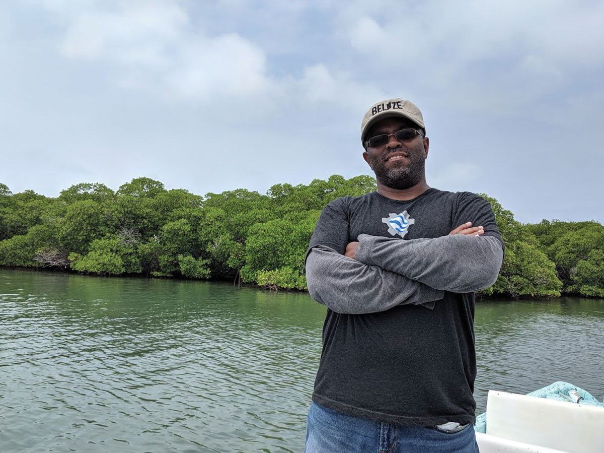
Jacqueline Campbell: Studying Oceans from Above
Planetary scientist studies oceans with a combination of laboratory work and satellite imagery.
Posted inFeatures
Emil Cherrington: Bringing Satellite Data Down to Earth
Showing how eyes in the sky can help people on the ground.
Posted inEditors' Highlights
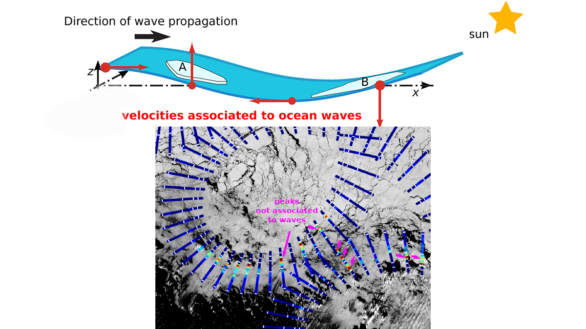
Satellites Remotely Measure Ocean Waves and Sea Ice Interactions
A new method for using satellite observations from multiple sensors improves measurements of ocean waves as they propagate through and interact with sea ice.
Posted inEditors' Vox
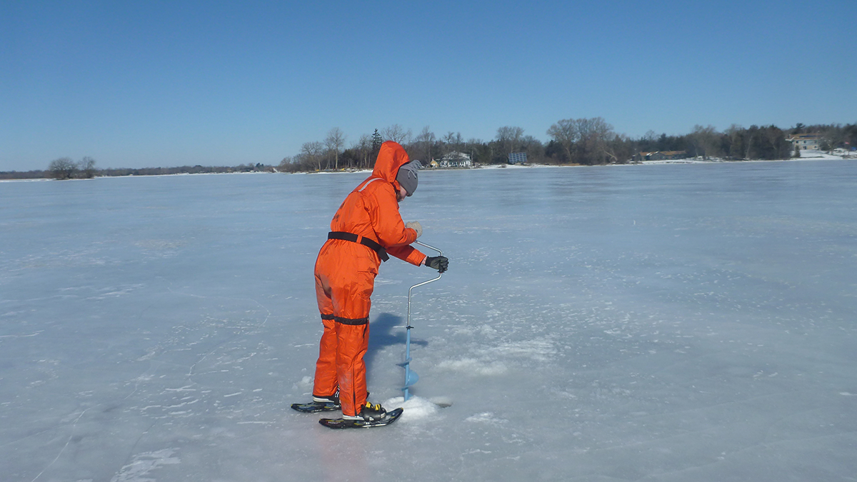
A Future Without Ice Cover
Winter is fading away, but the answers may be beneath the ice; a new collection on winter limnology tackles the unknowns.
Posted inEditors' Vox
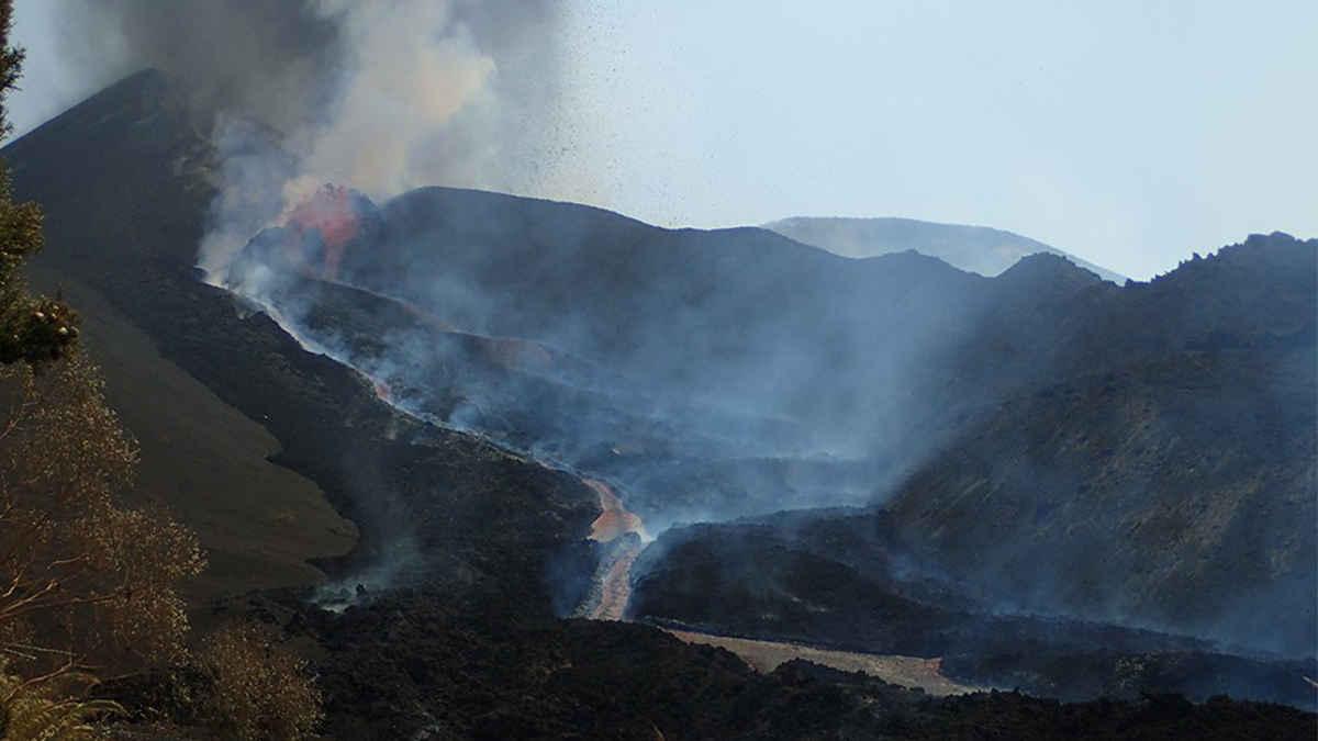
Dynamics of Volcanic Processes
A new cross-journal special collection invites contributions on modern approaches used to investigate dynamics of volcanic processes.
Posted inNews
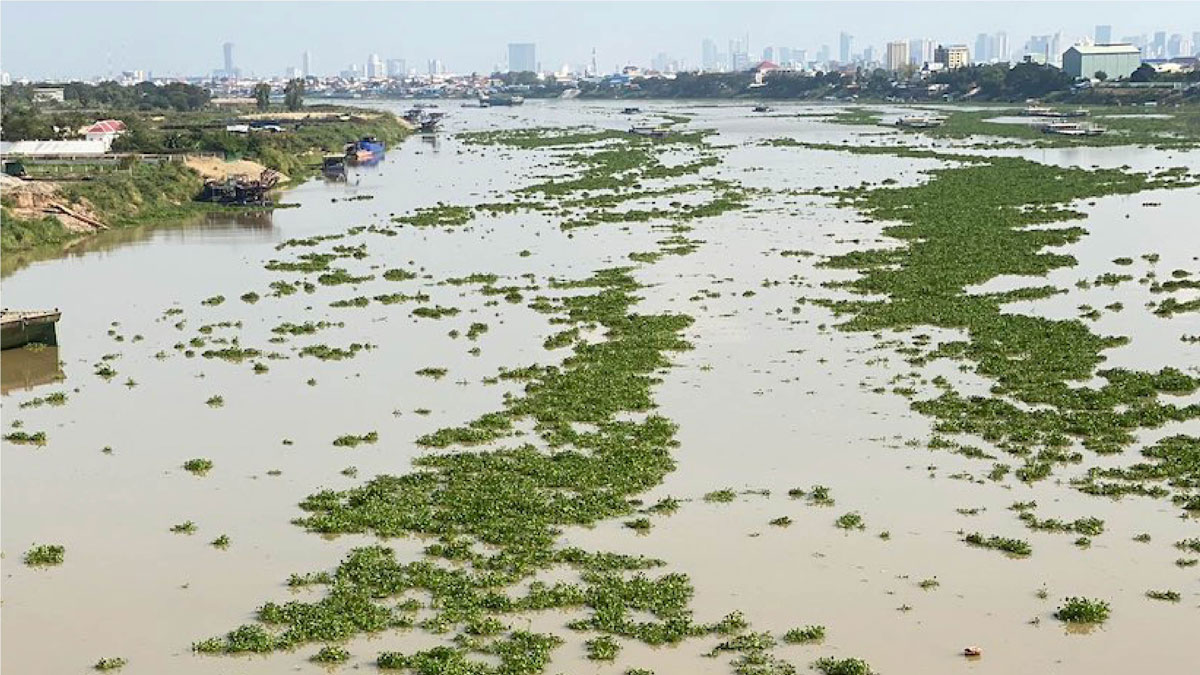
Remote Sensing Tracks Down “Plastic Plants” in Rivers
Researchers are using remote sensing to track floating mats of plastic trapped in water hyacinth plants.