Plastics can be retained in river systems for years and even centuries, but compared to marine debris, the amount of plastic pollution in rivers has been poorly quantified. There’s a reported lack of consistent and long-term observations of plastics in freshwater settings. Plus, the movement of plastics in waterways can be very dynamic and varied, and gathering reliable data about abundance and transport is crucial to supporting pollution prevention.
At the European Geosciences Union’s (EGU) General Assembly this year, a team of international scientists showed how remote sensing could be used to monitor plastic pollution in aquatic settings. They identified plastic-laden hyacinths in satellite imagery from the European Space Agency to quantify the amount of plastic pollution in the Saigon River near Ho Chi Minh City, Vietnam.
A Remote Sensing Solution
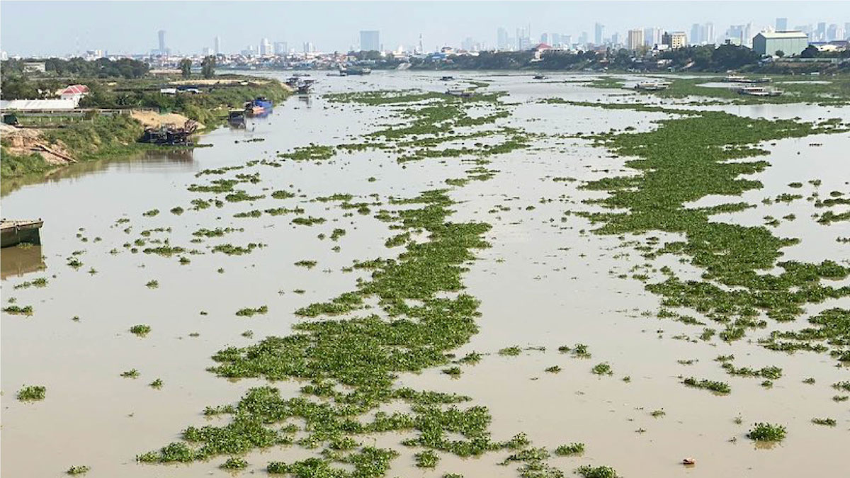
Water hyacinths are mats of tropical foliage with purple and white flowers that float in freshwater environments like rivers and lakes. Although these plants are pretty, they are invasive to the Saigon River, and plastics get caught in the foliage. These plastic-laden patches can grow large enough to be seen from space, which the researchers used to their advantage. To differentiate between vegetation and plastic debris, they analyzed the optical data using computational image processing techniques.
“Such indirect detection approaches…are of great importance to understand and quantify the pathways of plastic litter.”
“Such indirect detection approaches…are of great importance to understand and quantify the pathways of plastic litter,” said Mathias Bochow, an environmental scientist atGFZ German Research Centre for Geosciences and one of the authors of the new work.
The team estimated around 210,000 plastic objects per square kilometer along the Saigon River. The actual figure is likely to be higher because the image resolution offered by the satellites leaves smaller plastics undetected in the foliage. Even so, the case study highlights that water hyacinths can be a viable proxy for detecting large plastics in polluted rivers, the researchers say.
Keeping Up with Floating Plastics
In addition to quantifying the amount of plastic debris in the Saigon River, the scientists also shed light on the dynamics of the plastic’s transport, discovering that more plastic moved downstream in the dry season compared to the wet season. According to coauthor Louise Schreyers, a Ph.D. candidate at Wageningen University in the Netherlands, “flow, tidal dynamics, and wind influence the propagation of these floating debris at the water surface. Remote sensing could help in overcoming this because space-borne observations cover a much larger geographical area than field surveys, and observations can be repeated over time.”
“There is not one remote sensing sensor or method that can monitor all kinds of plastic pollution in all environments. Instead, we need to tune remote sensing applications to specific situations.”
Thanks to remote sensing, which can cover isolated areas and operate at vast scales, researchers can track the journey of floating plastics across an entire river system, allowing us to better understand the movement and distribution of plastics in rivers and other waterways. “There is not one remote sensing sensor or method that can monitor all kinds of plastic pollution in all environments. Instead, we need to tune remote sensing applications to specific situations,” said Lonneke Goddijn-Murphy, an expert in marine optics and physics and research fellow at the University of the Highlands and Islands, Scotland, who was not involved in the recent study.
In the future, further advancements in remote sensing and satellite technologies will be needed to learn more about “plastic plants” and the global pollution problem, so that more trash can be cleaned up, the authors say.
—Clarissa Wright (@ClarissaWrights), Science Writer