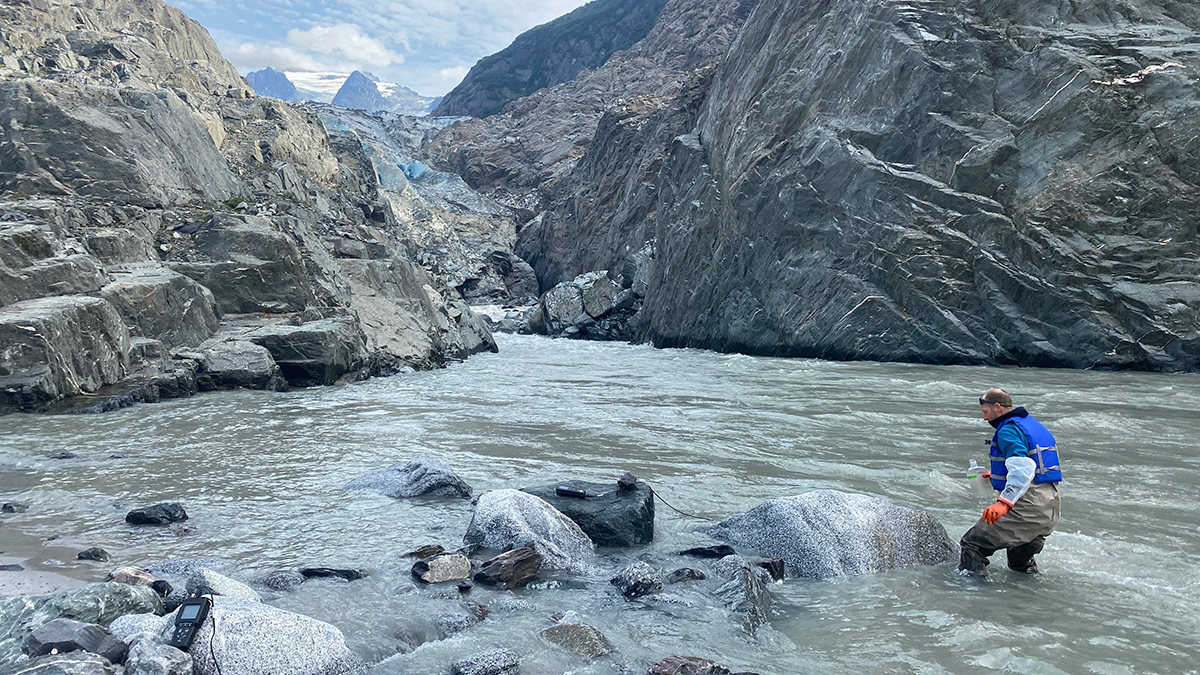
A new study catalogs how dissolved inorganic carbon moves through southeast Alaska’s waterways.
Alaska
Posted inEditors' Highlights
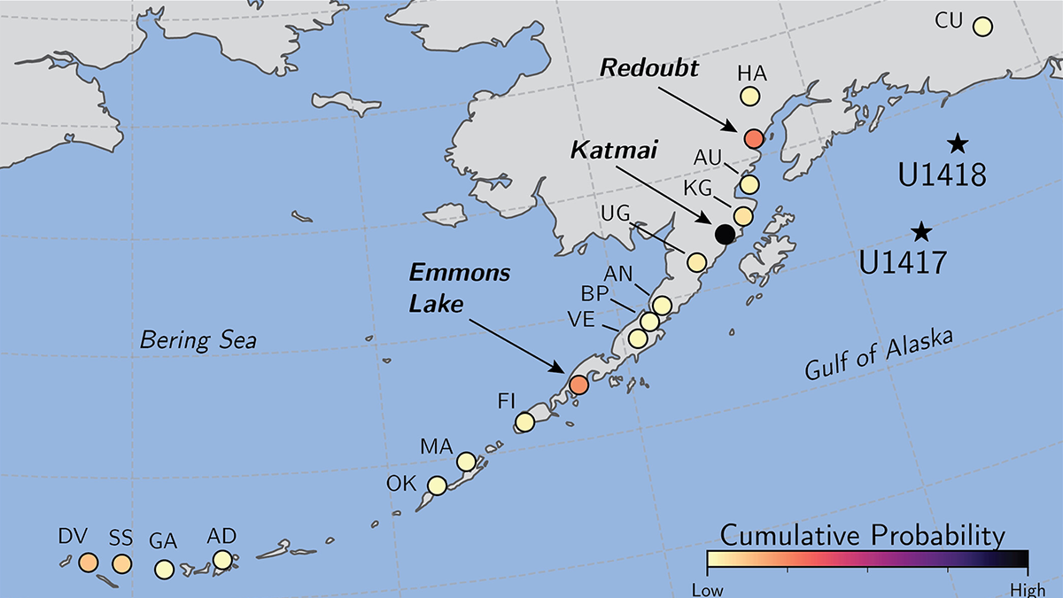
Machine Learning Identifies Source Volcanoes of Ash Deposits
Tracing ash layers from explosive eruptions back to their source volcanoes is needed to evaluate hazards to population and aviation, a problem addressed by a new machine learning classification method.

Posted inENGAGE, News
Protein Powder Makes Ice Crystals Flower
Dust from Alaska is particularly effective at forming ice crystals because it contains biological components, researchers believe. The finding has implications for cloud physics and our planet’s climate.
Posted inFeatures
Как необычная дружба разрушила мифы о вечной мерзлоте
“Прекрасные долгие споры” между американским ученым и российским исследователем помогли прояснить несколько фундаментальных предположений о таянии вечной мерзлоты.

Posted inEditors' Highlights
Northern Ecosystems are Shaped by Snow
Changing climate in the Arctic leads to a shorter snow season but deeper snow in the depths of winter. Under the insulating snow, biological processes are accelerated leading to higher nutrient availability and carbon losses.
Posted inEditors' Vox
Landfast Sea Ice: The Most Important Ice You’ve Never Heard Of
Landfast sea ice, sea ice that is held stationary against the Antarctic continent, links firmly with many key climate processes, but its importance is only being fully realized as its extent dwindles.

Posted inResearch Spotlights
Beavers Are Remaking Microbial Ecosystems in the Arctic
As beavers expand their range northward into the Arctic tundra, changes in bacterial, archaeal, and fungal communities appear to be following.

Posted inEditors' Highlights
Frozen Riverbanks May Erode Faster in a Warming Arctic
Frozen flume experiments reveal the sensitivity of permafrost riverbank erosion to water temperature, bank roughness, and pore-ice content.

Posted inFeatures
Hig Higman: Trekking Across the Last Frontier on the Hunt for Geohazards
Higman specializes in human-powered research expeditions in Alaska’s epic landscape.
Posted inEditors' Highlights
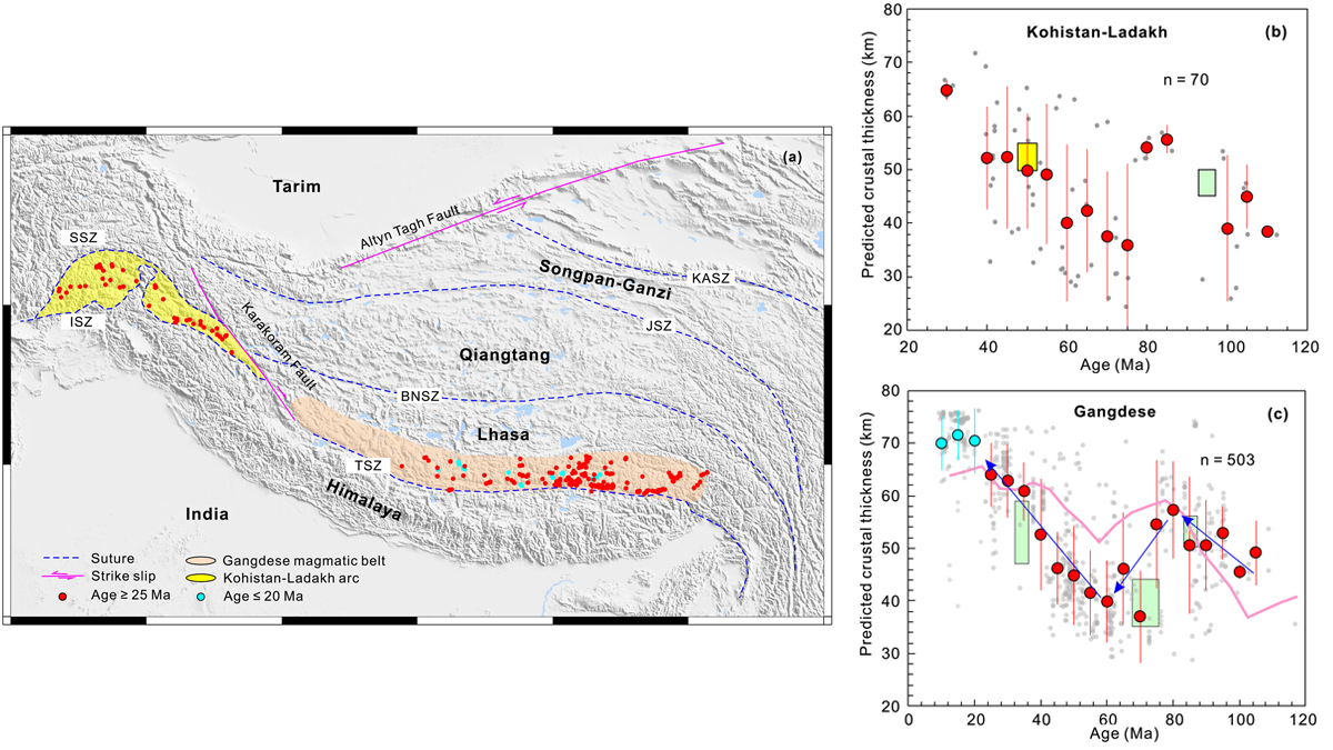
Machine Learning Helps Constrain the Thickness of Ancient Crust
A machine learning model trained using data on the chemical composition of magmatic rocks yields comparable, if not better, results to previously developed geochemical proxies.