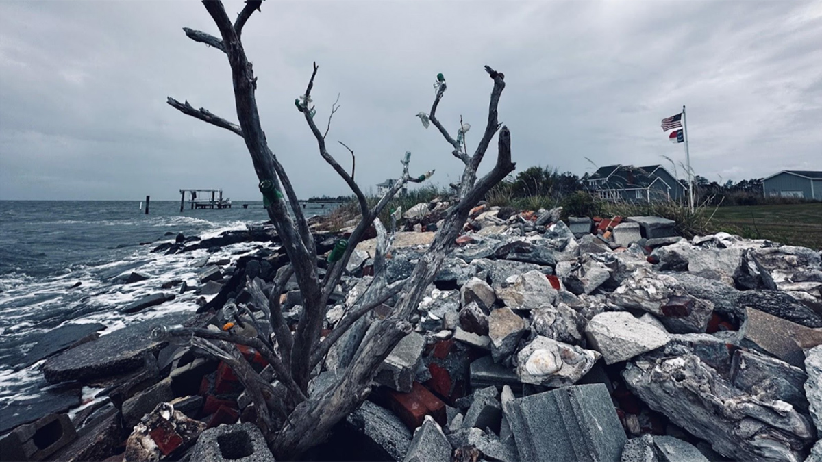
An interdisciplinary network of scientists and stakeholders is working to understand how saltwater intrusion and sea level rise are affecting rural communities and to help address the consequences.
aquifers
Posted inEditors' Highlights
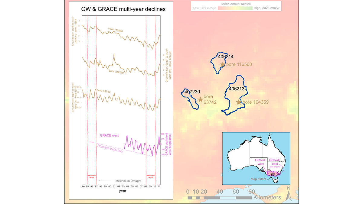
Let’s Not Forget About Long Droughts
Why do conceptual hydrologic models struggle to model long-term droughts? A new study investigates.
Posted inEditors' Highlights
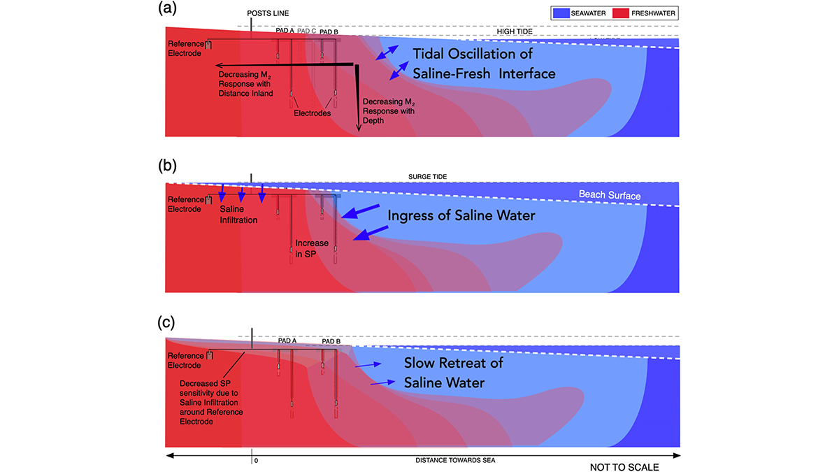
Tides Generate Detectable Electrical Signals in Coastal Aquifers
Spontaneous potentials show possibility for monitoring coastal saltwater intrusion.
Posted inEditors' Highlights
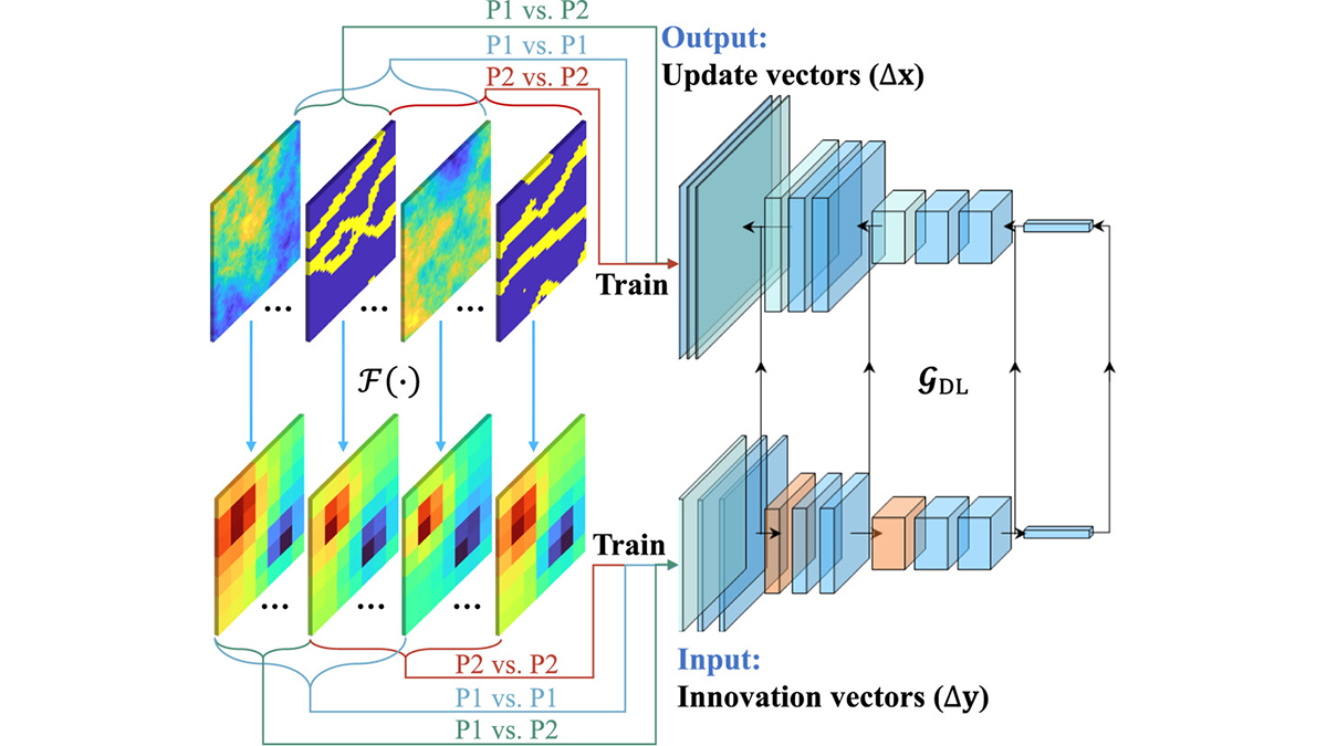
Robustness Through Diversity: Learning from Heterogeneous Aquifers
Learning from diverse aquifer structures, which are all over the place, leads to robust inverse methods.
Posted inResearch Spotlights
Microbial Genes Could Improve Our Understanding of Water Pollution
New research in Germany’s Ammer floodplain examines microbial biomarkers to help improve modeling of denitrification.
Posted inScience Updates
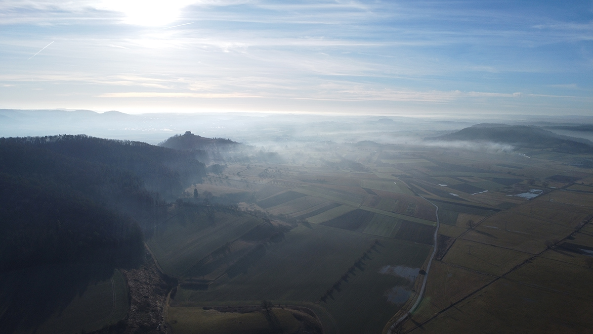
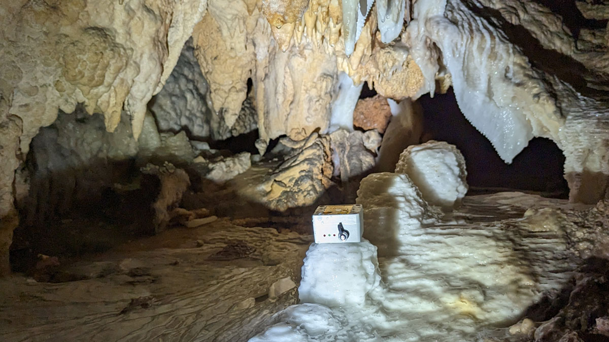
When Does Rainfall Become Recharge?
Counting drips in caves is helping to reveal how much precipitation is needed to start refilling underground aquifers.
Posted inEditors' Highlights
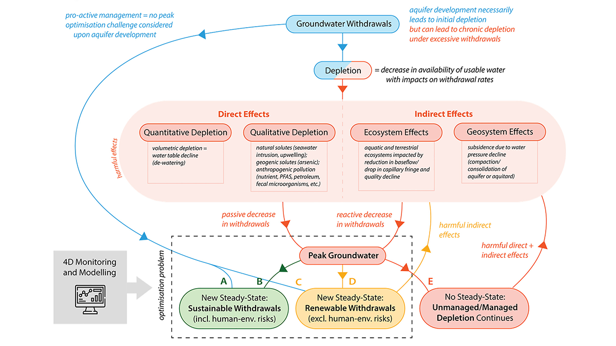
Avoiding and Responding to Peak Groundwater
A new review shows how rising demand, shrinking supplies, and policy decisions together shape when groundwater use peaks and what can be done to avoid long-term depletion.
Posted inEditors' Highlights
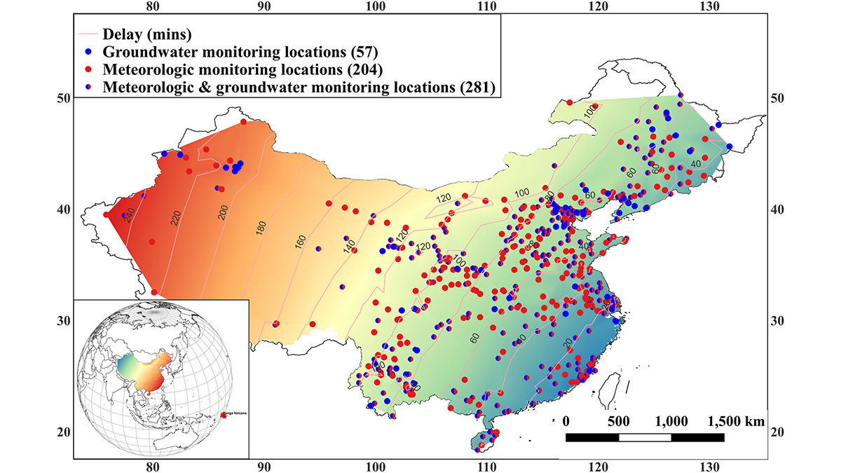
A Volcanic Boom Puts the Squeeze on Remote Confined Aquifers
A new study shows that ground water levels responded to forcing by barometric pressure pulses from the 2022 Hunga Tonga-Hunga Ha’apai Volcanic Eruption.
Posted inEditors' Vox
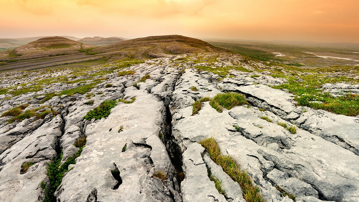
Groundwater Pollution in Karst Regions: Toward Better Models
New advances in modeling contaminant transport offer a clearer picture of how to protect karst aquifers.
Posted inNews
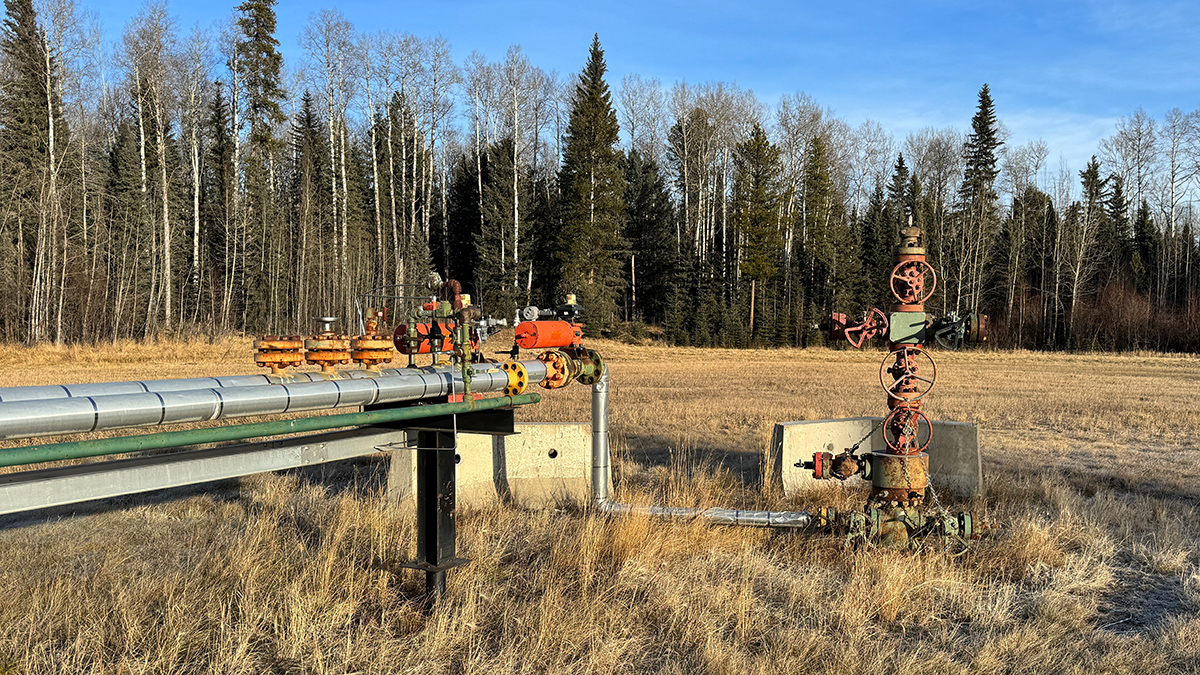
Scientists Map Where Orphan Wells Pose Threats to Aquifers
A new study from the U.S. Geological Survey finds that groundwater in Appalachia, the Gulf Coast, and California is susceptible to contamination from orphaned oil and gas wells.