
A new climate-based model indicates that scientists may be underestimating groundwater’s importance in sustaining streams and plant life.
aquifers
Posted inEditors' Highlights
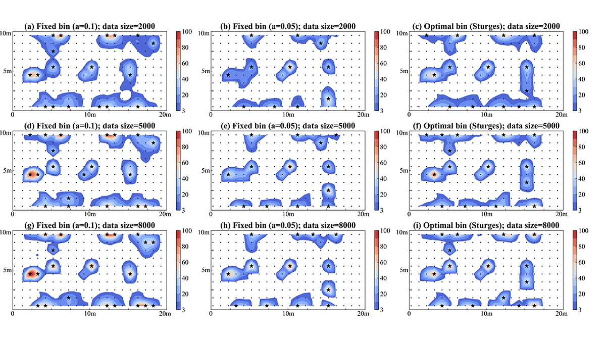
Using Big Data for Monitoring Network Design and Beyond
Large data sets can be generated using deep learning to improve the design of observation networks for monitoring subsurface flow and transport.
Posted inEditors' Vox
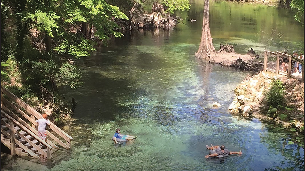
The Importance of Springs and Why Humanity Needs to Protect Them
A new book explores why springs are critical for humanity and ecosystems, the threats they are facing, and how we can act now to protect and restore them.

Posted inNews
Reaching New Levels in Groundwater Monitoring
As regions around the world face record-breaking droughts, researchers are using seismology to track groundwater levels and show that sustainable policies reduce strain on aquifers.
Posted inEditors' Highlights
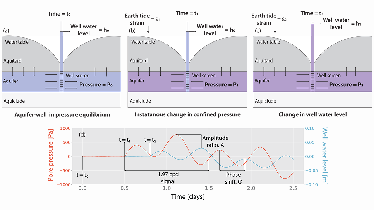
Modeling Groundwater Responses to Earth Tides
Tidal fluctuations in water well levels can reveal characteristics of the subsurface, and a new model based on coupled physics delineates the limitations of inherently simplistic analytical solutions.
Posted inNews
Groundwater May Fix as Much Carbon as Some Ocean Surface Waters
Microbes from wells as deep as 90 meters created organic carbon at a rate that overlaps with some nutrient-poor spots in the ocean.
Posted inEditors' Highlights
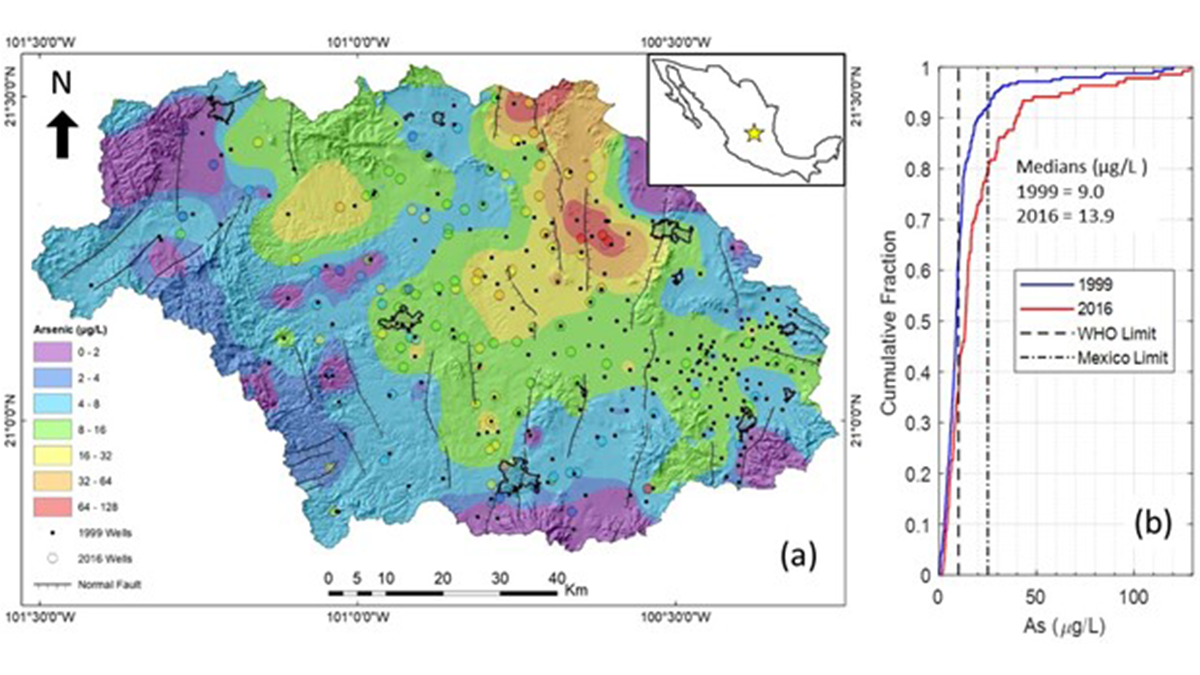
Protecting Children’s Health Can Benefit the Economy
A new study presents an integrated approach to predicting the human health impacts, economic implications, and remediation solutions for using contaminated groundwater in Central Mexico.
Posted inResearch Spotlights
Los microbios podrían comer minerales magnéticos en un sitio de derrame de petróleo
Nuevos experimentos en un antiguo sitio de derrames de petróleo en Minnesota sugieren que los procesos no biológicos por sí solos no pueden explicar la disminución de la magnetización.

Posted inResearch Spotlights
Microbes Might Munch Magnetic Minerals at Oil Spill Site
New experiments at an old oil spill site in Minnesota suggest that nonbiological processes alone may not account for decreased magnetization.

Posted inResearch Spotlights
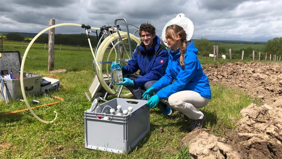
Shedding Light on Microbial Communities in Deep Aquifers
Researchers use a packer system to study the microbial communities living in waters sampled from deep, uncontaminated peridotite aquifers.