Editors’ Vox is a blog from AGU’s Publications Department.
Karst groundwaters are vital resources, providing drinking water to nearly 10% of the world’s population. However, human activities and global change have deteriorated the karst water quality and dependent ecosystems.
A new article in Reviews of Geophysics explores contaminant transport in karst groundwaters and recent efforts to model it. Here, we asked the authors to give an overview of karst aquifers, how scientists model contaminant transport, and future research directions.
What are karst aquifers and where do they form?
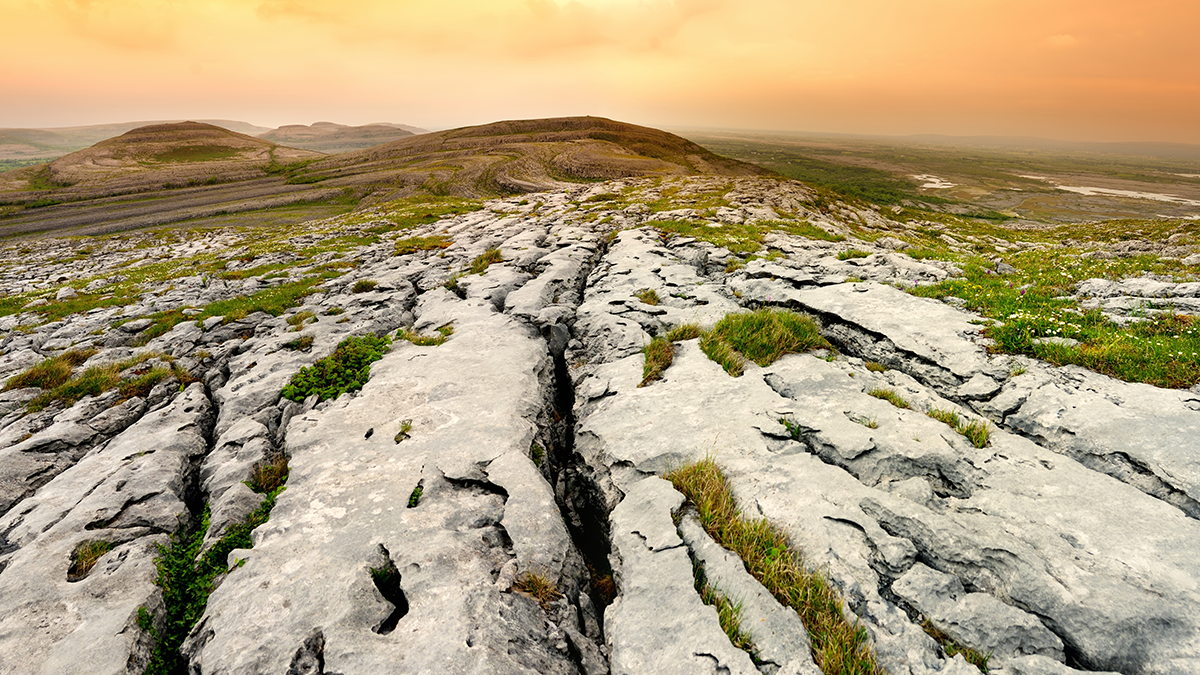
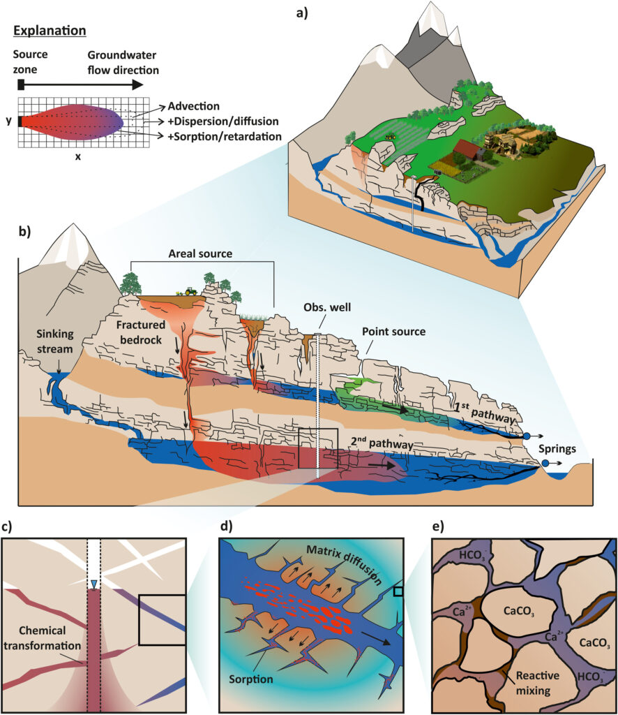
Karst aquifers are underground water reservoirs that develop in soluble rocks like limestone or dolomite. Over thousands of years, these rocks dissolve to form complex underground networks of channels, caves, and fractures (Figure 1). These unique systems are found all over the world—from Florida to the Dinaric Alps—and they supply drinking water for nearly one in ten people globally while supporting ecosystem functioning.
Why are karst aquifers important to understand?
Karst aquifers are both vital and vulnerable. They respond quickly to environmental changes, and pollutants can spread rapidly through their distinctive underground networks. Because water moves so fast and through unpredictable pathways, it’s hard to know how long contaminants will persist or where they’ll go. Understanding them is key to ensuring safe drinking water and protecting the ecosystems that depend on them.
What are the main sources of contamination in karst aquifers?
Contaminants come from both natural and human-made sources. Industrial chemicals, agricultural runoff, sewage, and land use changes are common threats. Even natural elements like arsenic or uranium can pose risks if they dissolve into groundwater. Due to the thin soils and fast-moving water in karst aquifers, there’s little time or space for these pollutants to be filtered or degraded before they spread (Figure 1).
How do scientists monitor for contamination in karst aquifers?
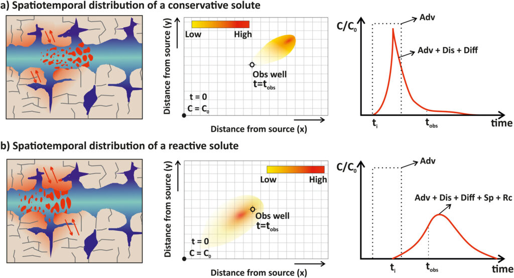
Scientists use tracer tests—adding a harmless dye or chemical to water and tracking where it goes—to map water flow. They also analyze natural “tracers” like isotopes or chemical signals already in the water. These techniques help us understand how fast water travels, how long it stays underground, and how different sources mix (Figure 2). This information is essential for predicting contamination risks, and support efforts to protect karst water resources.
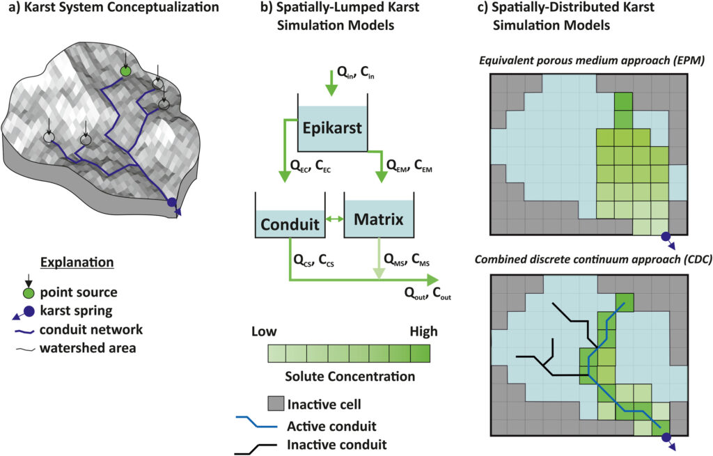
What kinds of models are being developed to track the movement of contaminants within karsts?
Researchers are developing computer models that simulate how water and contaminants move through the complex karst network. These models range from simplified, large-scale representations to detailed simulations of karst flow through conduits and fractures (Figure 3). They help us explore different scenarios—like how a pollutant might spread after a flood or how land use changes affect water quality. Therefore, they are essential for effectively managing karst water quality and planning pollution prevention strategies.
What are some of the challenges of karst transport modeling?
The biggest challenge is heterogeneity—karst systems are incredibly variable at all scales. We often lack detailed data on the shape of the underground conduits, flow speeds, or chemical conditions. This makes it difficult to build reliable models. Even small changes in how water moves can greatly affect contaminant behavior, so improving model accuracy is a major research focus.
What additional research, data, or modeling efforts are needed to overcome these challenges?
We need better field data—from tracer tests, groundwater monitoring, and mapping—to calibrate and validate models. Advances in remote sensing and machine learning also offer new tools. Future research should focus on integrating hydrological, chemical, and biological processes and on translating model results into actionable decisions. Collaboration across disciplines is key to (better) understanding, managing, and protecting karst water resources in a changing world.
—Kübra Özdemir Çallı ([email protected], ![]() 0000-0003-0649-6687), Institute of Groundwater Management, TU Dresden, Germany; and Andreas Hartmann ([email protected],
0000-0003-0649-6687), Institute of Groundwater Management, TU Dresden, Germany; and Andreas Hartmann ([email protected], ![]() 0000-0003-0407-742X), Institute of Groundwater Management, TU Dresden, Germany
0000-0003-0407-742X), Institute of Groundwater Management, TU Dresden, Germany