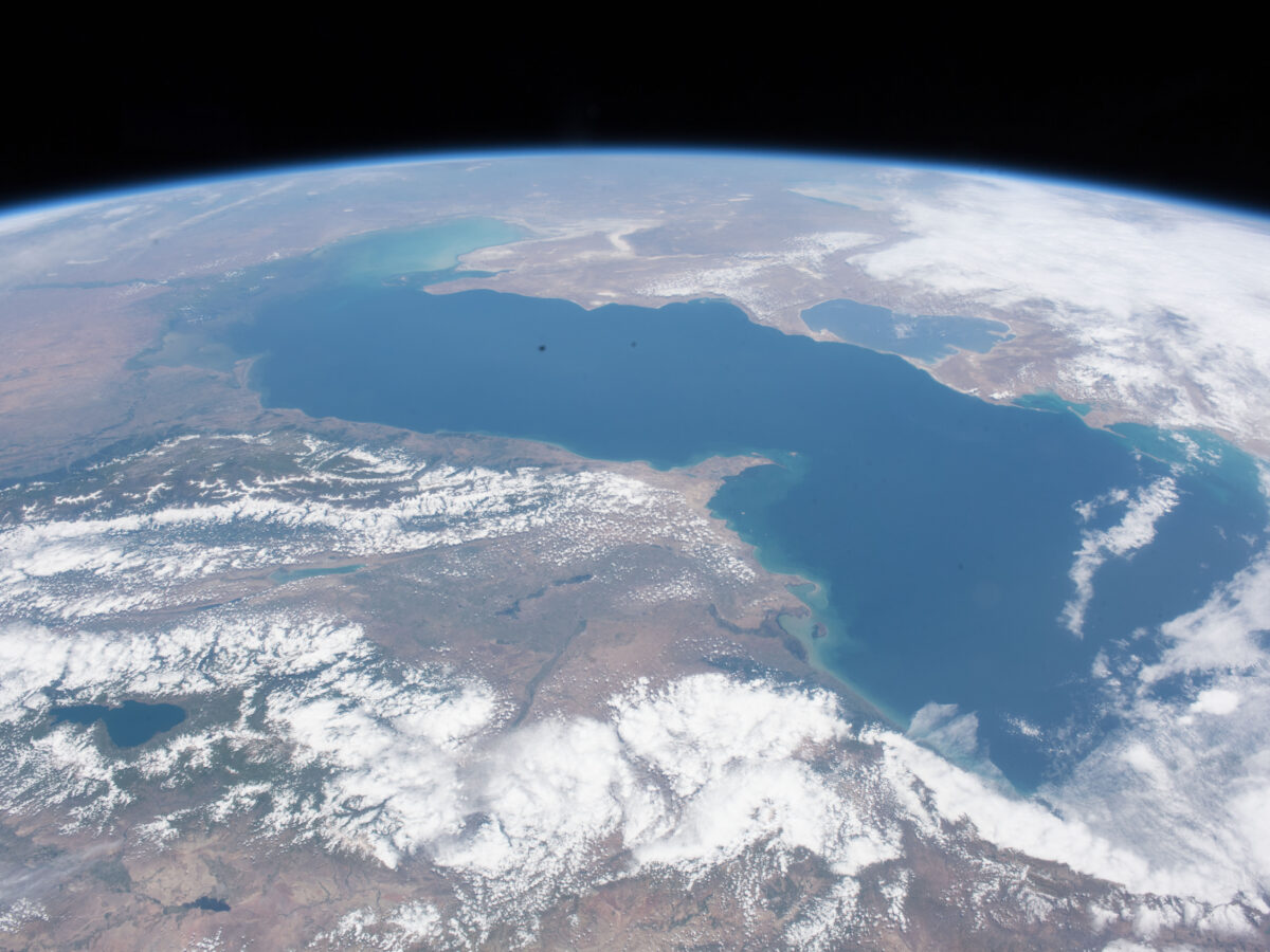
Land subsidence and uplift determine where the Caspian Sea’s coastline shifts the fastest.
beaches, coasts, & shorelines

Posted inResearch Spotlights
A Better Way to Predict Arctic Riverbank Erosion
Permafrost thaw might cause Arctic riverbanks to erode more quickly. But a new study shows why these erosion rates aren’t as dramatic as some scientists feared.
Posted inNews
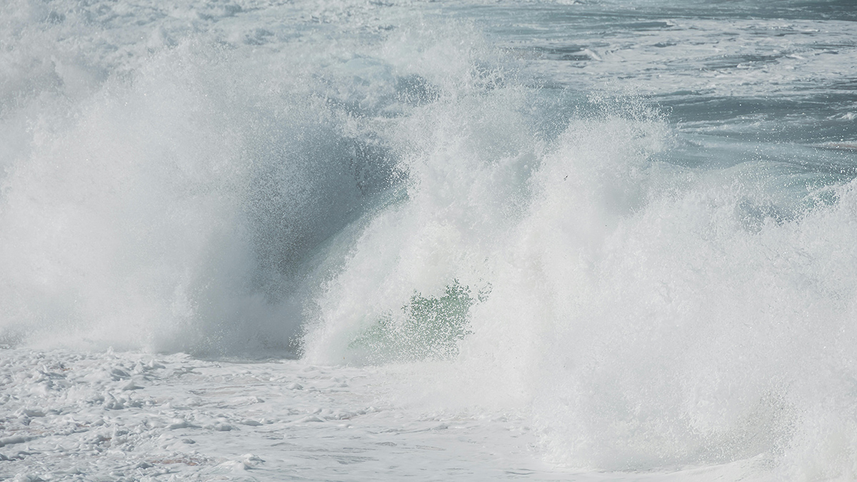
Ocean Waves Mist Decades-Old PFAS into the Atmosphere
“Forever chemicals” enter the air as sea spray aerosols, polluting coastlines and beyond.

Posted inEditors' Highlights
Barrier Islands Are at the Forefront of Climate Change Adaptation
Coastal evolution modeling sheds light on the impacts of coastal development and adaptation decisions on barrier islands in the era of sea-level rise.

Posted inNews
American Samoa’s Sinking Land Speeds Up Sea Level Rise
A new interactive tool is helping residents understand how their lands and homes are at risk.

Posted inFeatures, RTL
هل يمكن لغمر الأعشاب البحرية أن يبرّد المناخ؟.
يمكن للأعشاب البحرية المغمورة أن تخزّن الكربون في قاع المحيط، ولكن يظل من غير الواضح مدى فاعلية هذه الاستراتيجية، وكيف ستؤثر على صحة المحيط.

Posted inEditors' Highlights
Where and How Sea-Level Rise Threatens Coastal Areas and Communities
To better understand how sea-level rise threatens coastal areas, scientists propose a new indicator to estimate the risk of coastal flooding under climate change.

Posted inENGAGE, News
Sea Otters’ Appetite for Crab Is Helping Strengthen Estuary Banks
Apex predators can have a powerful impact on coastal erosion rates by keeping grazer populations down, but their influence has been largely overlooked.
Posted inResearch Spotlights
Researchers Compare Observations Versus Modeling of Coastal Carbon Cycle
While storing carbon dioxide, the coastal ocean also releases methane and nitrous oxide. New research shows that understanding the impact of coastal oceans on climate requires more research into these fluxes and how they counteract each other.
Posted inNews
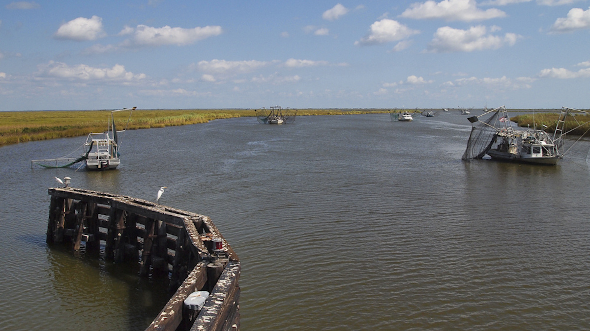
Mapping Sinking Land for Tribal Resilience in Louisiana
The Grand Caillou/Dulac Band of Biloxi Chitimacha Choctaw Tribe has been losing land to the sea, which could hamper efforts to gain federal recognition.