
NOAA has quietly reported that they will soon decommission 14 datasets, products, and catalogs related to earthquakes and marine, coastal, and estuary science.
beaches, coasts, & shorelines
Posted inNews
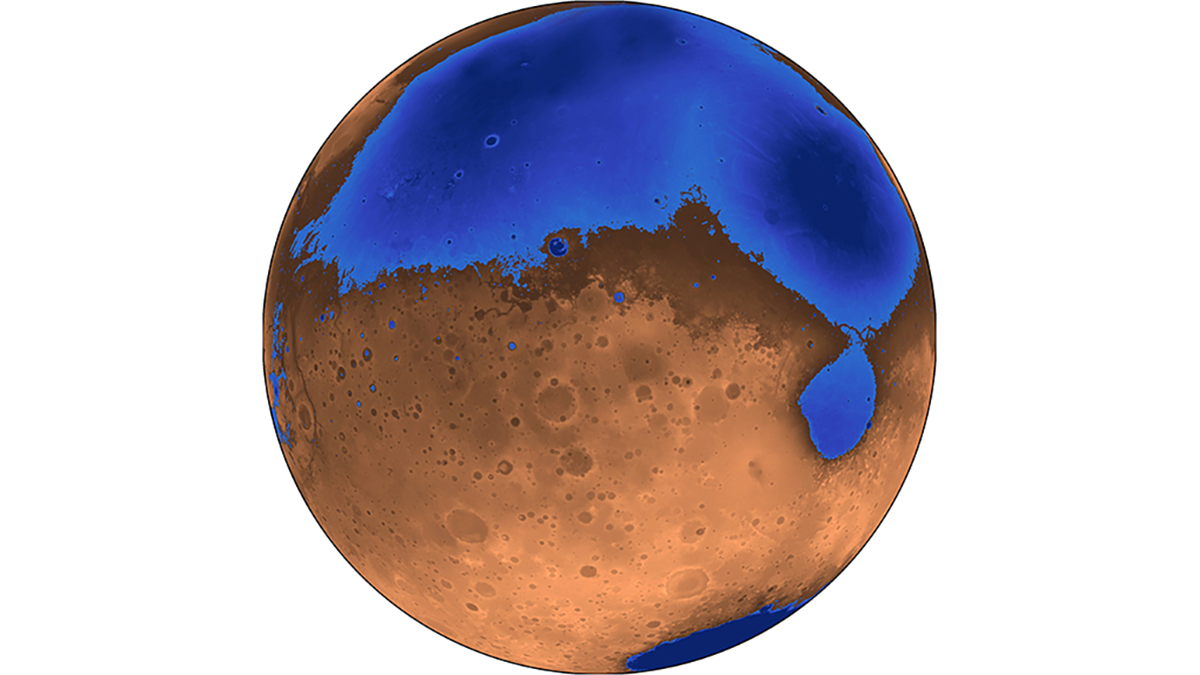
Buried Sediments Point to an Ancient Ocean on Mars
Ground-penetrating radar data collected by the Zhurong rover reveal gently sloping sediments in Mars’s northern lowlands that hint at a shoreline.

Posted inResearch Spotlights
Flooding from Below: The Unseen Risks of Sea Level Rise
Researchers demonstrate a method for assessing how rising seas could raise groundwater levels, potentially transmitting flood hazards far inland.

Posted inEditors' Vox
Asian Megadeltas: Tackling Coastal Flooding Challenges
Integrating scientific insights into current actions is crucial for steering future research directions and underpinning informed management of coastal flooding in Asian deltas.
Posted inEditors' Highlights
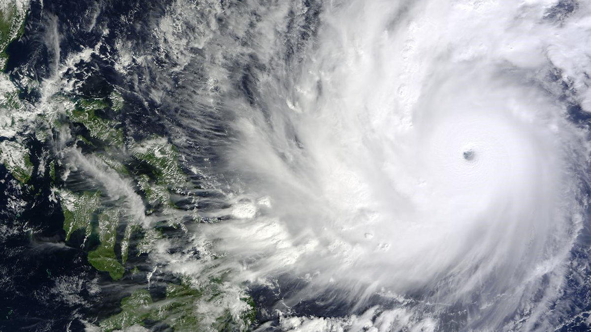
Impacts of Urban Heat and Friction on a Tropical Cyclone
A new computer modeling-based study demonstrates dual mechanisms that reduce pre- and post-landfall tropical cyclone intensity.
Posted inEditors' Highlights
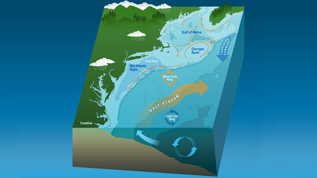
Coastal Dynamics Revealed by Satellite Salinity Data
One decade of high-quality satellite salinity observations provide valuable insights into the complex dynamics in the Mid-Atlantic Bight.

Posted inNews
A Seychelles Shoreline Resists the Rising Seas
The geomorphology of a protected atoll likely contributed to its ability to maintain its shoreline over a turbulent half-century.

Posted inNews
Climate Change Is Driving Dangerous Bacteria Farther North
Satellite data could help address rising rates of vibriosis infections, often the result of eating undercooked seafood, along the East Coast of the United States.

Posted inNews
Coastlines Around the World Are Losing Sediment
A new tool maps coastal sediments on the basis of water color. It shows that 75% of the world’s coastlines may be losing suspended sediment.
Posted inNews
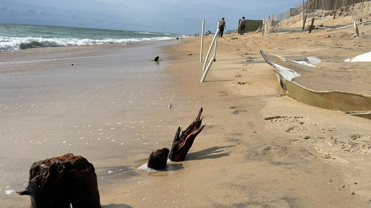
Buried Tree Stumps Show Shoreline Shifts of the Outer Banks
Storms are unburying centuries-old stumps on North Carolina’s barrier islands. Researchers hope these long-gone forests can help land managers plan for the future.