
Using a physical experiment, researchers show how off-fault deformation occurs along strike-slip faults with different types of motion.
California
Posted inResearch Spotlights
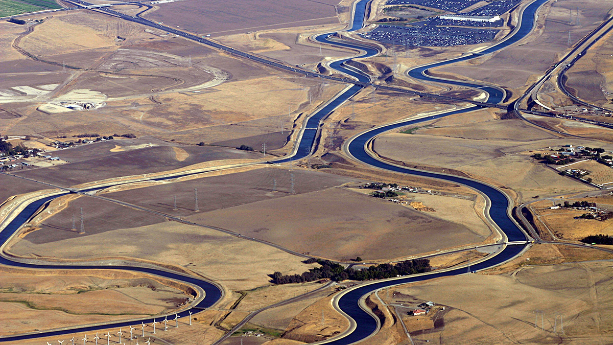
Assessing Water Infrastructure Investments in California
Exploratory modeling in California’s Central Valley indicates that evaluating the costs, benefits, and risks to individual providers is necessary to ensure the viability of future water projects.

Posted inFeatures
A Lidar’s-Eye View of How Forests Are Faring
Success in Yosemite is driving the wider use of lidar surveys to support forest health and wildfire resilience, study wildlife habitats, and monitor water resources.
Posted inNews
A New Index to Quantify River Fragmentation
Researchers have developed a new analysis based on a river’s catchment area as opposed its length.

Posted inNews
Forest Fires Could Boost Western U.S. Water Supplies
Streamflow in the West has been below average since the early 2000s, but a new analysis shows that streams aren’t as dry as expected.
Posted inResearch Spotlights
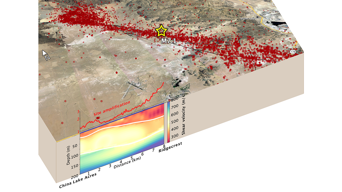
Fiber-Optic Cables Can Produce High-Resolution Underground Maps
Telecom fiber repurposed as distributed acoustic sensing arrays can image near-surface structure and potentially improve seismic hazard mapping in urban areas.
Posted inNews
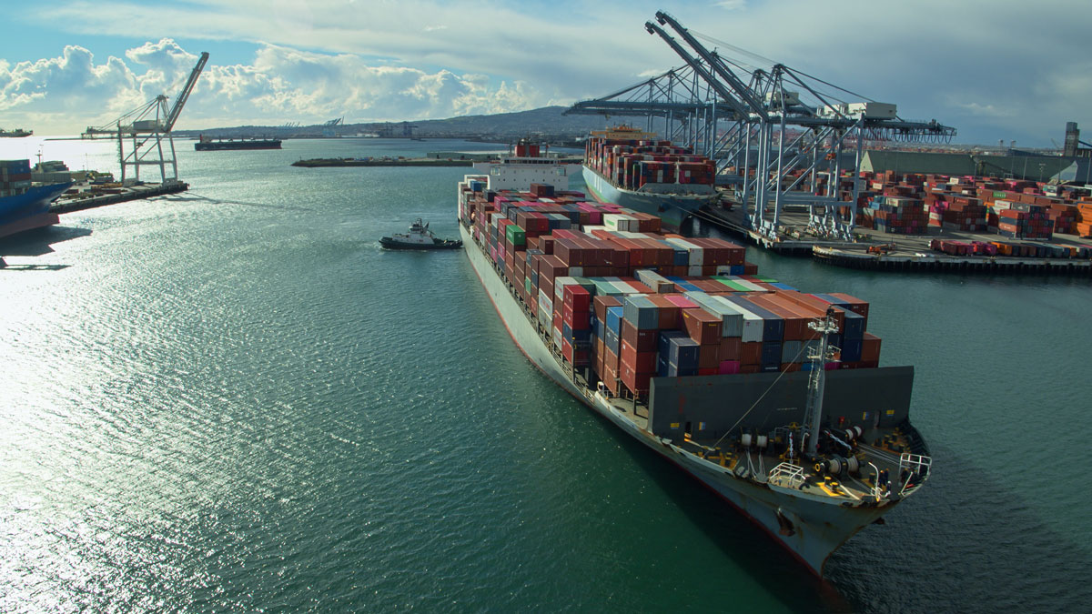
Rising Seas Boost Tsunami Impacts on Distant Shorelines
Modeling suggests that rising sea levels will render Southern California ports increasingly vulnerable to waves from distant-source tsunamis.

Posted inResearch Spotlights
Rethinking How Valley Fever Spreads
Scientists have long assumed that dust storms lead to infections with the desert soil fungus Coccidioides, but new evidence suggests otherwise.

Posted inEditors' Highlights
Managing Strategic Water Resources in a Changing Climate
Another significant step has been taken in methods for managing water resources in the face of climatic changes and other future uncertainties. Dynamic adaptation is becoming a reality.
Posted inENGAGE, News
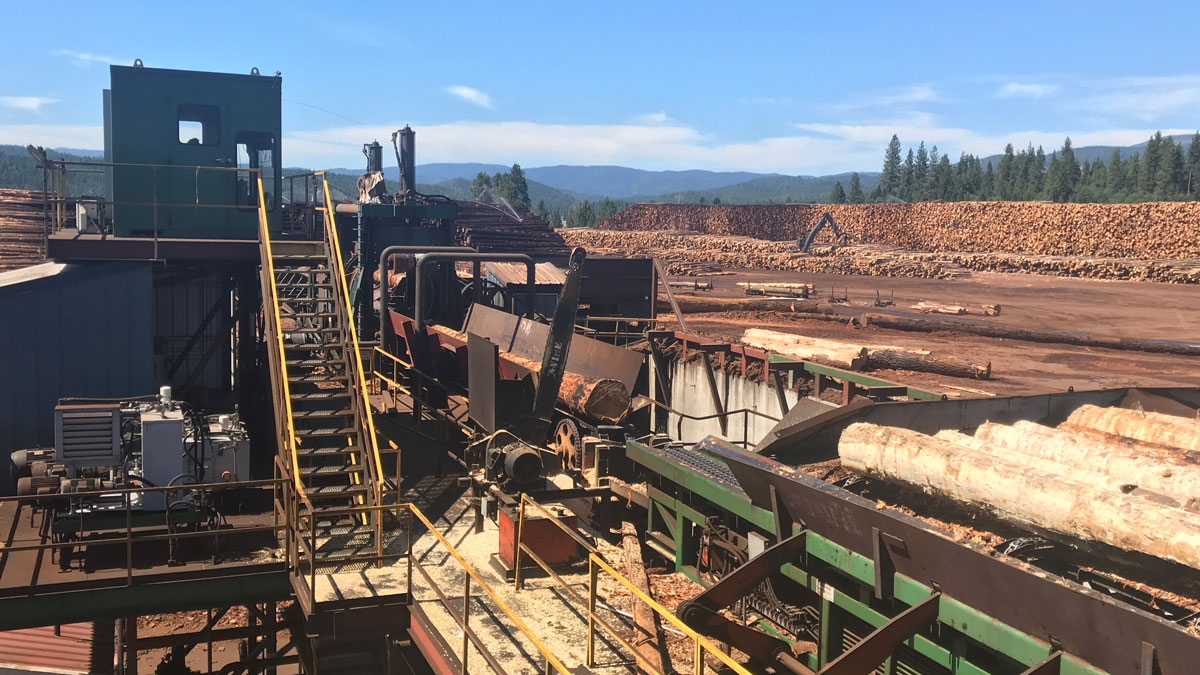
Clever Wood Use Could Mitigate Wildfires and Climate Change
California plans to use forest thinning to reduce wildfire risk. New research suggests the state could also see a climate benefit by repurposing waste wood produced by thinning.