
Although warming oceans may make population booms and mass strandings more common, the species may ultimately be one of the beneficiaries of climate change.
California
Posted inResearch Spotlights
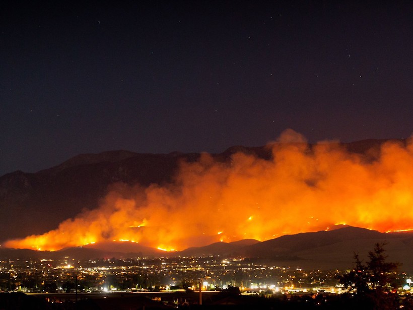
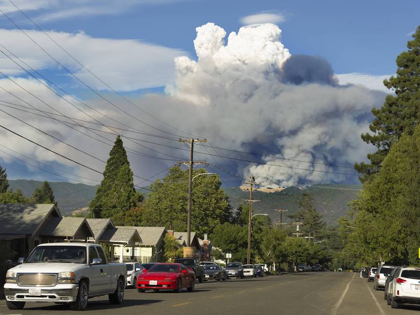
Uncovering Patterns in California’s Blazing Wildfires
A study of trends in wildfire occurrence over the past 30 years shows that environmental, climatic, and human-related factors can point out regions with high fire probabilities.

Posted inNews
Weighing Inputs of Waves and Precipitation to Coastal Erosion
Conducting weekly lidar surveys of coastal cliffs for 3 years enabled a California team of coastal erosion researchers to quantify and separate marine effects from subaerial effects.
Posted inEditors' Highlights
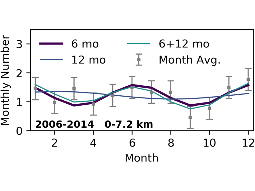
Why are Earthquakes on the San Andreas Seasonally Modulated?
There is growing evidence that some earthquakes occur seasonally but also that water loading cannot explain these observations.
Posted inNews
Adaptation Can Compound Climate Change Impacts on Energy and Water
Researchers have created a framework to trace the impacts of climate change and adaptation across energy and water systems in California.

Posted inResearch Spotlights
How Heavy Rain and Drought Influence California Crustal Strain
New research using continuous GPS data reveals how multiyear precipitation patterns can amplify the effects of hydrological loading on crustal deformation.

Posted inResearch Spotlights
How Some Trees Survive the Summer Dry Season
Oak trees in California seasonally tap moisture in unsaturated soil and weathered bedrock, even when the groundwater table is within reach of their roots.
Posted inResearch Spotlights
“Thirstier” Atmosphere Will Increase Wildfire Risk out West
New climate projections could inform long-term wildfire and water resources management strategies in California and Nevada.

Posted inResearch Spotlights
Acidifying Oceans Could Get Help from Kelp
Forests of fast-growing kelp influence the chemistry of the water in which they live. A new study evaluates their potential to ameliorate ocean acidification in sensitive coastal ecosystems.
Posted inEditors' Highlights
Comparing Impacts of CO2 and Particle Emission Reductions
Black carbon contained in airborne particles is often cited as a major factor warming the climate, but how much can California reduce climate change through reducing airborne particle concentrations?