An ancient carbon dioxide release associated with a much hotter Earth than today took place at only a tenth the pace of our present atmospheric carbon buildup, a new study confirms.
Climate Change
Posted inScience Updates
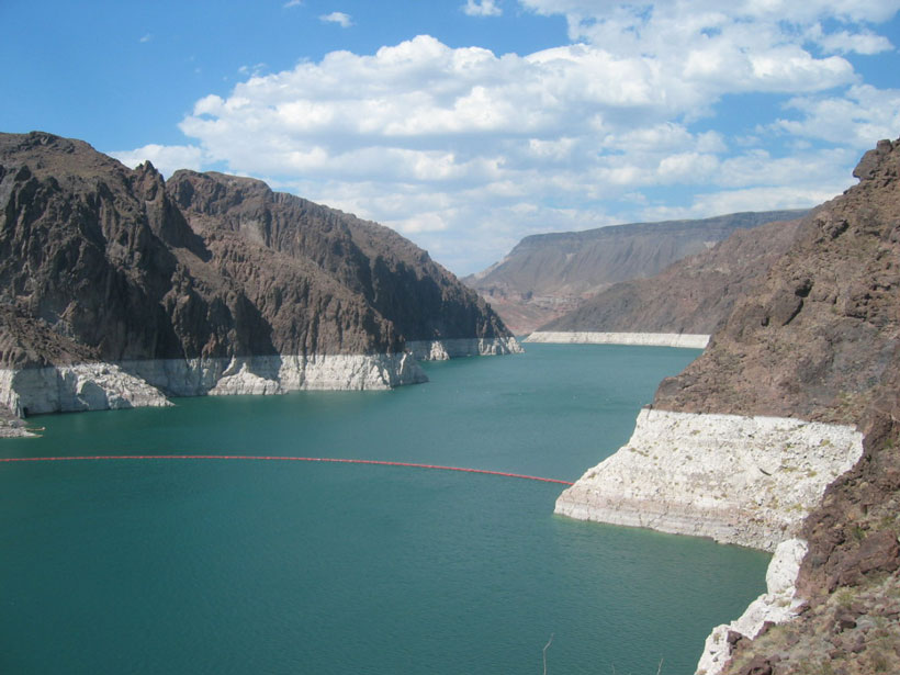
New Interest in Reservoir Evaporation in Western United States
Reservoir Evaporation Workshop; Boulder, Colorado, 22–23 October 2015
Posted inResearch Spotlights
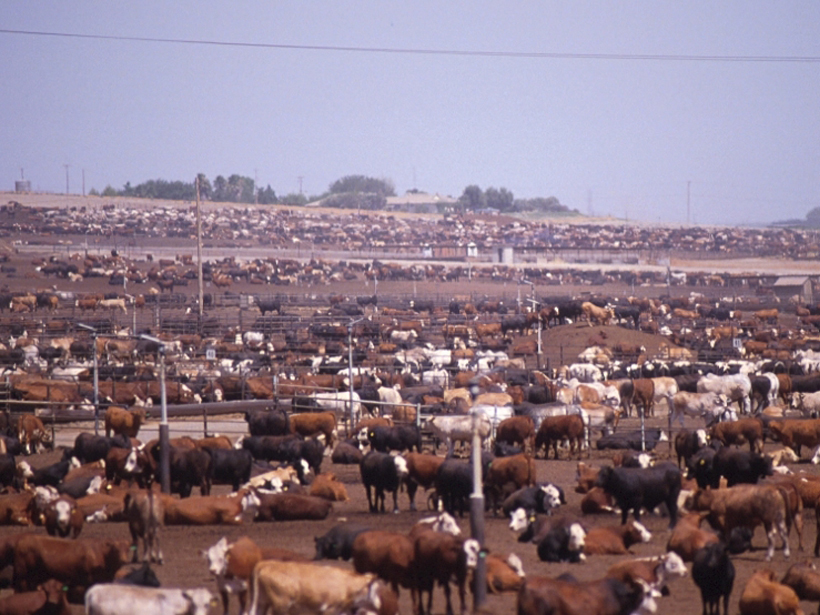
U.S. Methane Emissions on the Rise
Data suggest that the United States may be responsible for half of global methane increase in the past decade.
Posted inNews
Science of Tying Some Extreme Weather to Climate Change Advances
A report from the National Academies of Sciences, Engineering, and Medicine says attribution of some classes of extreme events can provide policy makers with better information about future risks.

Posted inResearch Spotlights
Glacial Meltwater Features Depend on Glacier Type and Location
With climate change, some glaciers will melt faster than others, altering the proportions of nutrients in meltwater and changing downstream ecosystems.

Posted inEditors' Vox
New Insights from 60 Years of Crevasse Research
Deep cracks in the ice may provide insight into glacier decay and help predict sea level rise.
Posted inResearch Spotlights
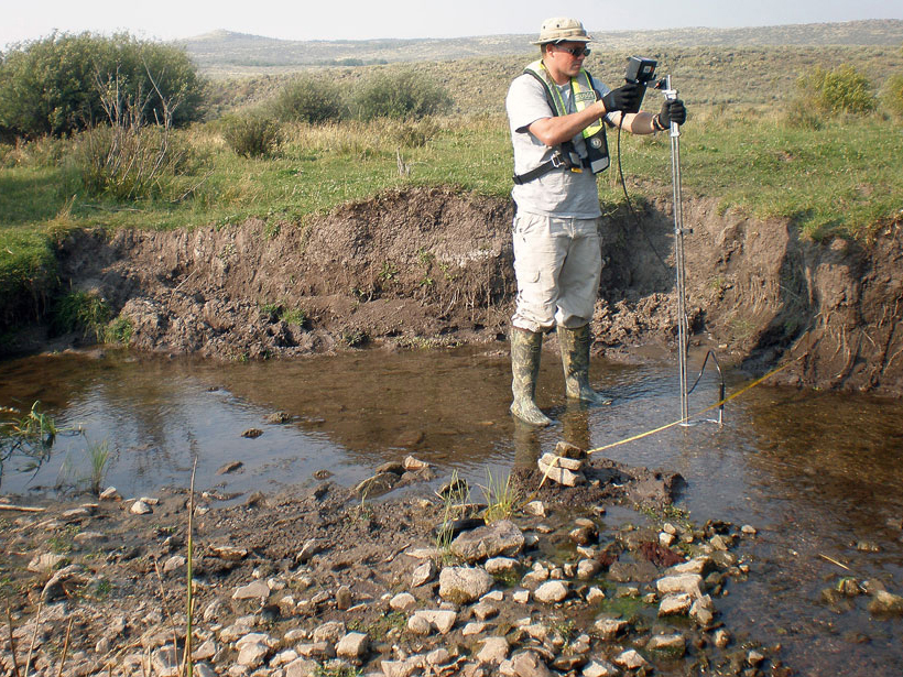
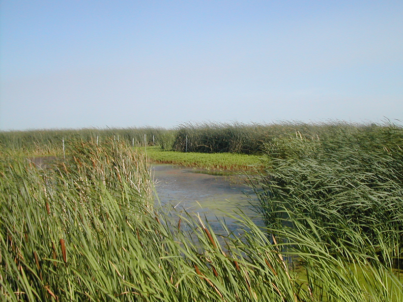
After a Century, Restored Wetlands May Still Be a Carbon Source
Methane emissions can drastically lower, or even reverse, the benefits of carbon sequestration in restored wetlands, according to new measurements from the Sacramento–San Joaquin Delta.

Posted inNews
Florida Mayors Spotlight Climate Change as U.S. Election Issue
In the run-up to presidential primaries today in Florida, a bipartisan group of mayors there raised the issue by convincing moderators to pose questions about it in national debates and in other ways.

Posted inResearch Spotlights
Moored Ocean Buoy Tracks Marine Carbon Cycle Variations
Years of data from a North Pacific ocean station show that the ocean's ability to pull carbon out of the atmosphere is controlled by biological and physical processes that change between seasons.

Posted inScience Updates
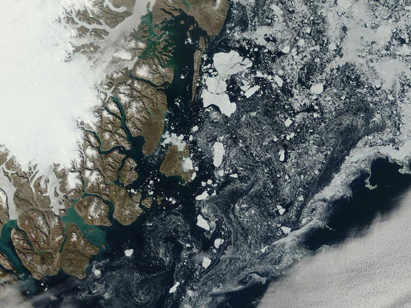
How Will Sea Ice Loss Affect the Greenland Ice Sheet?
On the Puzzling Features of Greenland Ice-Core Isotopic Composition; Copenhagen, Denmark, 26–28 October 2015