
A positive trend in tropical cyclone induced ocean mixing and primary production is compensating the overall decline in global primary production due to anthropogenic climate change.
hurricanes, typhoons, & cyclones

Posted inFeatures
Chasing Cyclones from Space
The pioneering use of satellite-based synthetic aperture radar to characterize tropical cyclones in near-real time has provided a crucial new tool with which to forecast powerful storms.
Posted inNews
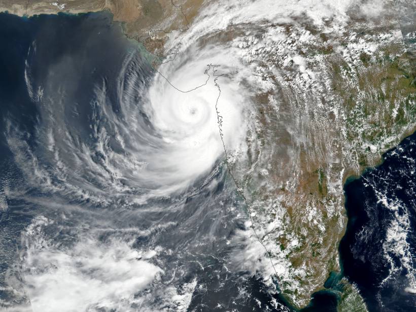
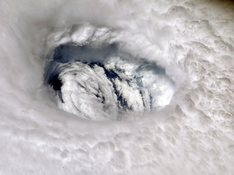
Cyclone Tauktae Documents a Climate Trend in the Tropics
The western Indian Ocean has been warming at a rate faster than any other region in the tropical oceans, a pattern that is contributing to more frequent and intense storm activity.
Posted inNews
Your Summer Outlook: Cloudy with an Above-Normal Chance of Hurricanes
Get ready for another above-average hurricane season, but it likely won’t be as busy as last year.

Posted inNews
Puerto Rico Adapts to a Changing, Challenging Environment
The Caribbean is ground zero for some of the biggest impacts of climate change today. Puerto Ricans are building innovative initiatives to protect and prepare their communities for what’s next.
Posted inResearch Spotlights
Descifrando las causas de la actividad de los huracanes en el pasado
Registros individuales de paleohuracanes extraídos de los sedimentos de islas azotadas por tormentas no muestran una clara influencia del clima en la frecuencia de los huracanes en el último milenio.

Posted inEditors' Highlights
Devastation of Hurricane Maria to Puerto Rican Landscape
The destructive winds and rain of Hurricane Maria in 2017 caused a dramatic transformation to Puerto Rico’s landscape and altered the characteristics of land-air interaction.

Posted inResearch Spotlights
Untangling Drivers of Ancient Hurricane Activity
Individual paleohurricane records extracted from the sediments of storm-battered islands do not clearly implicate climate as having shaped hurricane frequency over the past millennium.
Posted inEditors' Highlights
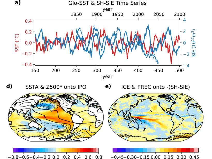
International Collaboration Yields Unique Climate Simulations
Porting and optimizing CESM1.3 to run on the TaihuLight computer enabled an astounding 750 years of simulation with 0.25° grid spacing for land & atmosphere and 0.1° grid spacing for ocean & sea ice.
Posted inEditors' Highlights
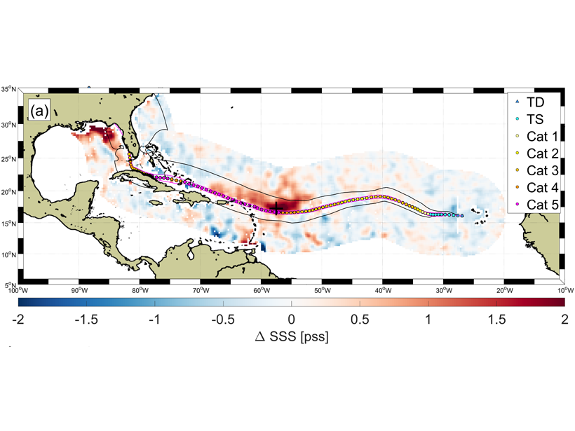
Hurricanes Wakes Show Asymmetrical Response in Ocean Salinity
It’s well known that hurricanes can substantially impact ocean surface temperature, but a new study shows they can also induce an ocean salinity response in unexpected ways.