Source: Geophysical Research Letters
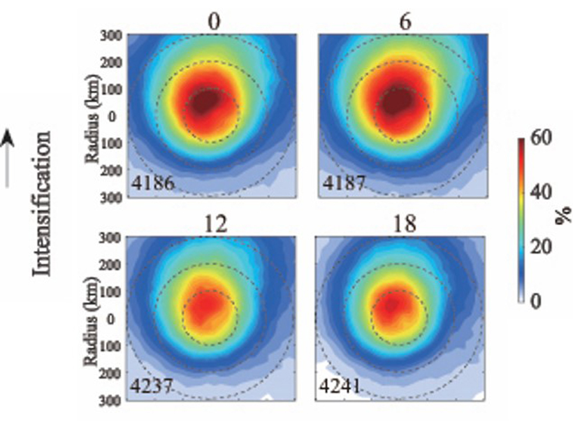
In recent years, there has been increasing interest in the diurnal cycle of tropical cyclone characteristics. Wu et al. [2020] analyze the diurnal variations in the intensity of tropical cyclones using satellite data of convective clouds. While tropical cyclone intensity has no significant variation, they showed that there is a nocturnal tropical cyclone intensification globally and by basin. This high rate of intensification begins in the evening (around 21h local time) and peaks in the early morning (03 to 09h local time) associated with the amount of deep convective clouds coverage. This temporal dependence of the intensification rate emphasizes the importance of the radiative forcing in tropical cyclones. This new understanding of tropical cyclone intensification (and decay) could potentially be used to improve forecasting of tropical cyclone intensity.
Citation: Wu, Q., Hong, J., & Ruan, Z. [2020]. Diurnal variations in tropical cyclone intensification. Geophysical Research Letters, 47, e2020GL090397. https://doi.org/10.1029/2020GL090397
―Suzana Camargo, Editor, Geophysical Research Letters
Text © 2020. The authors. CC BY-NC-ND 3.0
Except where otherwise noted, images are subject to copyright. Any reuse without express permission from the copyright owner is prohibited.