
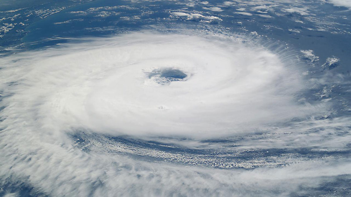
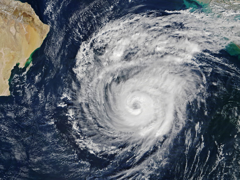
A new study finds nature can’t have it both ways: On the basis of thousands of case studies from dozens of hurricanes, there’s always a trade-off between resistance and resilience.
hurricanes, typhoons, & cyclones
Posted inEditors' Highlights
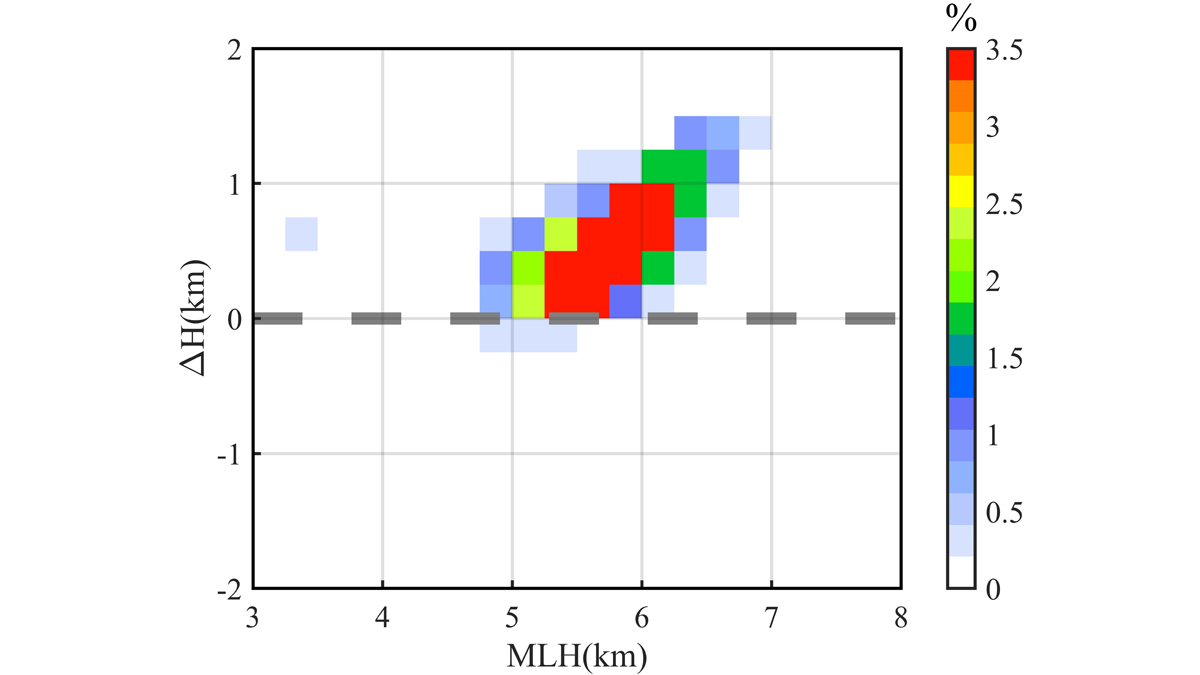
Melting Layer Characteristics of Cyclones
Dual‐frequency Precipitation Radar observations reveal the characteristics and microphysical processes of the melting layer in cyclone precipitation over the western North Pacific.

Posted inEditors' Highlights
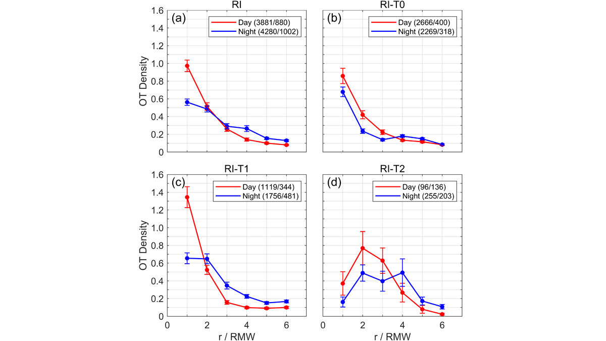
Clouds Overshooting Tops and Typhoon Intensity
An examination of the relationship between the diurnal variation of cloud overshooting tops density and typhoon intensity in 45 typhoons, using the Himawari-8 Satellite.
Posted inEditors' Highlights
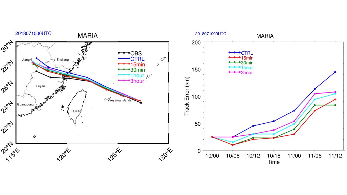
Impact of Geostationary Sounder on Typhoon Forecasts
An analysis of the impact of targeted observations from the Geostationary Interferometric Infrared Sounder at high-temporal resolution on forecasts for Typhoon Maria in 2018.
Posted inResearch Spotlights
Cyclone “Seed” Survival Affects Hurricane Season Intensity
Understanding how seed storms grow into full-blown hurricanes and typhoons could help predict hurricane season intensity in a changing climate.
Posted inEditors' Highlights
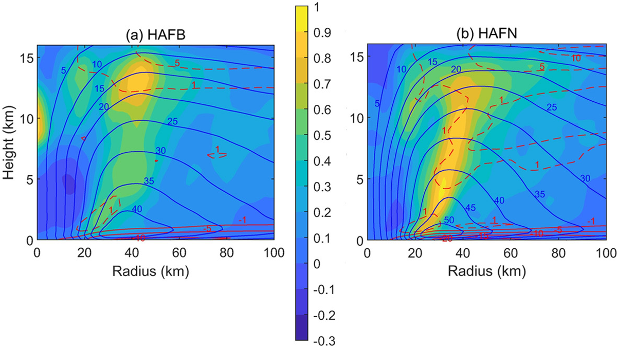
Hurricane Forecast Improvement with Better Turbulent Processes
A new look at turbulent processes has improved the prediction of hurricane rapid intensification by properly accounting for the unique environment of a hurricane eyewall.

Posted inNews
Supercell Thunderstorms Shake Up the Stratosphere
Supercell storm tops may act like mountains that obstruct winds, transforming their flow into violent turbulence that mixes near-surface air with the stratosphere above.
Posted inENGAGE, News
Climate Change Is Making India’s West Coast More Vulnerable to Cyclones
A new study found significant increases in the intensity, frequency, and duration of cyclonic storms over the Arabian Sea. Is the west coast prepared?

Posted inNews
Lightning Tames Typhoon Intensity Forecasting
Typhoons regularly drench densely populated western Pacific regions, but lightning could forecast intensity more than a day before a storm’s strength peaks.