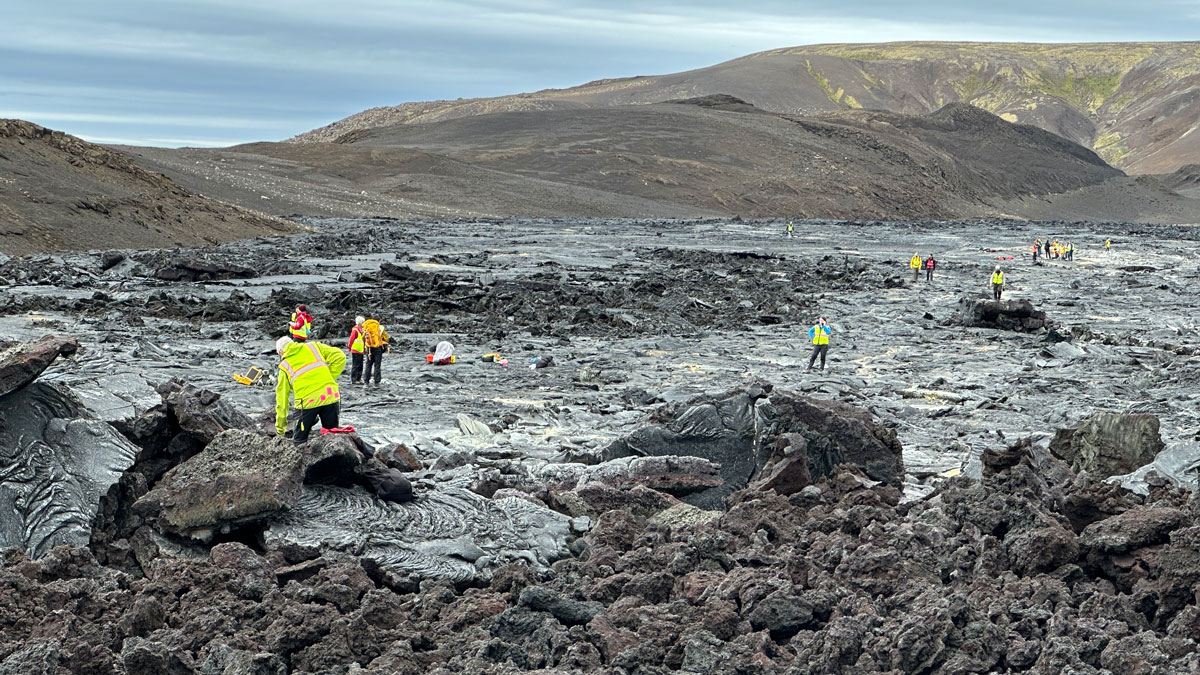
Scientists trekked across Icelandic lava flows that served as stand-ins for Venus’s volcanic landscapes, testing tools and methods the upcoming VERITAS mission will use when it reaches the planet.
fieldwork
Posted inResearch Spotlights
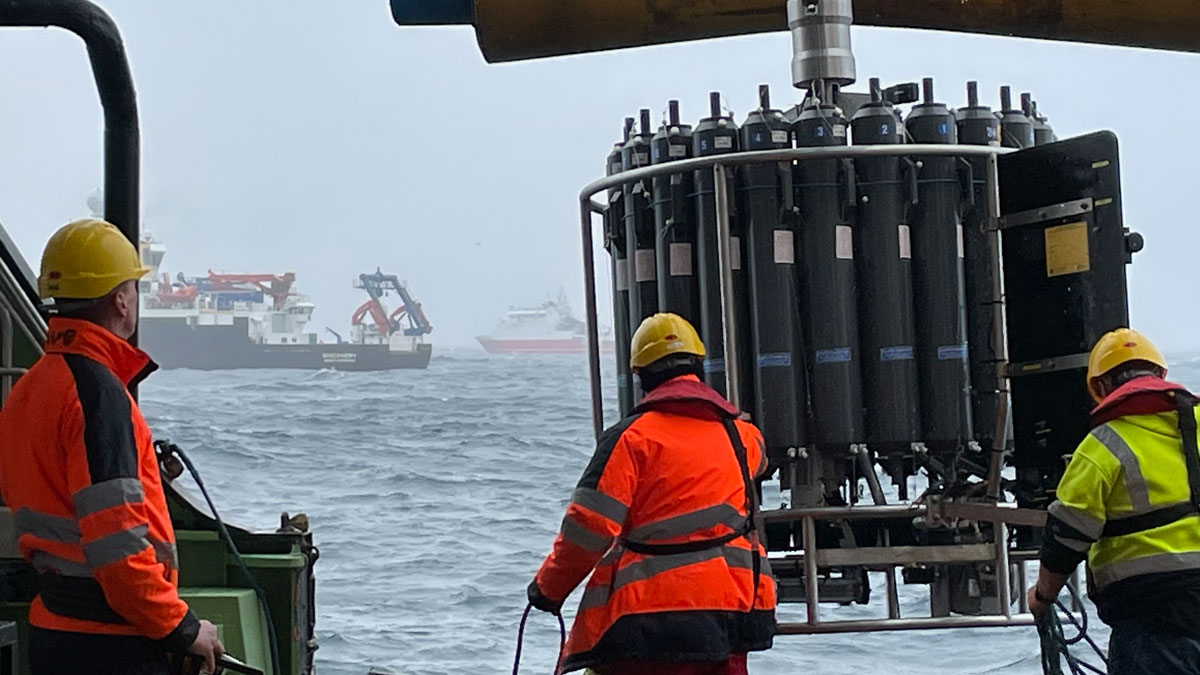
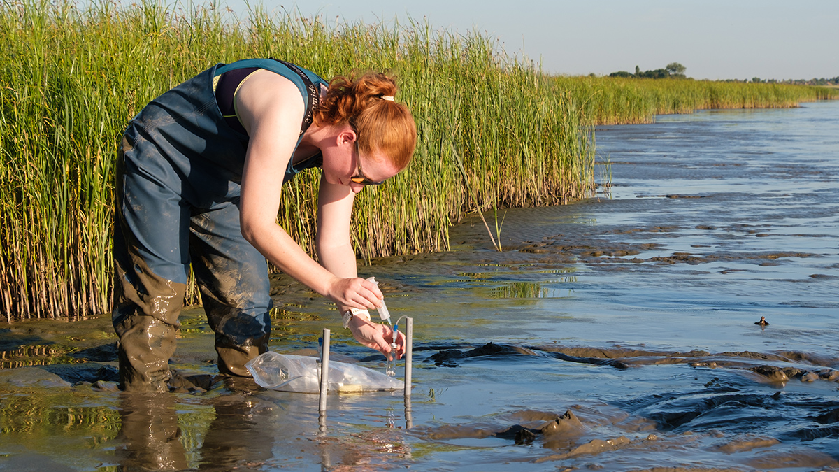
Marine Snow Grows Faster and Fluffier as It Sinks
New observations highlight how abiotic and biotic processes influence the tiny oceanic particles.
Posted inResearch & Developments
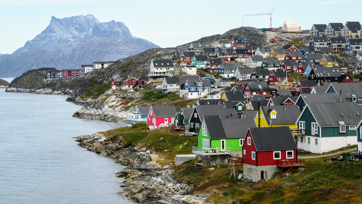
Hundreds of Scientists “Vehemently Oppose” U.S. Effort to Purchase Greenland
More than 200 scientists scientists have signed a letter condemning U.S. President Donald Trump’s efforts to acquire Greenland.

Posted inENGAGE, News
California Schools Are Feeling the Heat
Even though trees help keep children safe from the Sun, some school districts have lost 25% of their tree canopy in just 4 years.
Posted inNews
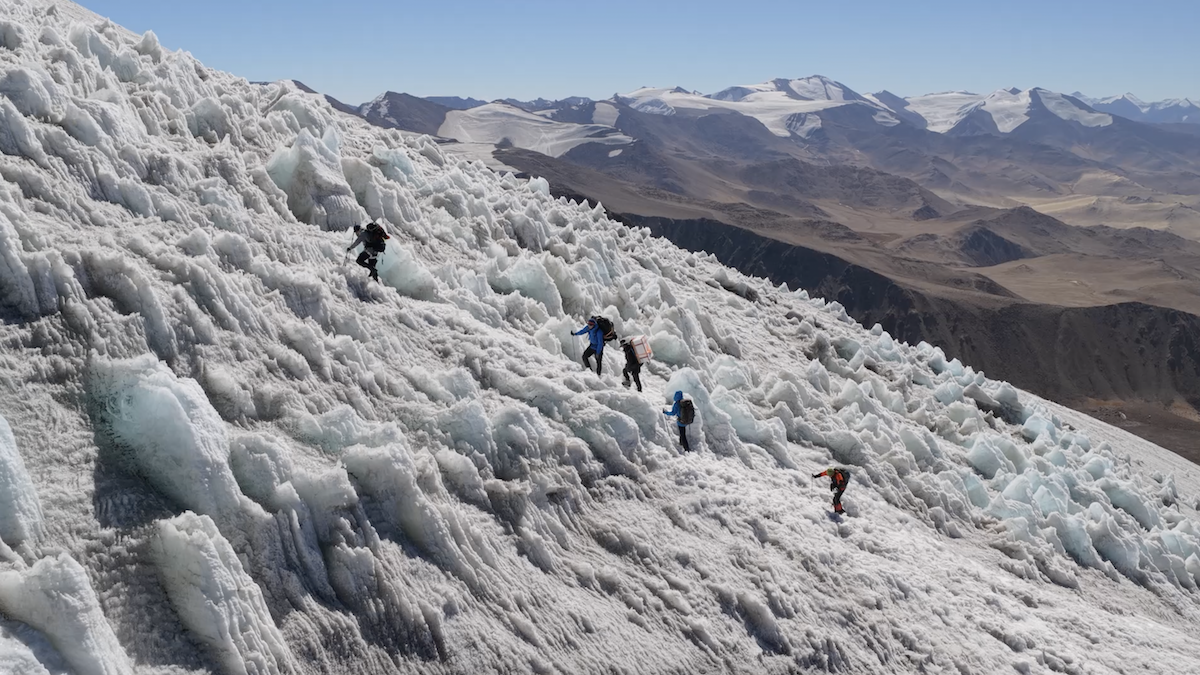
Pamir Glacier Expedition Returns with High-Elevation Ice Cores
The three glacial cores will unlock mysteries about past climate and weather patterns in central Asia.
Posted inNews
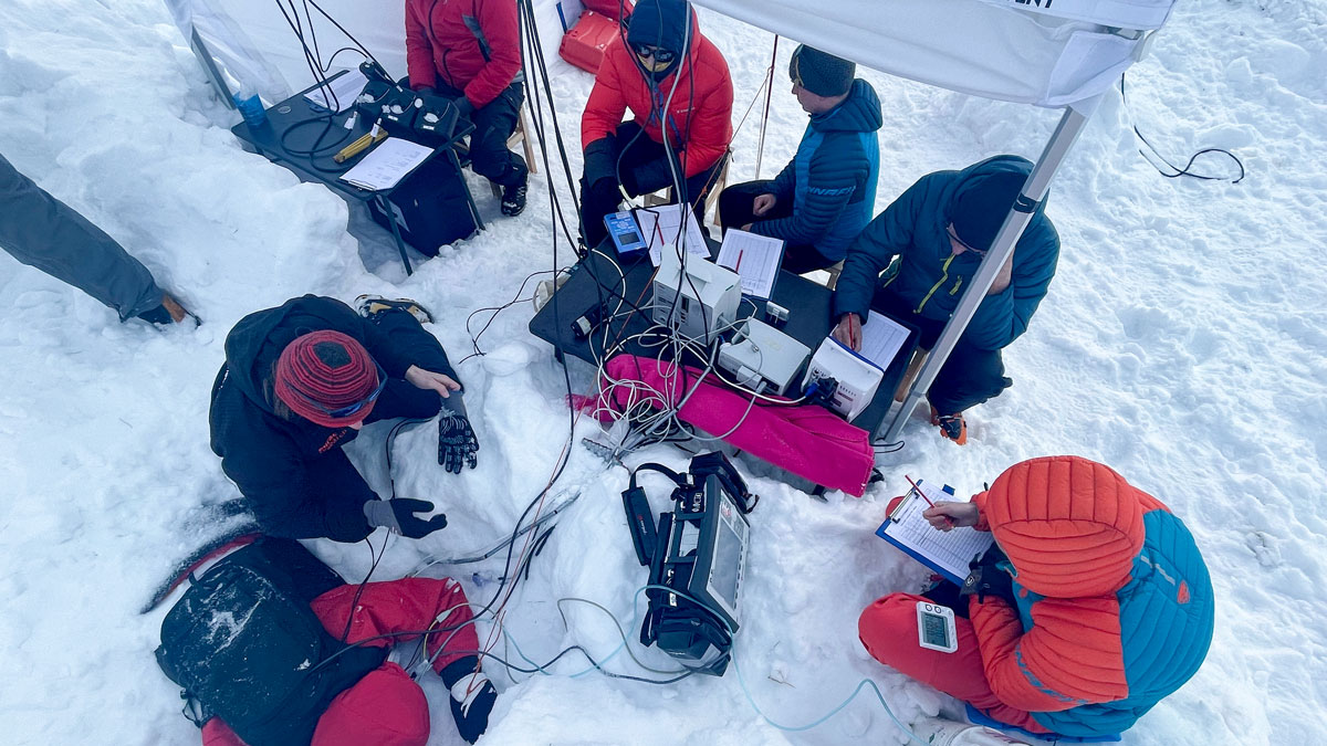
Safety Device Supplies Life-Saving Air in an Avalanche
An Alpine medical team buried 24 volunteers in a mountain pass. Their study confirmed the efficacy of the Safeback SBX, which uses snow’s natural porosity to supply air to buried avalanche victims.
Posted inNews
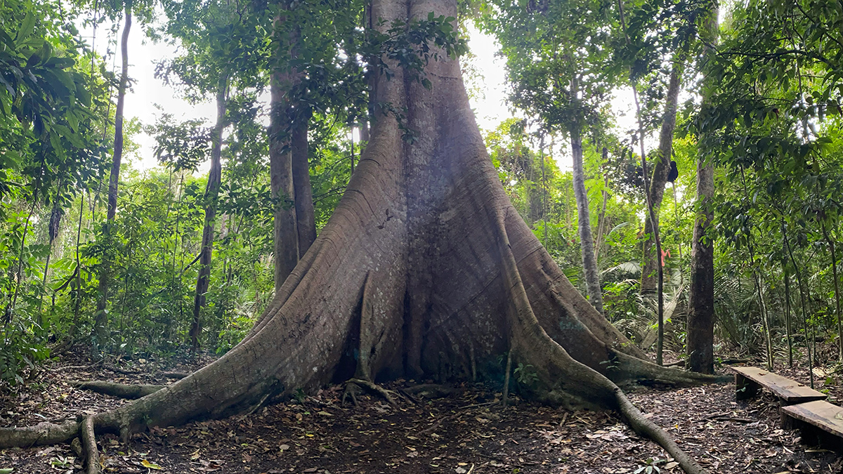
As CO2 Levels Rise, Old Amazon Trees Are Getting Bigger
New data show resilience among the rainforest’s giants, though scientists warn that nutrient limits and rising heat could end the trend.
Posted inFeatures
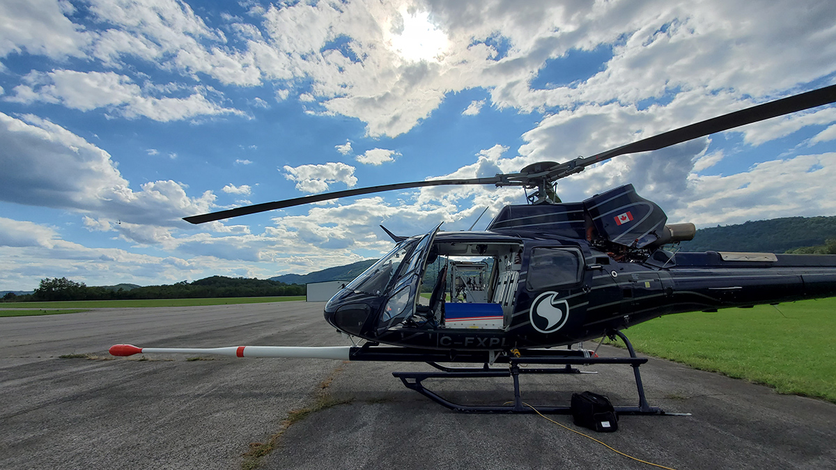
New Maps of Natural Radioactivity Reveal Critical Minerals and More
High-resolution airborne radiometric surveys are covering more ground than ever to provide insights into unseen geology, mineral resource potential, and possible health hazards.
Posted inNews
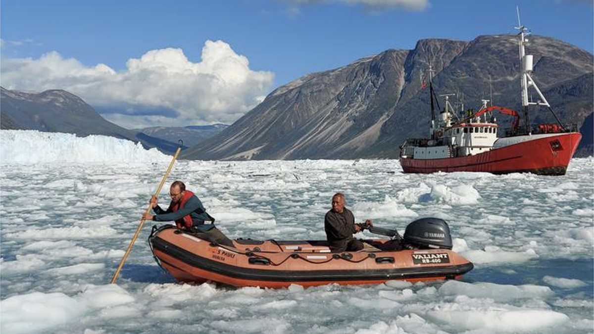
A Fiber-Optic Cable Eavesdrops on a Calving Glacier
A glass thread strung along the bottom of a fjord captured the entire process of calving, from the cracking of ice to the breakup of bergs.
Posted inScience Updates
Tracing Iron’s Invisible Transformations Just Beneath Our Feet
A new method that adds synthetic iron minerals to soils sheds light on hard-to-observe soil and sediment processes and may have a host of other applications in the Earth sciences and beyond.