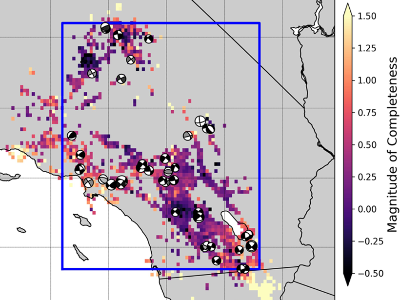
New research using a highly complete earthquake catalog shows that 72% of M4+ mainshocks are preceded by foreshocks, implying that foreshock activity is much more prevalent than previously thought.
Geophysical Research Letters

Posted inEditors' Highlights
Hiding Deep Hydrous Melts at the Core-Mantle Boundary
Silicate melts containing H2O in the lowermost mantle are surprisingly dense and may stagnate there, trapping primordial volatiles and potentially causing some of the ultra-low velocity zones.

Posted inEditors' Highlights
Molecular Ions Unexpectedly Frequent in Earth’s Magnetosphere
A Japanese satellite reveals rapid and surprisingly frequent transport of molecular ions from the ionosphere to the magnetosphere, under not only extreme but also moderate geomagnetic conditions.
Posted inEditors' Highlights
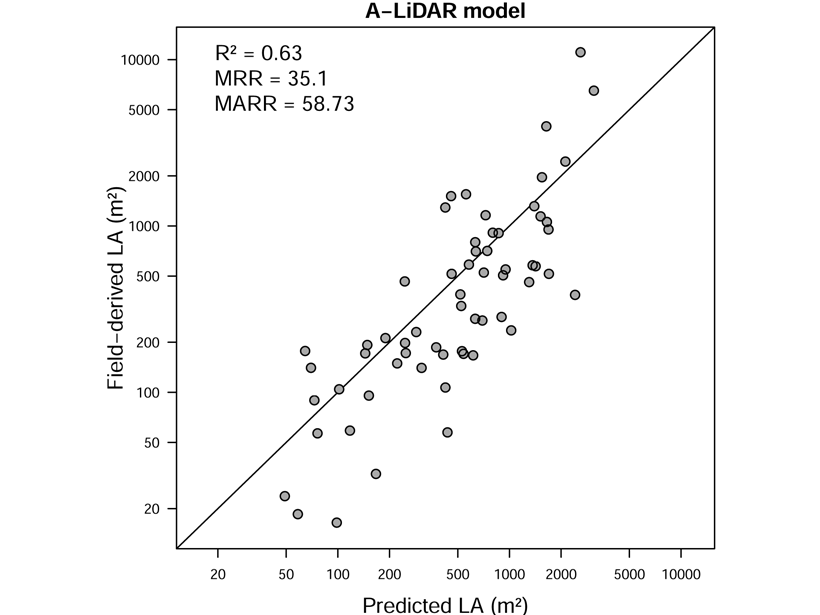
Tropical Forests May Have More Canopy Than Previously Thought
A rare attempt to directly estimate leaf area in a tropical African broadleaved forest suggests that there may be more tree foliage than previously estimated.
Posted inEditors' Highlights
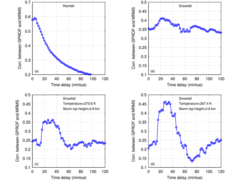
Accounting for the Fact that Snow Falls Slower than Rain
When calibrating satellite observations with ground-based ones, estimated precipitation rates are improved by considering that snow takes longer to fall compared to rain.
Posted inResearch Spotlights
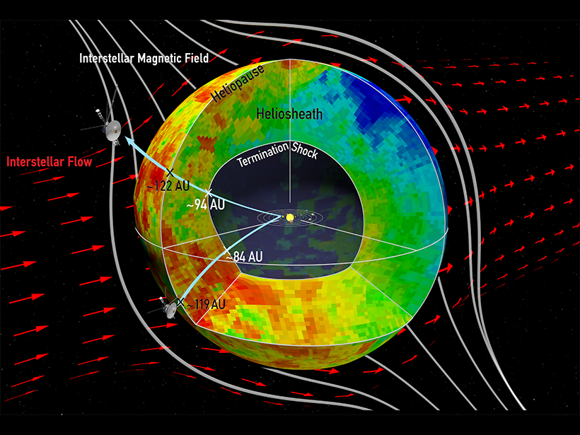
Sampling the Space Between the Stars
Data from the Cassini and Voyager spacecraft reveal new information about the Sun’s magnetic bubble.

Posted inResearch Spotlights
Past Climate Sensitivity Not Always Key to the Future
New research suggests that changes in continental configuration, solar brightness, and background atmospheric carbon dioxide levels all conspire to drive Earth’s climate sensitivity over geologic time.

Posted inResearch Spotlights
Detailed Origins of Sea Spray Revealed, One Droplet at a Time
An energized air-sea interface facilitates exchange between the atmosphere and the ocean. A new study looks at the formation of sea spray, an important component of this exchange.

Posted inEditors' Highlights
Peeling Back the Layers of the Climate of Mars
A new study ties layers in the polar deposits of Mars to changes in climate driven by orbital variations, constraining accumulation rates and further deciphering the climate history of the Red Planet.

Posted inResearch Spotlights
Tracking Earth’s Shape Reveals Greater Polar Ice Loss
Researchers offer a solution to better track mass changes in ocean water and polar ice.