
Climate change is contributing to crop stress associated with a growing demand for freshwater.
groundwater

Posted inNews
Farming Is Intensifying Floods in the South American Plains
The replacement of native vegetation by crops has raised groundwater levels in the Pampas, a new study suggests.

Posted inNews
Groundwater Pumping Is Causing Mexico City to Sink
Researchers say knowing how much water is being extracted is crucial for addressing infrastructure and water supply crises in the capital.
Posted inEditors' Highlights
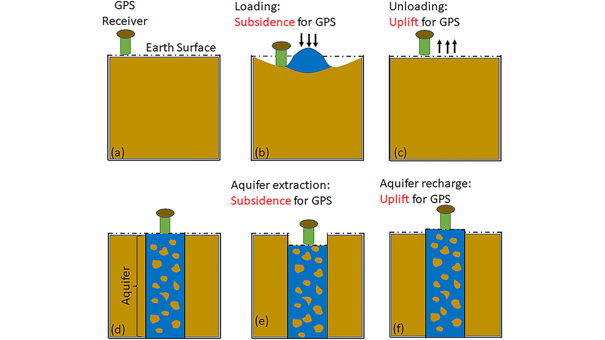
GPS Observations Sense Groundwater Change in Australia
By exploiting the fact that changes in groundwater cause deformations of the Earth’s surface, GPS receivers are used to detect groundwater changes related to extreme events and to seasonal oscillations.

Posted inNews
The Western Great Basin Has an Arsenic Problem—Blame Its Geology
A new study links geological factors such as faulting and geothermal activity to an elevated risk of arsenic contamination in private wells across the Great Basin.
Posted inEditors' Highlights
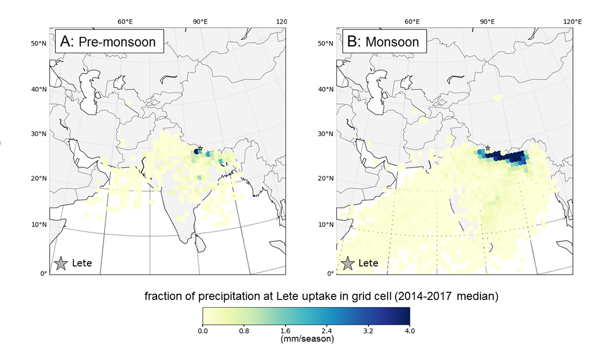
Source of Precipitation Moisture Feeding Himalayan Rivers
Isotope study showing the partitioning of moisture into snow, ice, and groundwater allows an understanding of the relative contribution to river flow to show where Himalayan river water comes from.
Posted inResearch Spotlights
El agua subterránea se repone mucho más rápido de lo que pensaban los científicos
Un nuevo modelo basado en el clima indica que los científicos podrían haber subestimado la importancia del agua subterránea para mantener los ríos y la vida vegetal.
Posted inEditors' Highlights
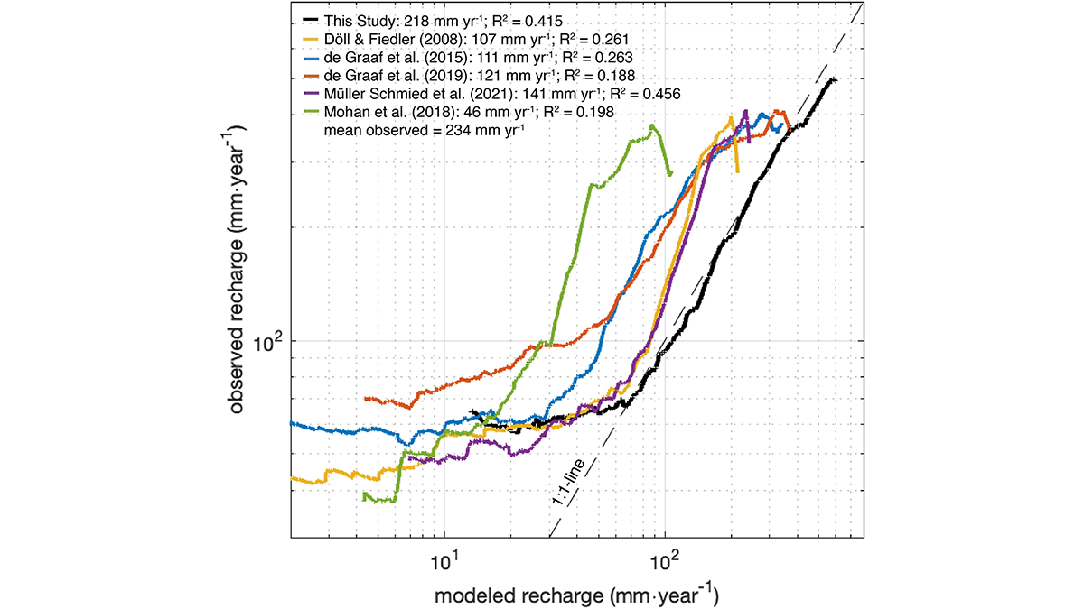
Global Models Underestimated Groundwater Recharge and Discharge
A new estimate for global groundwater recharge by rainfall and snowmelt, which dictates the upper limit of sustainable groundwater use, doubles the previous estimates from global models.
Posted inEditors' Highlights
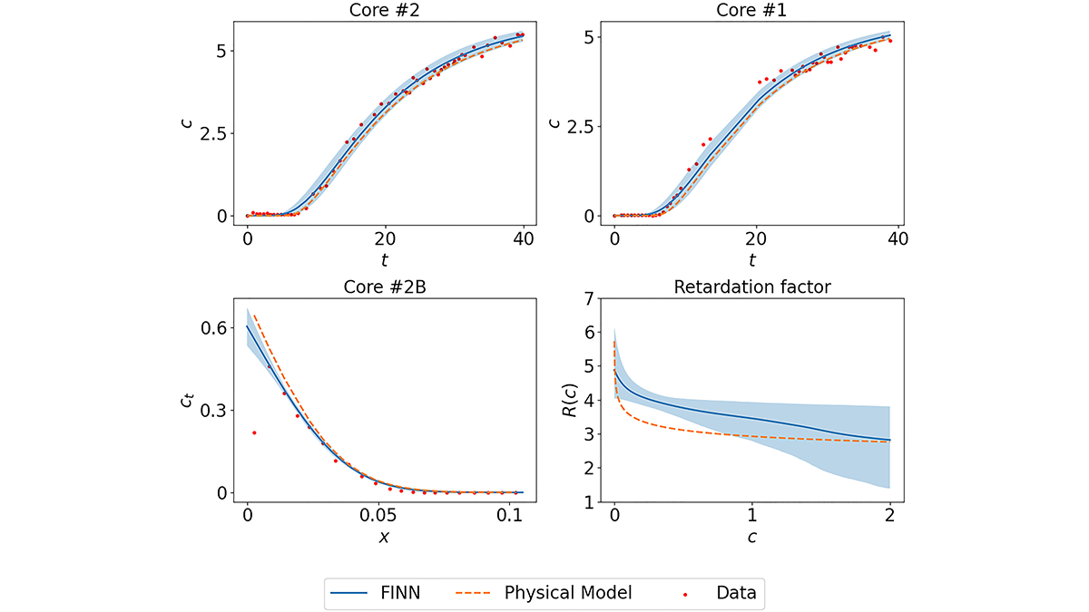
Playing Bricks with Neural Networks to Learn Sorption Processes
Designated neural network modules are combined to mimic numerically-discretized diffusion-sorption equations, which allows learning “missing pieces” in system understanding and their uncertainties.

Posted inResearch Spotlights
Groundwater Replenishes Much Faster Than Scientists Previously Thought
A new climate-based model indicates that scientists may be underestimating groundwater’s importance in sustaining streams and plant life.