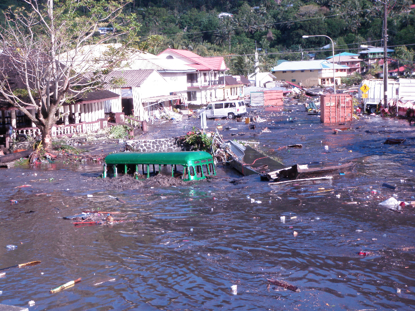
A next-generation network of seismic and wave sensors in the southwestern Pacific will warn coastal residents of an approaching tsunami before they see the wave.
hardware & infrastructure

Posted inNews
New Space Telescope Named for Nancy Roman, Astronomy Pioneer
Nancy Grace Roman’s namesake telescope will search for distant worlds and the earliest galaxies.

Posted inNews
Great Lakes Cities’ Sewer Designs Mean Waste in the Waters
In older cities, a single system of pipes may transport sewage and stormwater runoff. As the climate crisis brings more intense storms, urban areas like Toronto are overhauling their drainage systems.
Posted inEditors' Highlights
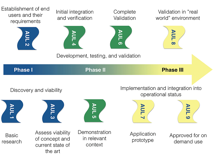
Highlighting the Path from Space Weather Science to Applications
The transition of space weather science from research to operations needs a framework with both good science and a good dialogue with end users.
Posted inScience Updates
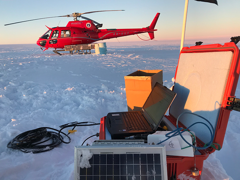
A Shared Resource for Studying Extreme Polar Environments
A new community pool of seismic instrumentation will facilitate and advance geologic and cryospheric research in Earth’s ice-covered environments.

Posted inEditors' Highlights
Remotely Monitoring Groundwater Using Standard Techniques
Novel use of standard, single-station seismological techniques can be used to remotely monitor aquifer systems.
Posted inNews
How to Launch a Satellite During a Blackout
PG&E shut down the power to Berkeley’s Space Sciences Laboratory right before a satellite launch.
Posted inNews
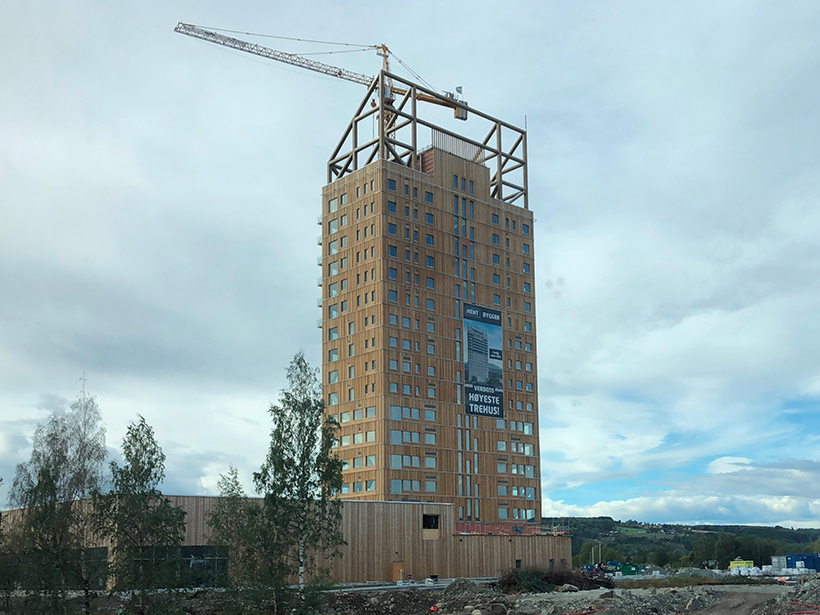
Wooden Buildings Could House the Carbon of the 21st Century
To keep carbon out of the atmosphere, researchers argue that we need to return to one of the world’s oldest building materials: wood.
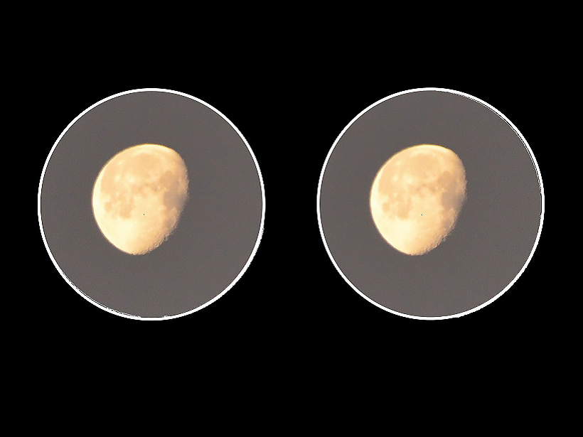
Posted inGeoFIZZ
Binocular Astronomy
Explore the night sky with your own two eyes and a touch of magnification.

Posted inFeatures
A Geodata Fabric for the 21st Century
We have the potential to transform our understanding of Earth—if we can just figure out how to harness ever growing data streams.