
Nationwide, civil engineers consider precipitation values from NOAA to design their structures. But those values are missing another contributor to flood risk: snowmelt.
hardware & infrastructure

Posted inResearch Spotlights
Fibers Pick Up Silicon Valley Traffic Changes During Quarantine
Fiber-optic cables measured a 50% decline in Sand Hill Road traffic in March.

Posted inNews
Using Dirt to Clean Up Construction
The construction industry is one of the world’s largest emitters of carbon dioxide. Whether it can reduce those emissions depends on replacing its most common building material.
Posted inNews
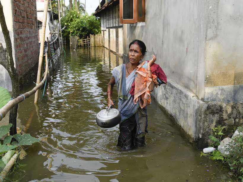
New Recommendations for a Proactive Flood Policy in India
As India grapples with devastating monsoon floods, a new review supports greater investment in nonstructural solutions.

Posted inNews
East Africa Invests in Strategies to Manage E-Waste
As Uganda develops its e-waste policy, neighboring Rwanda establishes a broad-based plan involving incentives and high-tech facilities.
Posted inOpinions
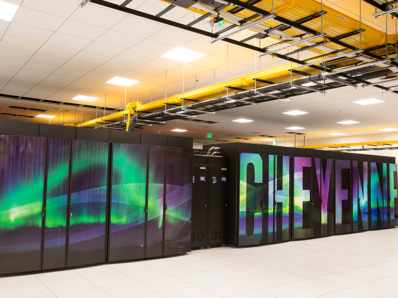
Earth System Modeling Must Become More Energy Efficient
As weather and climate models grow larger and more data intensive, the amount of energy needed to run them continues to increase. Are researchers doing enough to minimize the carbon footprint of their computing?

Posted inNews
The Seismic Hush of the Coronavirus
Scientists are listening for faint natural signals during the quiet of coronavirus lockdowns.

Posted inFeatures
Remaking a Planet One Atom at a Time
When is a planet not a planet? Where does helium rain? How can water be solid and liquid at the same time? For answers, scientists put common planetary materials under extreme pressure and watched what happened next.

Posted inNews
The Future of Big Data May Lie in Tiny Magnets
New research in the field of neuromorphic computing uses tiny magnets and their magnetic fields to optimize computing algorithms.

Posted inNews
Venus Exploration Starts in the Lab
Most technology would not last a day on our planet’s evil twin. By creating Venus’s surface and atmospheric conditions here on Earth, a team of engineers is designing spacecraft technology that will last for months.