
Multiple factors often interact to amplify the effects of severe storms, droughts, and other extreme water-related events.
Hazards & Disasters
Posted inEditors' Highlights
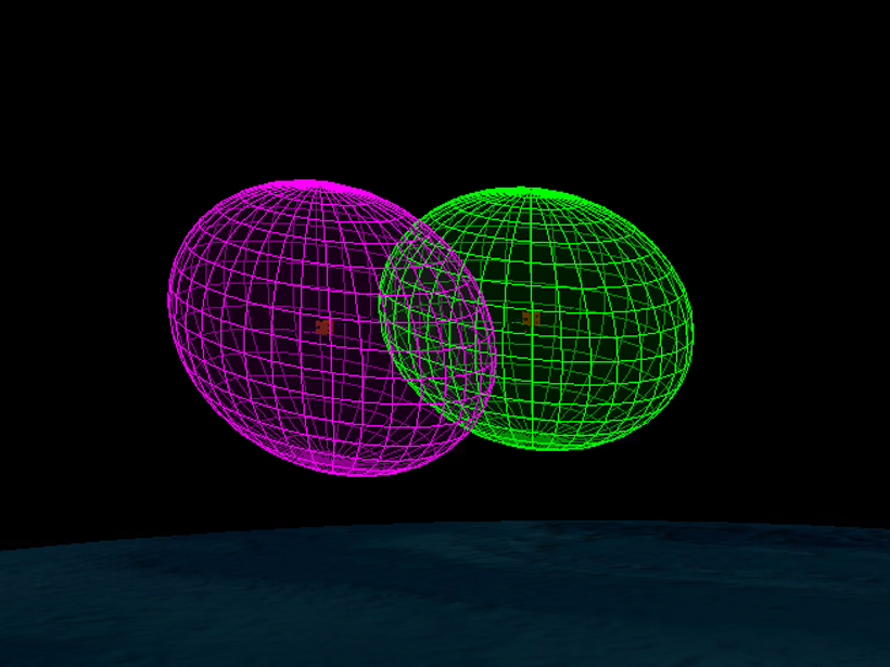
Predicting and Avoiding Collisions in Space
Solar wind drivers affecting the satellite environment have about a one hour predictive horizon, but solar wind speed periodicities and ensemble modeling can extend the forecast interval.
Posted inEditors' Highlights
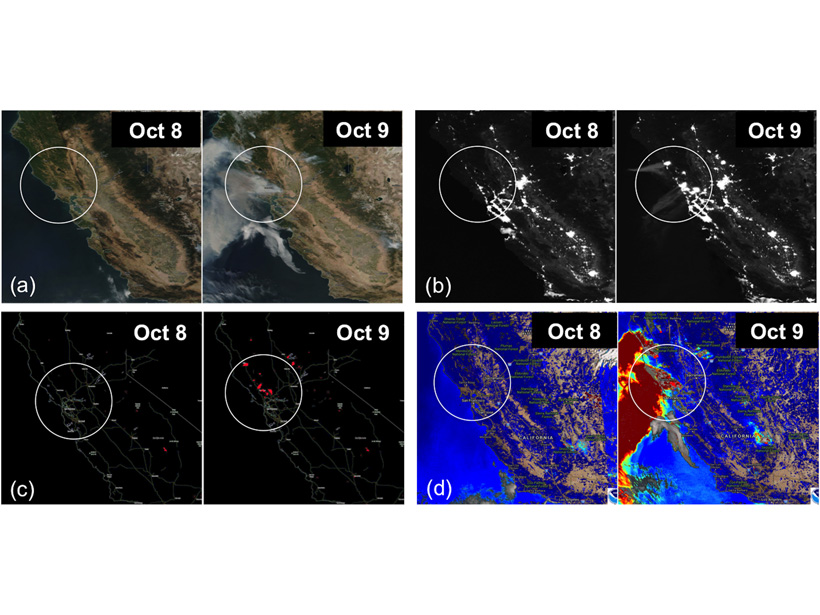
New Strategies to Protect People from Smoke During Wildfires
Satellite measurements coupled with inexpensive air quality monitors could help protect humans from smoke particulates during wildfire events.
Posted inResearch Spotlights
Constraining Central Washington’s Potential Seismic Hazard
Fault geometry and slip rate analyses show deformation in the Yakima Fold Province accelerated in the Pleistocene and has remained elevated, offering new insights into earthquake recurrence intervals.
Posted inFeatures
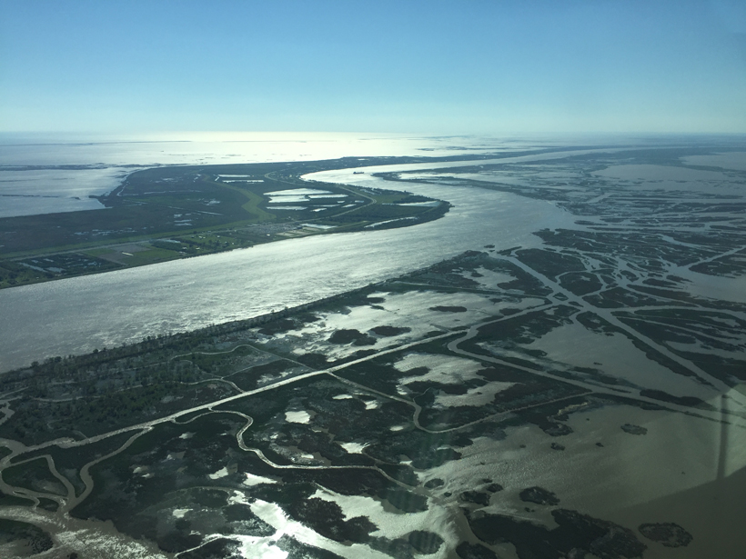
Rethinking the River
The Mississippi River and its delta and plume provide insights into research-informed approaches to managing river-dominated coastal zones.
Posted inNews
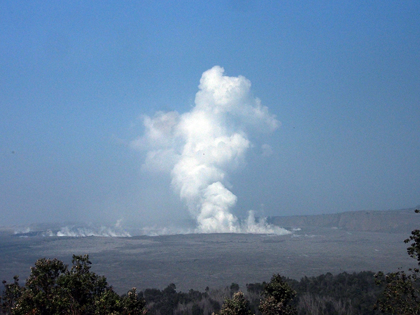
Huge Spike in Quakes Badly Damages Kīlauea Observatory
Meanwhile, some scientists say that the 35-year eruption from the Pu‘u Ō‘ō vent has ended and that the flows since 3 May are a new eruption. Others take issue with this view.

Posted inResearch Spotlights
Magma Flow in a Major Icelandic Eruption
Mechanical modeling suggests that previous, undetected eruptions released tectonic stress near the ice-covered Bárðarbunga volcano.

Posted inNews
Faster Lava Flows, Explosive Eruptions Begin at Kīlauea
Scientists say the dramatic increase in flows is likely due to the arrival of younger, hotter magma in the system.
Posted inScience Updates
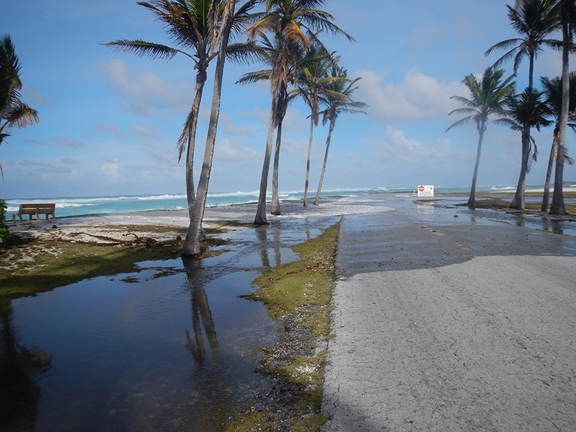
Challenges of Forecasting Flooding on Coral Reef–Lined Coasts
Understanding Flooding on Reef-lined Island Coasts Workshop; Honolulu, Hawaii, 5–7 February 2018
Posted inScience Updates
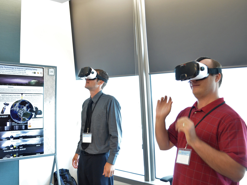
NOAA Seeks Emerging Technologies to Further Its Mission
National Oceanic and Atmospheric Administration Emerging Technologies for Observations Workshop; College Park, Maryland, 22–23 August 2017