• About
  • Sections
  • Topics
    • Climate
    • Earth Science
    • Oceans
    • Space & Planets
    • Health & Ecosystems
    • Culture & Policy
    • Education & Careers
    • Opinions
  • Projects
    • ENGAGE
    • Editors’ Highlights
    • Editors’ Vox
    • Eos en Español
    • Eos 简体中文版
    • Print Archive
  • Science Policy Tracker
  • Blogs
    • Research & Developments
    • The Landslide Blog
  • Newsletter
  • Submit to Eos
  • AGU.org
  • Career Center
  • Join AGU
  • Give to AGU
  • About
  • Sections
  • Topics
    • Climate
    • Earth Science
    • Oceans
    • Space & Planets
    • Health & Ecosystems
    • Culture & Policy
    • Education & Careers
    • Opinions
  • Projects
    • ENGAGE
    • Editors’ Highlights
    • Editors’ Vox
    • Eos en Español
    • Eos 简体中文版
    • Print Archive
  • Science Policy Tracker
  • Blogs
    • Research & Developments
    • The Landslide Blog
  • Newsletter
  • Submit to Eos
Skip to content
  • AGU.org
  • Career Center
  • Join AGU
  • Give to AGU
Eos

Eos

Science News by AGU

Support Eos
Sign Up for Newsletter
  • About
  • Sections
  • Topics
    • Climate
    • Earth Science
    • Oceans
    • Space & Planets
    • Health & Ecosystems
    • Culture & Policy
    • Education & Careers
    • Opinions
  • Projects
    • ENGAGE
    • Editors’ Highlights
    • Editors’ Vox
    • Eos en Español
    • Eos 简体中文版
    • Print Archive
  • Science Policy Tracker
  • Blogs
    • Research & Developments
    • The Landslide Blog
  • Newsletter
  • Submit to Eos

Hurricane Katrina

A satellite image shows Hurricane Katrina over the Gulf Coast.
Posted inFeatures

How Researchers Have Studied the Where, When, and Eye of Hurricanes Since Katrina

by Emily Dieckman 29 August 20258 September 2025

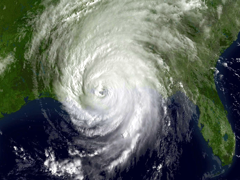
Twenty years after one of the country’s deadliest storms, scientists reflect on improvements in the ability to understand and predict disasters.

A broken bridge and flooded river in Kerr County, Texas
Posted inResearch & Developments

FEMA Puts Dissenting Staff on Indefinite Leave

Kimberly M. S. Cartier, News Writing and Production Intern for Eos.org by Kimberly M. S. Cartier 27 August 202527 August 2025

More than a dozen FEMA staff, all signatories of that Katrina Declaration, were placed on indefinite administrative leave.

New Orleans skyline
Posted inNews

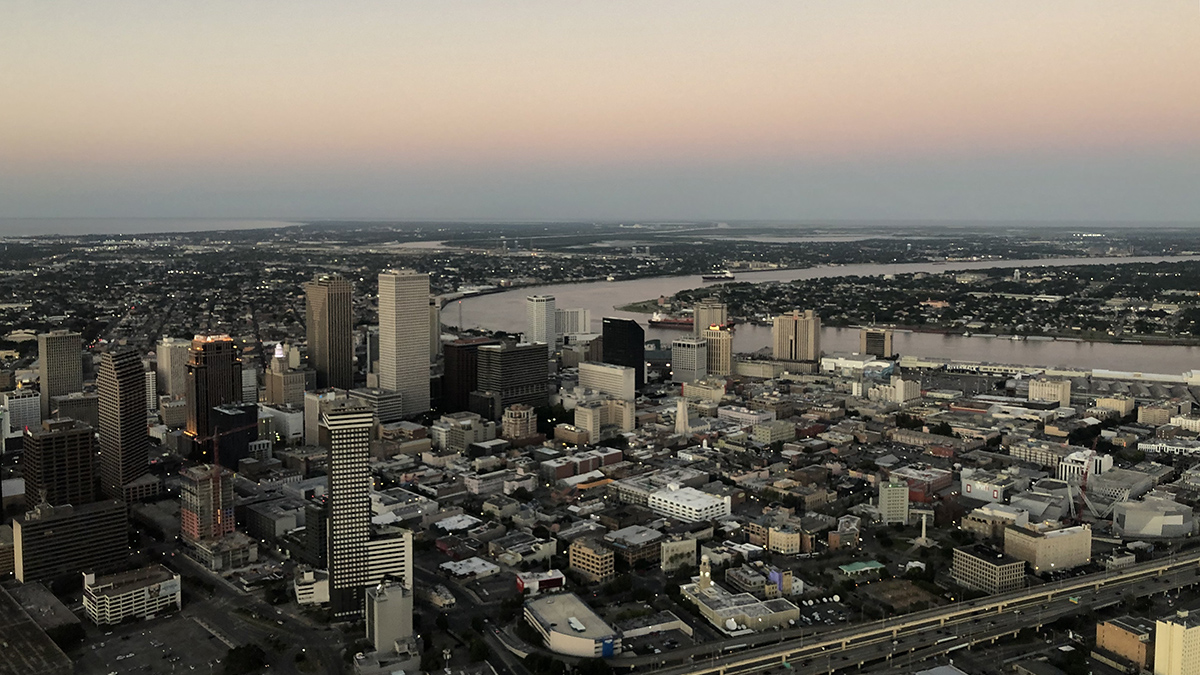
Parts of New Orleans Are Sinking

by Skyler Ware 14 August 202514 August 2025

Areas near the airport, along floodwalls, and in nearby wetlands are subsiding because of a combination of natural and anthropogenic forces.

Photo of a thunderstorm
Posted inEditors' Vox

Foundations in Hazards and Disasters for Undergraduate Students

by Bethany D. Hinga 22 April 202423 April 2024

A new textbook for undergraduates explores different types of natural hazards and disasters through foundational scientific knowledge, engaging case studies, and mitigation strategies.

Aerial view of flooding in around Houston, Texas.
Posted inScience Updates

Forecasting Compound Floods in Complex Coastal Regions

by Saeed Moghimi, Edward Myers, Shachak Pe’eri, Y. Joseph Zhang and Fei Ye 16 November 202127 October 2022

Coastal communities face more frequent floods in which rain, rivers, and ocean storm surge combine forces. A reliable system that accurately predicts inundation from these events is urgently needed.

A dredge works through the night to clear shoaling along the Mississippi River at New Orleans.
Posted inFeatures

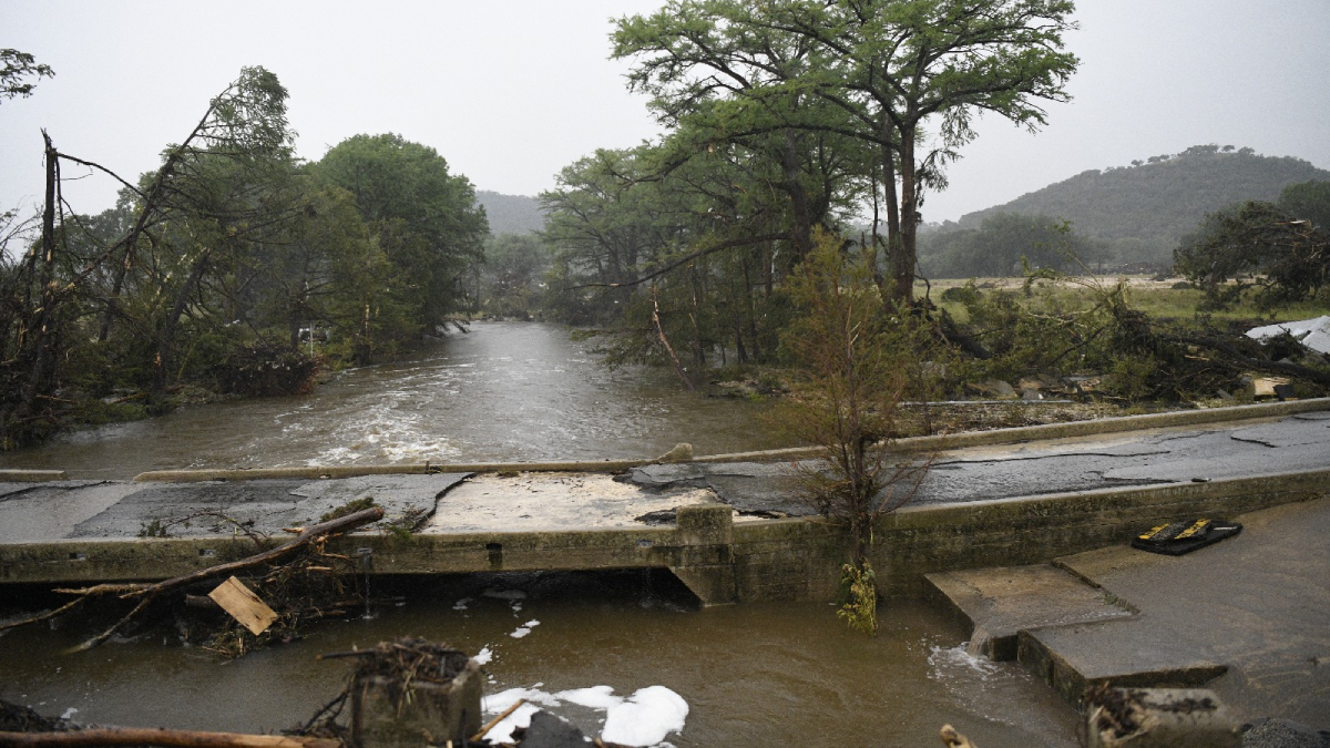
High Water: Prolonged Flooding on the Deltaic Mississippi River

by N. M. Gasparini and B. Yuill 20 March 202027 October 2022

Changing climate and land use practices are bringing extended periods of high water to the lower Mississippi River. New management practices are needed to protect people, industry, and the land.

Flooding in Colfax, Iowa, in August 2010.
Posted inResearch Spotlights

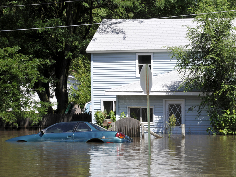
Calculating the Risk of Rare Floods

Elizabeth Thompson by Elizabeth Thompson 1 May 201927 October 2022

The first spatially realistic catalog of synthetic flood event risk across the entire United States uncovers high-risk areas and estimates the probability of another Katrina–level flood loss.

Posted inNews

Does U.S. Hurricane Rating Scale Get the Danger Right?

JoAnna Wendel, freelance science writer and illustrator by JoAnna Wendel 28 August 201527 October 2022

Some scientists think it's time to retire the Saffir-Simpson scale and start fresh.

Posted inOpinions

Ten Years After Katrina: What Have We Learned?

by T. H. Dixon 27 August 20151 November 2021

One mitigation strategy—relocating people and sensitive infrastructure to higher ground—eventually will need to be considered as sea level rise accelerates.

A view of a Washington, D.C., skyline from the Potomac River at night. The Lincoln Memorial (at left) and the Washington Monument (at right) are lit against a purple sky. Over the water of the Potomac appear the text “#AGU24 coverage from Eos.”

Features from AGU Publications

Research Spotlights

Magnetic “Switchback” Detected near Earth for First Time

8 October 20258 October 2025
Editors' Highlights

New Evidence for a Wobbly Venus?

29 September 202525 September 2025
Editors' Vox

All Publish, No Perish: Three Months on the Other Side of Publishing

29 September 202525 September 2025
Eos logo at left; AGU logo at right

About Eos
ENGAGE
Awards
Contact

Advertise
Submit
Career Center
Sitemap

© 2025 American Geophysical Union. All rights reserved Powered by Newspack