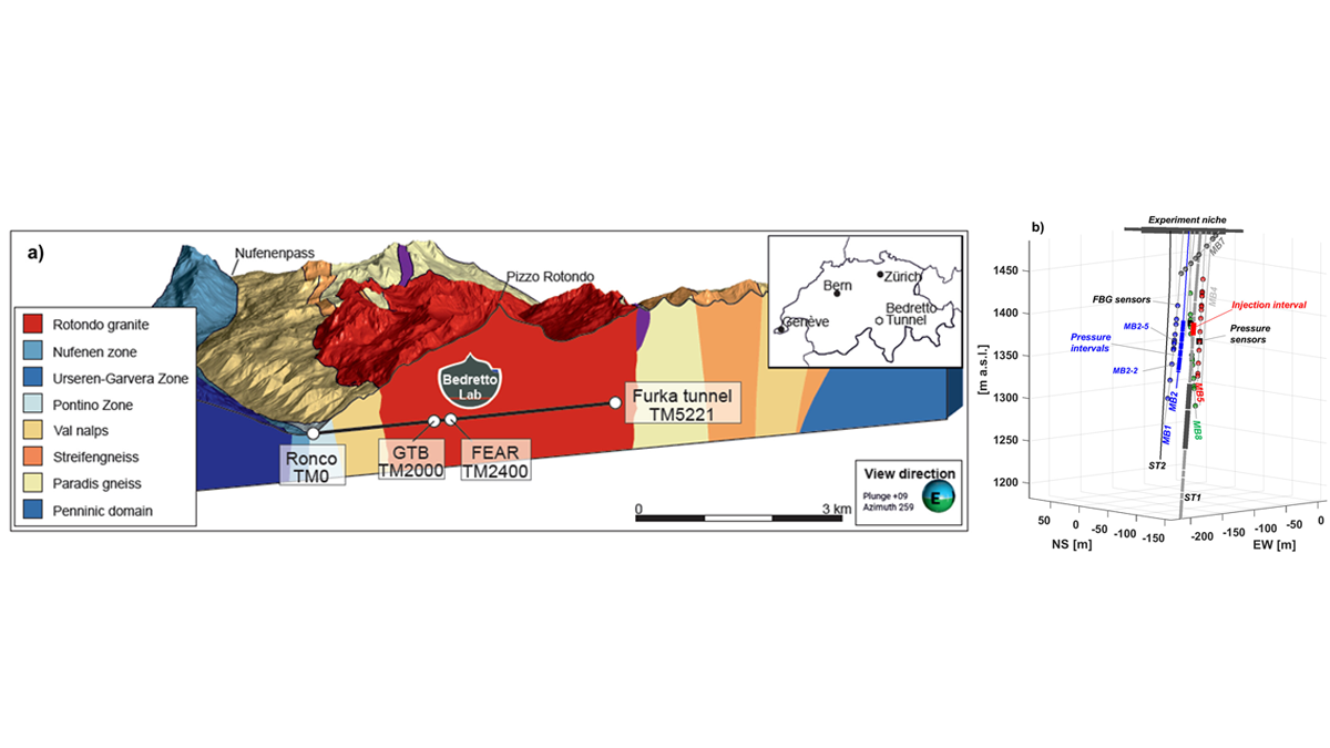
Controlled multi-day hydraulic stimulation experiments in the BedrettoLab aim to generate seismicity in order improve the understanding for rupture processes of natural and induced earthquakes.
Journal of Geophysical Research: Solid Earth
Posted inEditors' Highlights
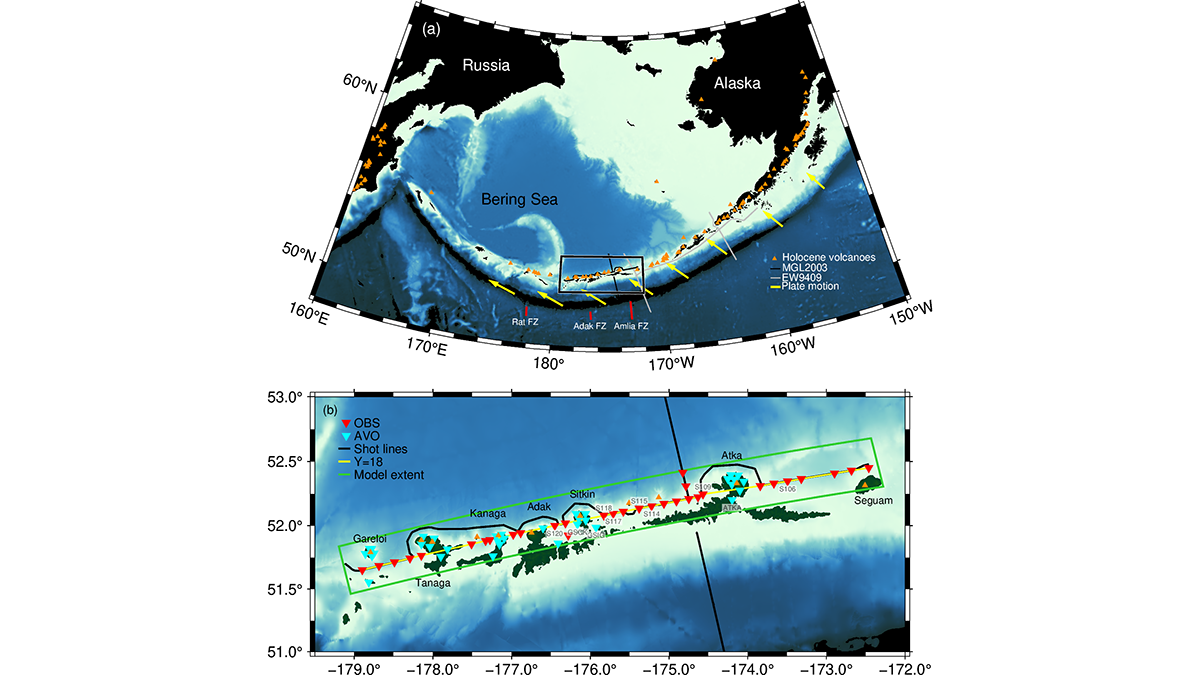
A Snapshot of Continental Crust in the Making
New seismic images from the Aleutian Arc show how active volcanic arcs may build new continental crust, highlighting the complex transition at multiple stages.
Posted inEditors' Highlights
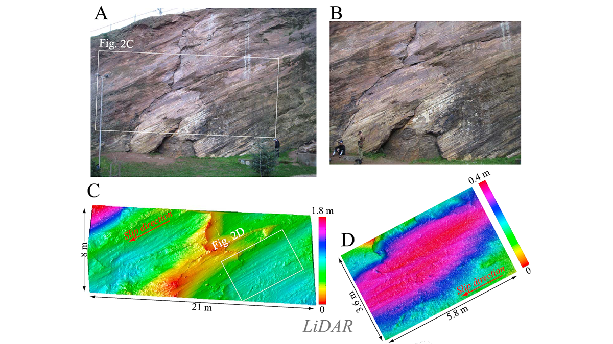
Multi-Scale Fault Roughness Encapsulated in a Friction Law
A new rate- and roughness-dependent friction law incorporates multi-scale fault processes to reproduce earthquake fracture energy scaling.
Posted inEditors' Highlights
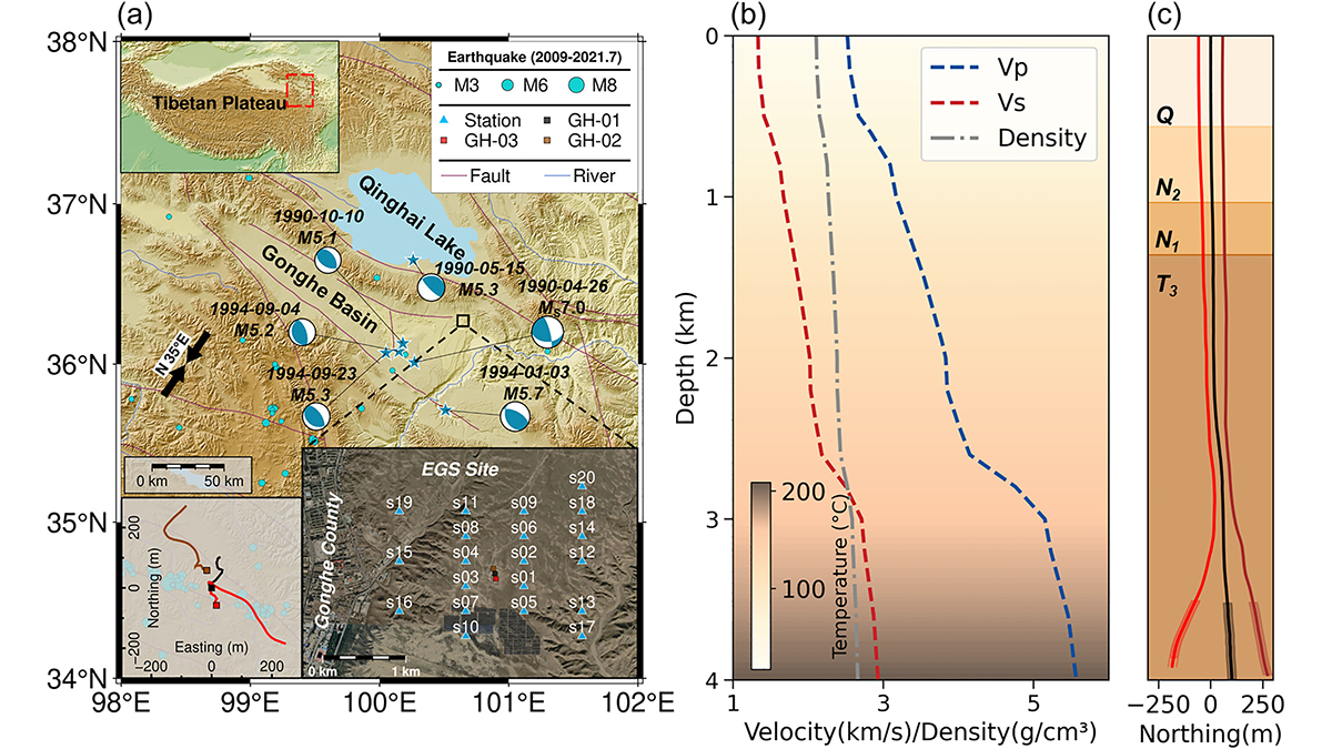
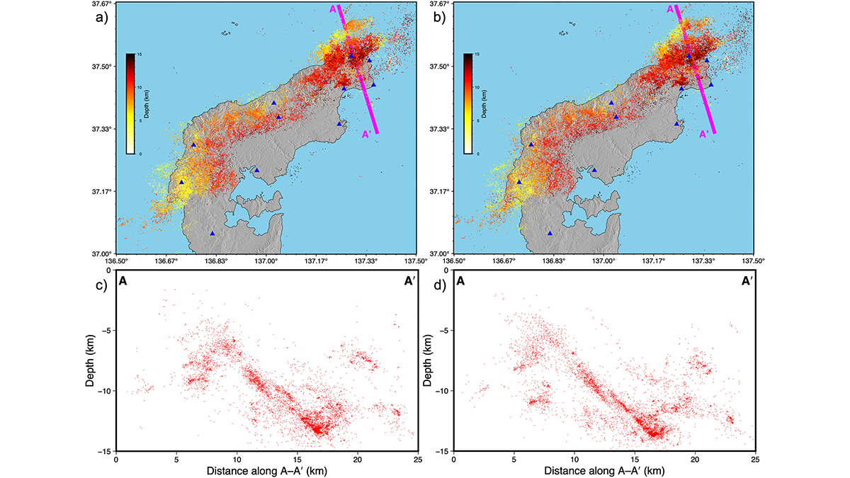
Pre-Existing Structure and Stress Shape Geothermal-Induced Seismicity
At China’s first Enhanced Geothermal System site, dense seismic observations, integrated with borehole data and stress modeling, reveal weak faults and scale-dependent control of stress and structure on induced seismicity.
Posted inEditors' Highlights
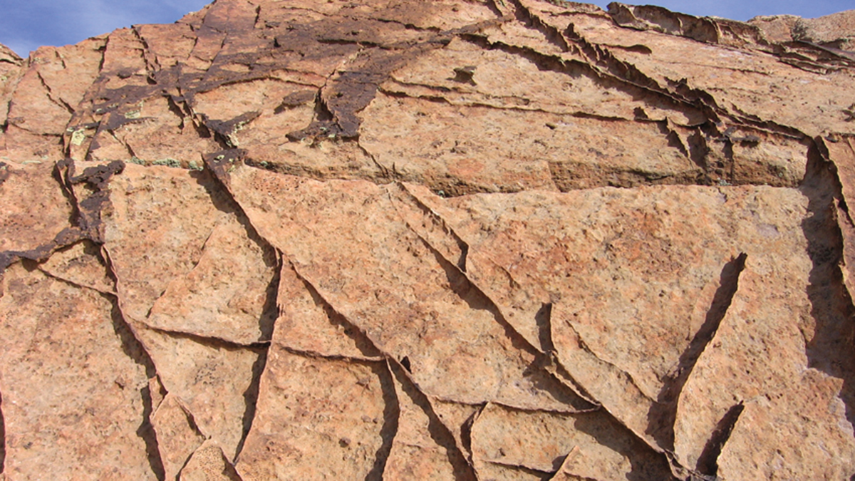
From Grains to Bands: Modeling Deformation in Porous Rocks
How do bands emerge in highly porous rocks? A study based on energy minimization reveals how microscale heterogeneity and stress conditions drive the formation of complex deformation bands.
Posted inResearch Spotlights
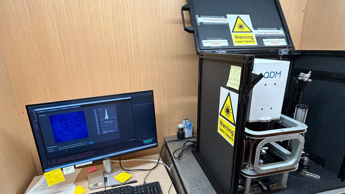
Navigating the Past with Ancient Stone Compass Needles
The emerging field of magnetic microscopy allows scientists to reconstruct ancient magnetic fields from individual magnetic particles. A new study evaluates the accuracy of the technique.
Posted inEditors' Highlights
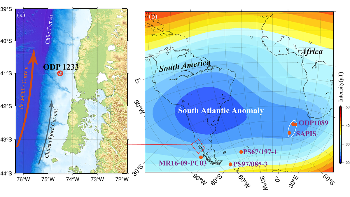
How Sediment Magnetism Captures the South Atlantic Anomaly
Magnetic data from an ODP core deposited during normal secular variation (65-41 thousand years ago) off the Chilean margin help clarify geomagnetic field behavior in the South Atlantic Anomaly region.
Posted inEditors' Highlights
Taming the Seismicity Tsunami with a Scalable Bayesian Framework
By combining the power of artificial intelligence with advanced physics simulations, a new framework called “SPIDER” allows us to map seismic activity with unprecedented clarity.
Posted inEditors' Highlights
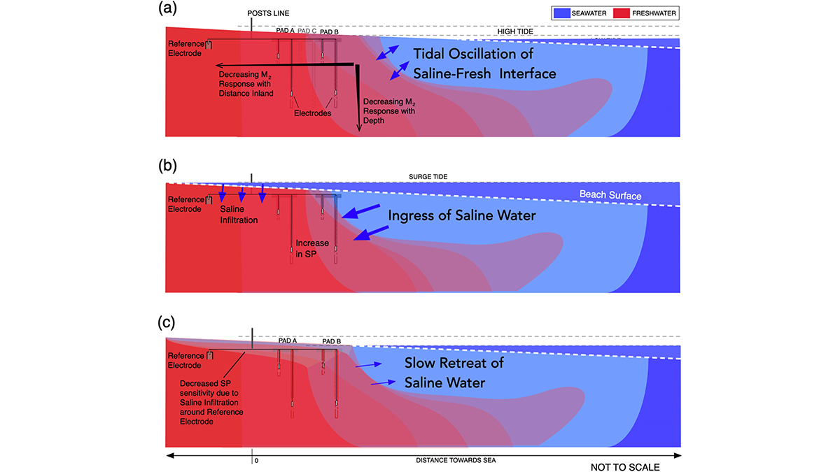
Tides Generate Detectable Electrical Signals in Coastal Aquifers
Spontaneous potentials show possibility for monitoring coastal saltwater intrusion.
Posted inEditors' Highlights
A New Way to Measure Quartz Strength at High Pressure
Direct stress measurements inside deforming quartz reveal how its strength changes with temperature, improving models of continental crust deformation.