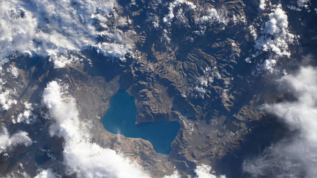
Ten years’ worth of data reveal that two theories about how the Tibetan Plateau deforms are both probably right.
landscape & topography
Posted inResearch Spotlights
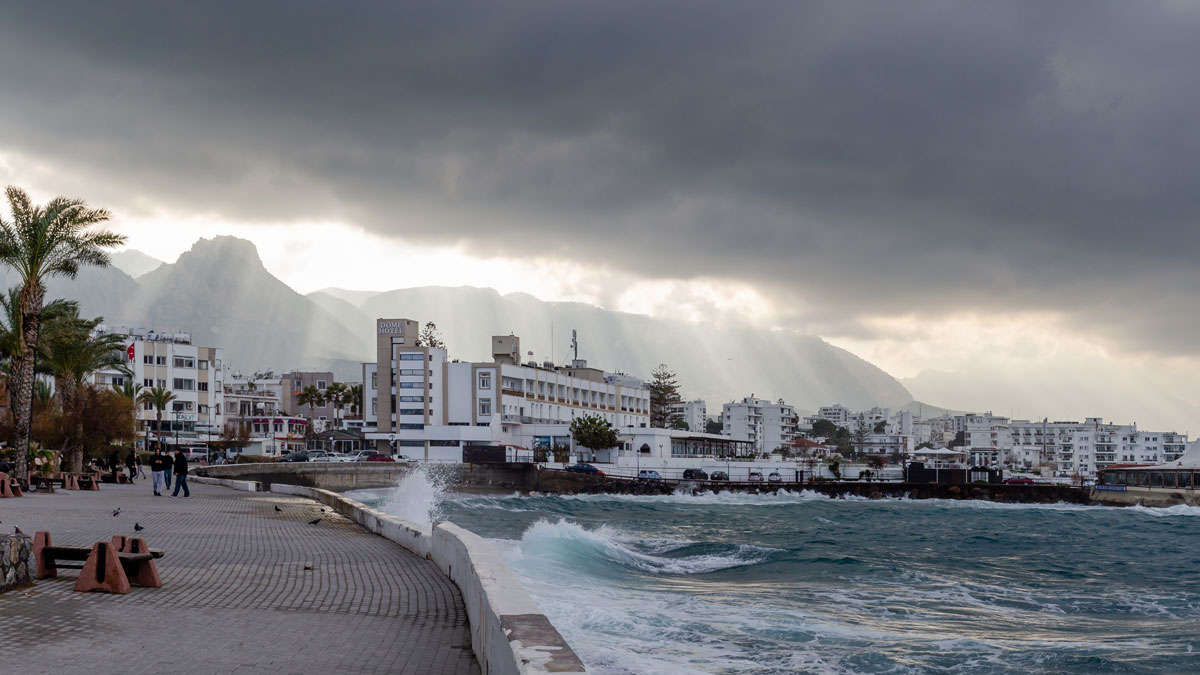
How to Study Coastal Evolution
Researchers reviewed what’s known about how coastlines are changing and made recommendations for how to learn more.

Posted inScience Updates
An Art-Science Partnership Offering New Views of Dynamic Landscapes
The immersive and interactive WILDLAND exhibition allowed the public—and the exhibition’s creators—to explore connections among water, trees, fire, and other natural and human-made materials expressed across a spectrum of artistic approaches.
Posted inNews
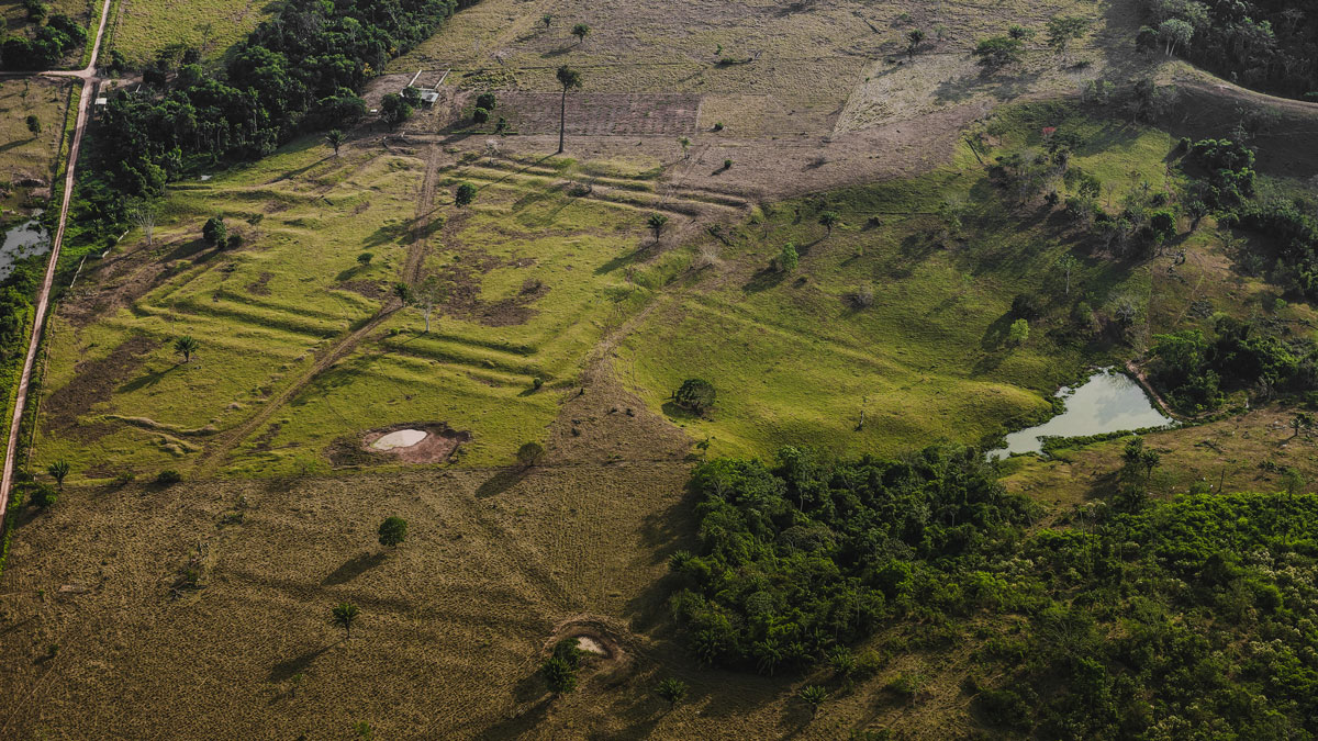
How Ancient Indigenous Societies Made Today’s Amazon More Resilient
Portions of the forest managed by pre-Columbian populations hold higher biomass and are more able to withstand climate change.
Posted inNews
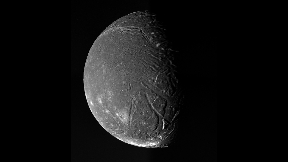
Tiny Uranian Moon Likely Had a Massive Subsurface Ocean
Ariel’s tempestuous subsurface ocean may have once composed more than half its total volume.
Posted inNews
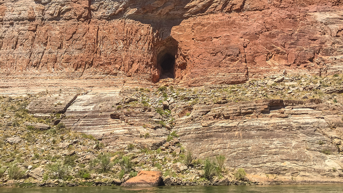
An Asteroid Impact May Have Led to Flooding near the Grand Canyon
There’s remarkable synchronicity between the timing of a paleolake in what is today Grand Canyon National Park and the formation of nearby Barringer Meteorite Crater.

Posted inNews
33.8 Million People in the United States Live on Sinking Land
The most populated cities in the country are slowly subsiding, posing risks to infrastructure and exacerbating flooding—and not just on the coasts.

Posted inNews
Investigadores cuantifican el impacto de los animales en la transformación de la Tierra
Los animales salvajes utilizan 76,000 gigajulios de energía—el equivalente a cientos de miles de monzones o inundaciones—moldeando los ecosistemas terrestres y de agua dulce de nuestro planeta.
Posted inNews
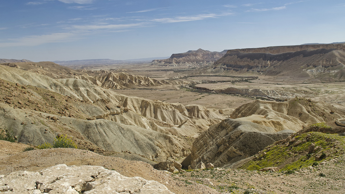
Climate Shifts Drive Episodic Drainage Changes
Drainage divide migration is influenced by tectonics and climate over long periods. New research in Israel shows that even shorter-term wet-dry cycles can move divides.
Posted inEditors' Highlights
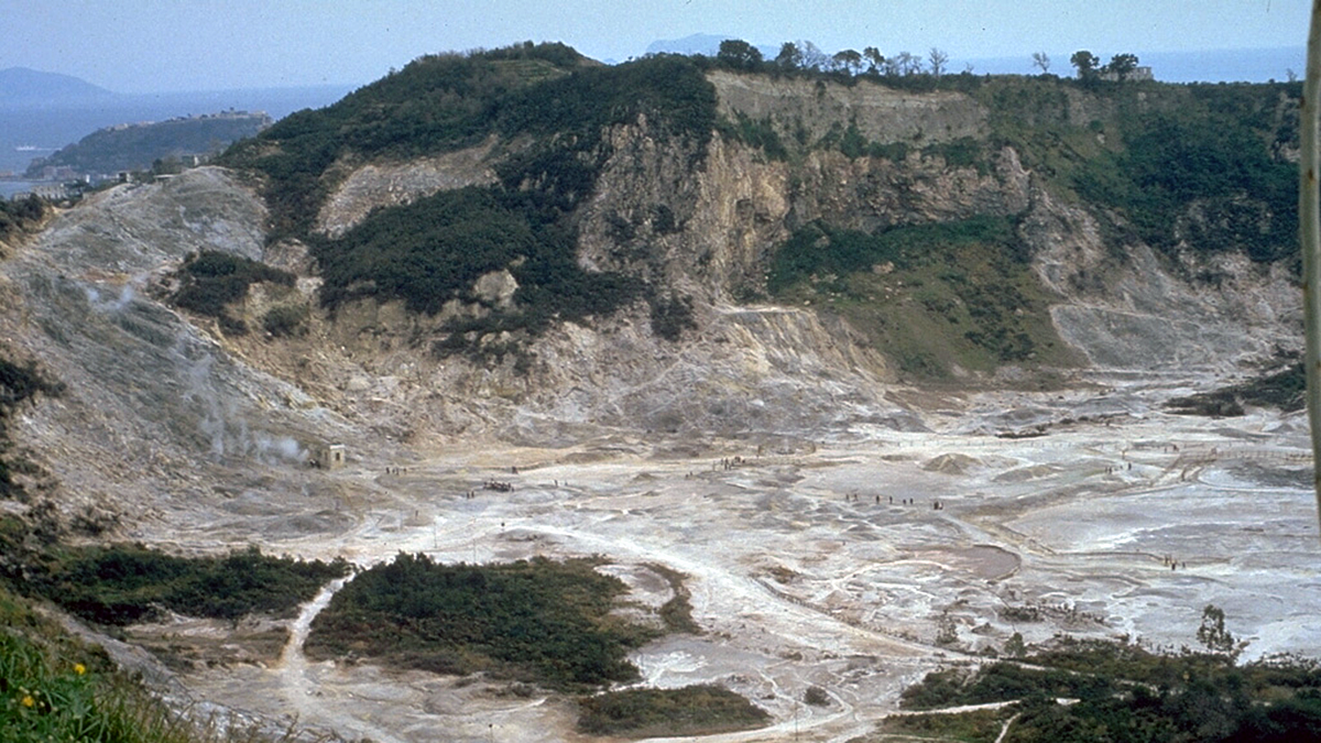
Deflected Dikes Perturb the Plumbing System
A multidisciplinary synthesis of the Campi Flegrei, Italy volcanic setting highlights the importance of sub-caldera layering for magma dynamics.