
Wild animals expend 76,000 gigajoules of energy—the equivalent of hundreds of thousands of monsoons or floods—shaping our planet’s terrestrial and freshwater ecosystems.
landscape & topography

Posted inEditors' Vox
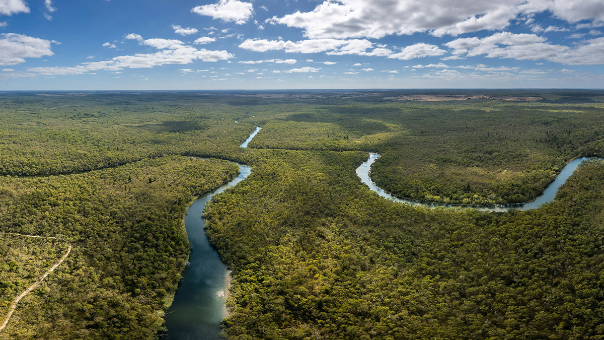
Topography and the Terrestrial Water Cycle
The relationship between topography and the terrestrial water cycle has been documented for thousands of years, yet there is still much to learn about Earth’s complex dynamics – both above, at, and below the surface.
Posted inEditors' Highlights
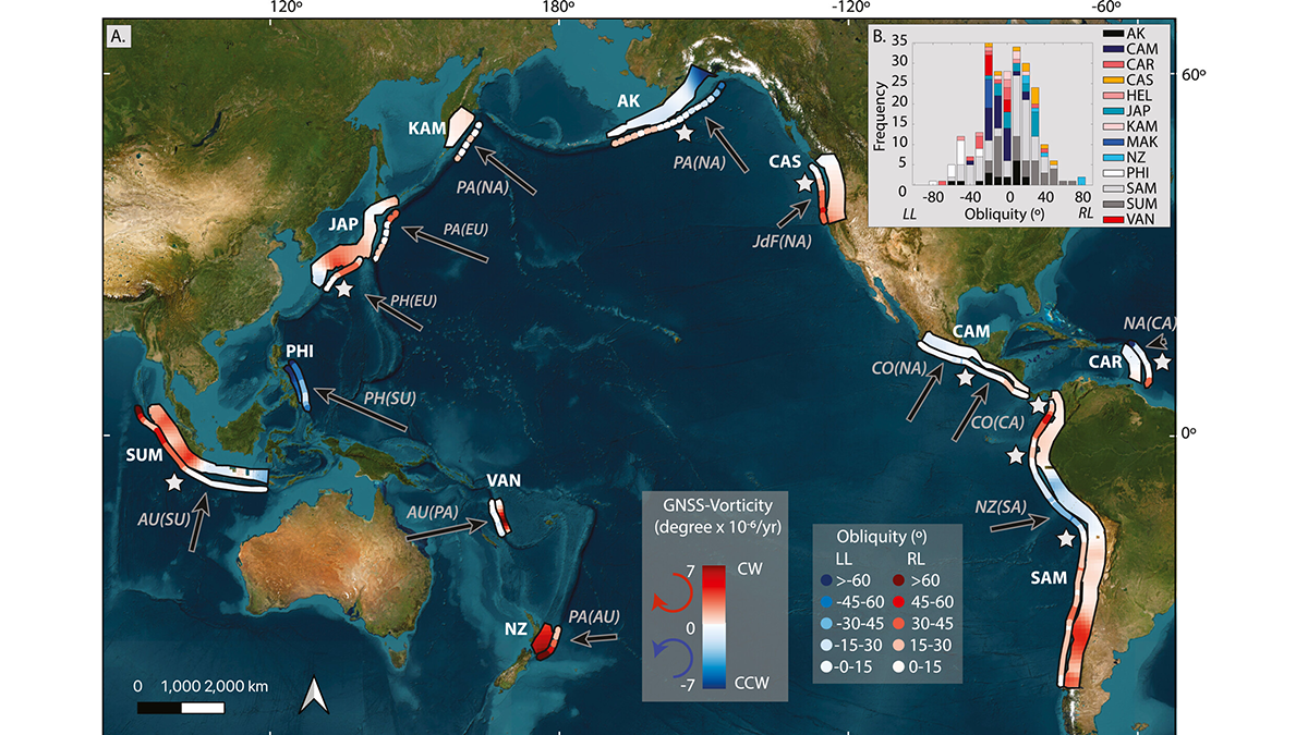
Skewed Subduction Shear Zones
A global reanalysis of both short- and long-term deformation clarifies how obliquity affects strain partitioning in convergent plate boundaries.
Posted inEditors' Highlights
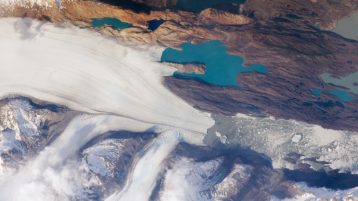
The Pulsed Pace of Glacial Erosion
New data from Lago Argentino, Patagonia reveal that glacial erosion occurs in discrete pulses, which challenges previous ideas that erosion rates have increased over time due to climate change.

Posted inFeatures
How to Build the World’s Highest Mountain
The rocks of Mount Everest’s peak made an epic journey from seafloor to summit.
Posted inEditors' Highlights
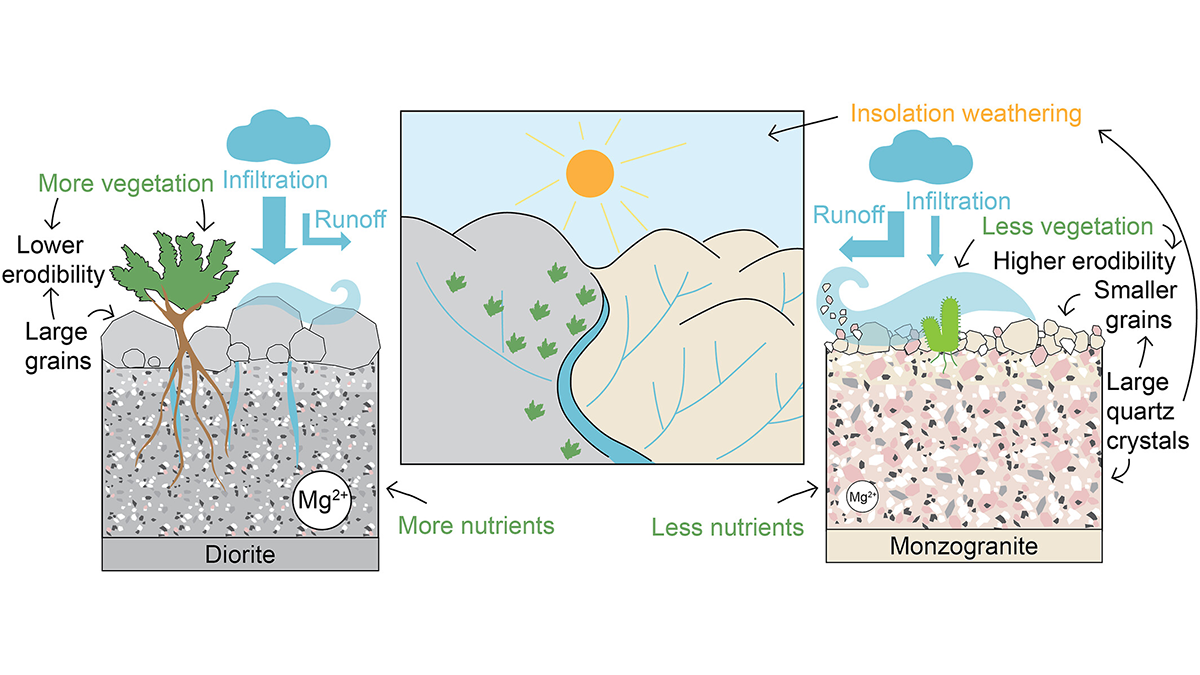
How Rock Type Shapes River Networks and Influences Landscape Evolution
A new study in Chile shows how small differences in rock type can drive large differences in erosion, vegetation, and river networks, illuminating the role of mineralogy in shaping landscapes.
Posted inNews
Arctic Ice Is Getting Smoother and Moving Faster
A decrease in pressure ridges over the past 3 decades is making the ice more uniform, with unclear consequences.
Posted inNews
Mantle Motion Matters for Mapping Modern (and Ancient) Ice
Mantle motions have major effects on topography and the distribution of ice sheets. The motions are key for researchers trying to properly parse past mantle movement.
Posted inNews
New Rules for Catastrophic River Avulsion
Scientists thought two factors influencing river avulsion were unrelated, but new research suggests they may be working in tandem. The findings could help predict new river pathways and improve disaster preparedness.
Posted inEditors' Highlights
Improvements to Measuring the Ups and Downs of the Landscape
If you are a jazz fan, you may be familiar with Ella Fitzgerald singing ‘How deep is the ocean, how high is the sky’. Using data from the Shuttle Radar Topography Mission we now know how high the land really is.