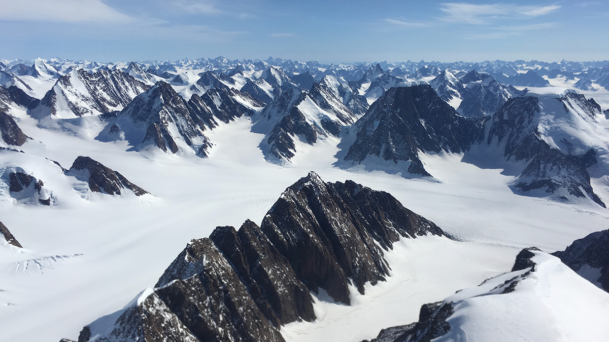
Advances in remote sensing offered an opportunity to redraw Greenland’s geologic map for the first time in 15 years.
landscape & topography
Posted inEditors' Highlights
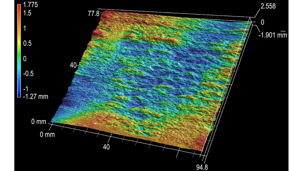
Hydraulic Fractures Are Lazy
The layering of rock masses can help constrain and focus the growth of hydraulic fractures.
Posted inNews
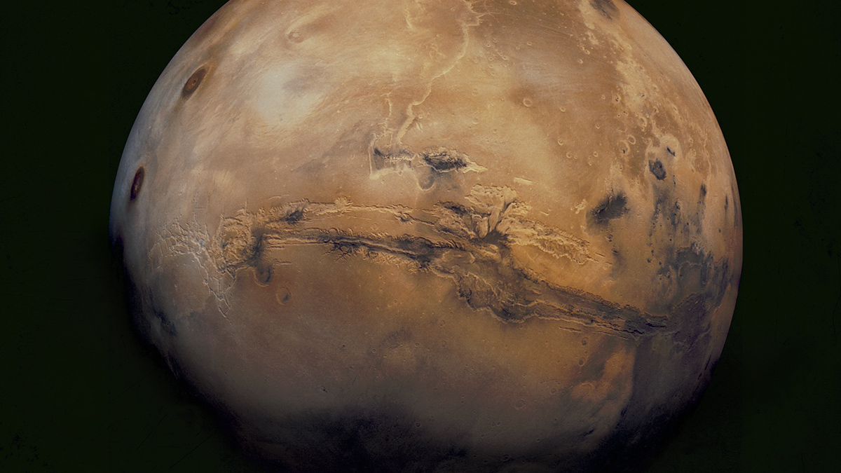
Martian Jumble May Be Hiding a Giant Volcano
The discovery of Noctis Mons could make the region a target for future Mars missions.

Posted inEditors' Highlights
Rainstorm Intensity Drives Desert Landscape Evolution
New mathematical models show that the persistence of near-vertical cliffs in arid landscapes is maintained by infrequent, but high-intensity rain storms.

Posted inEditors' Highlights
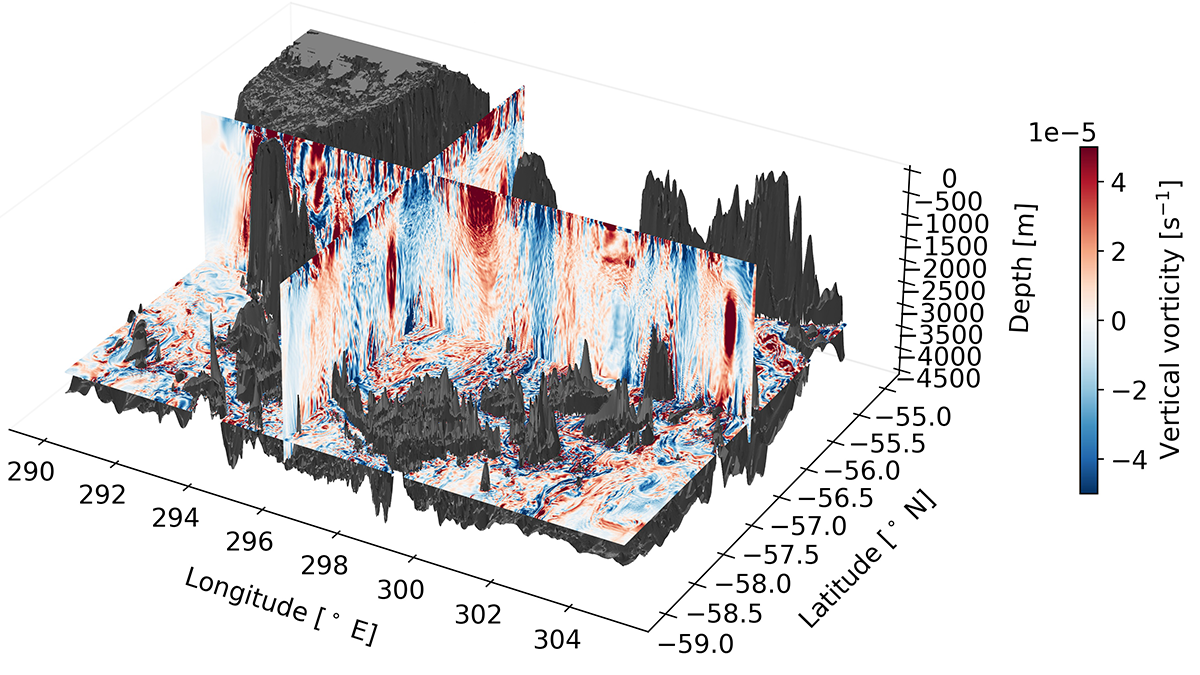
Overturning Ocean Water by Turbulence
A high-resolution regional model of the Southern Ocean reveals how topographically induced mixing in the abyss is important in creating the water masses that can upwell back up to the surface.
Posted inNews
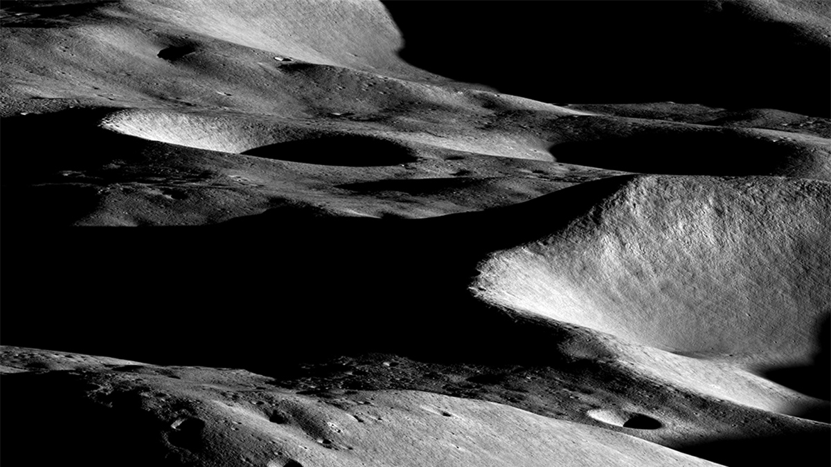
Mapping the Moon to Shield Astronauts from Radiation
Scientists are charting landing spots that offer future lunar astronauts protection from the Sun and deep space.
Posted inEditors' Vox
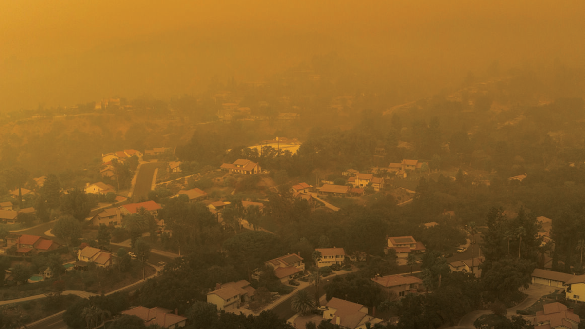
The Connections Between Landscape Fires and Your Health
A transdisciplinary reference guide to investigating relationships between biomass burning during landscape fires, the smoke it creates, and the impacts on human health and well-being.
Posted inNews
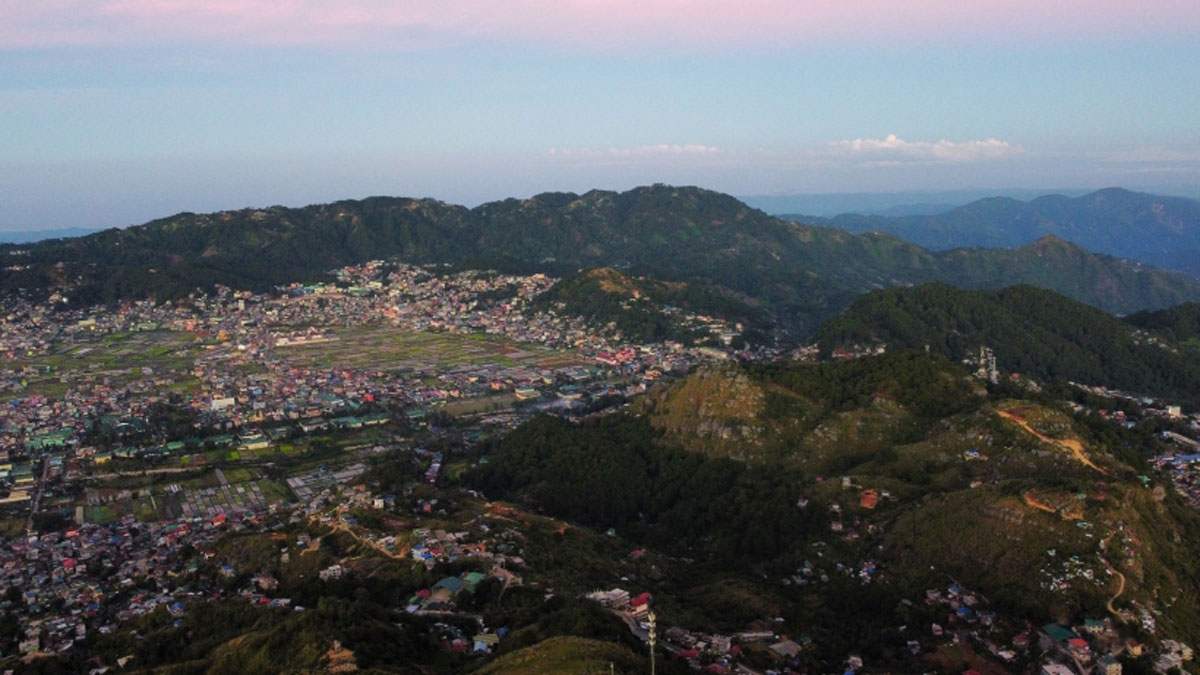
Shallower Clouds Hang More Often over Lost Forests
Two decades of satellite data show that deforestation in Southeast Asia has led to widespread low-lying clouds that might affect regional climate.
Posted inNews
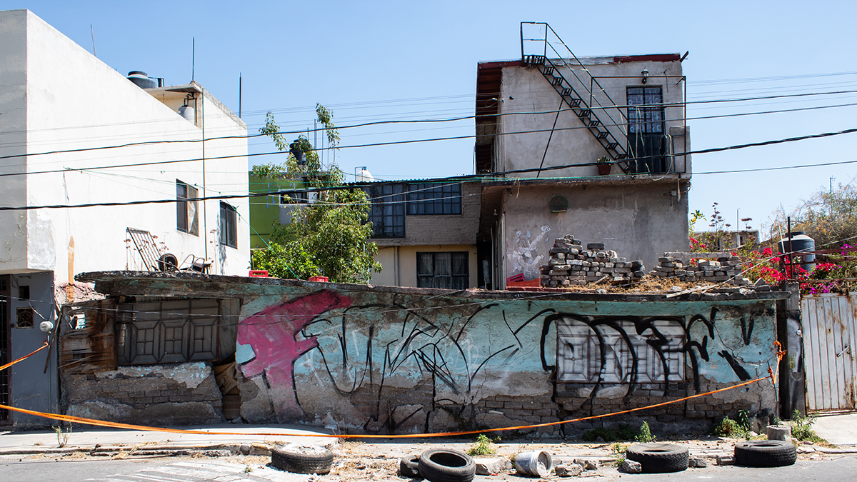
La extracción de agua subterránea está causando el hundimiento de la CDMX
Investigadores aseguran que saber cuánta agua está siendo extraída es crucial para resolver la crisis de infraestructura y de abastecimiento de agua en la capital.