• About
  • Special Reports
  • Topics
    • Climate
    • Earth Science
    • Oceans
    • Space & Planets
    • Health & Ecosystems
    • Culture & Policy
    • Education & Careers
    • Opinions
  • Projects
    • Postcards From the Field
    • ENGAGE
    • Editors’ Highlights
    • Editors’ Vox
    • Eos en Español
    • Eos 简体中文版
    • Print Archive: 2015–2025
  • Policy Tracker
  • Blogs
    • Research & Developments
    • The Landslide Blog
  • Newsletter
  • Submit to Eos
  • AGU.org
  • Career Center
  • Join AGU
  • Give to AGU
  • About
  • Special Reports
  • Topics
    • Climate
    • Earth Science
    • Oceans
    • Space & Planets
    • Health & Ecosystems
    • Culture & Policy
    • Education & Careers
    • Opinions
  • Projects
    • Postcards From the Field
    • ENGAGE
    • Editors’ Highlights
    • Editors’ Vox
    • Eos en Español
    • Eos 简体中文版
    • Print Archive: 2015–2025
  • Policy Tracker
  • Blogs
    • Research & Developments
    • The Landslide Blog
  • Newsletter
  • Submit to Eos
Skip to content
  • AGU.org
  • Career Center
  • Join AGU
  • Give to AGU
Eos

Eos

Science News by AGU

Support Eos
Sign Up for Newsletter
  • About
  • Special Reports
  • Topics
    • Climate
    • Earth Science
    • Oceans
    • Space & Planets
    • Health & Ecosystems
    • Culture & Policy
    • Education & Careers
    • Opinions
  • Projects
    • Postcards From the Field
    • ENGAGE
    • Editors’ Highlights
    • Editors’ Vox
    • Eos en Español
    • Eos 简体中文版
    • Print Archive: 2015–2025
  • Policy Tracker
  • Blogs
    • Research & Developments
    • The Landslide Blog
  • Newsletter
  • Submit to Eos

landscape & topography

Colorful satellite image of the location where a submarine canyon’s deep waters meet the Grand Bahama Bank
Posted inNews

How Do Submarine and Terrestrial Canyons Compare?

Rachel Crowell, Science Writer by Rachel Crowell 6 November 201929 June 2022

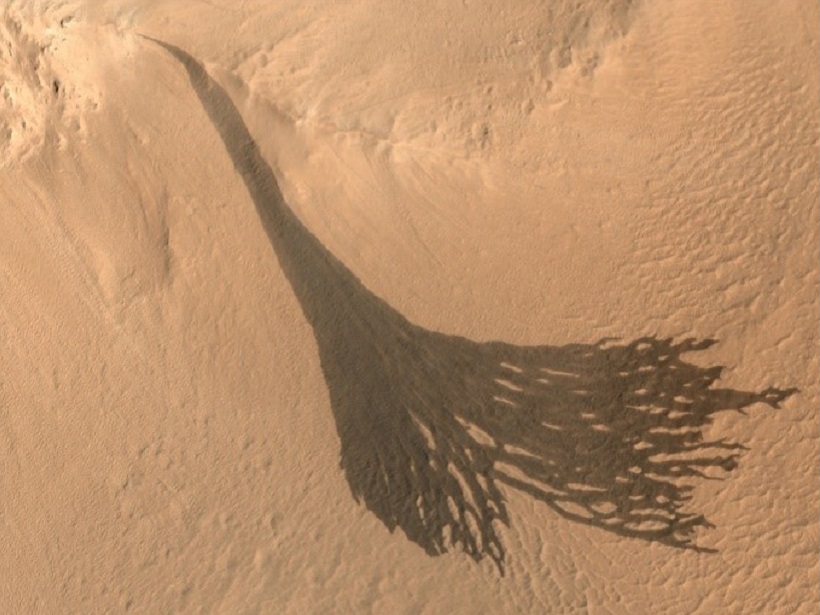
Insights from a new study could spark discoveries about Martian landscapes and also help researchers get to the bottom of canyon formation here on Earth.

Map of landslide activity in California between April 2016 and February 2018
Posted inEditors' Highlights

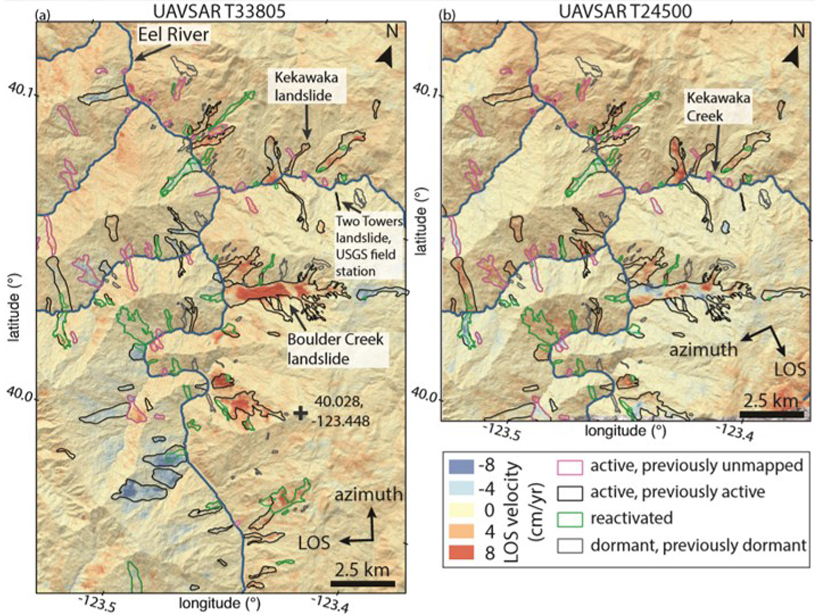
Landslide Activity Ramps Up With Extreme Rainfall

by Amy E. East 29 July 201923 January 2023

An increase in activity of hundreds of slow-moving landslides during extreme wet conditions in California provides insights into the landscape response to ongoing climate change.

A visualization from space of rivers in Southeast and East Asia from a new global river map.
Posted inResearch Spotlights

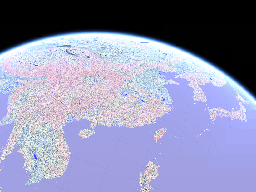
A More Accurate Global River Map

by E. Underwood 12 July 201915 March 2023

A new map of global river systems is based on crowdsourcing and the latest topography data sets.

The Sun peeks over a ridge near the top of Mount Kinabalu in northern Borneo.
Posted inScience Updates

Deciphering the Fate of Plunging Tectonic Plates in Borneo

by S. Pilia, N. Rawlinson, A. Gilligan and F. Tongkul 28 May 201925 August 2022

What happens when subduction stops? A team of scientists installed a dense seismic network in Borneo to investigate causes and consequences of subduction termination.

GPS station in southern Colorado
Posted inNews

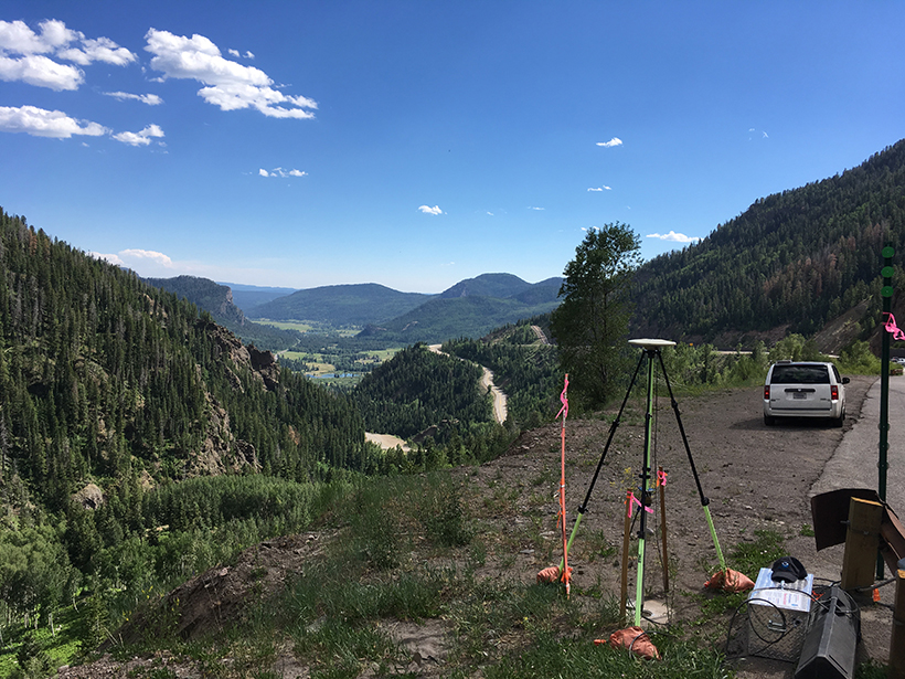
Airborne Gravity Surveys Are Remaking Elevations in the U.S.

Jenessa Duncombe, Staff Writer by Jenessa Duncombe 6 May 20194 April 2023

Measuring gravity’s tiny fluctuations is giving the United States an upgraded system of elevations.

Posted inEditors' Highlights

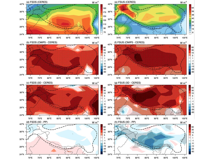
3D Radiation-Topography Interaction Warms Up Tibetan Plateau

by Z. Li 16 April 20196 December 2022

3-D radiation-topography interaction, which can increase the sunlight absorption by the surface, is missing in all climate models, causing strong cold biases over the Tibetan Plateau.

The Bas Glacier d’Arolla in Valais, Switzerland
Posted inResearch Spotlights

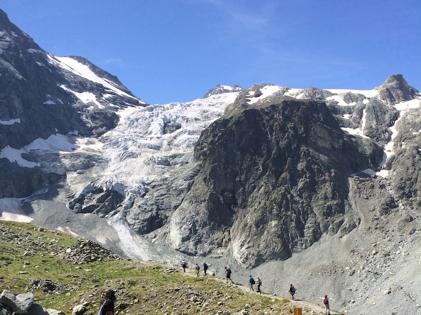
Decadal Changes in Glacial Discharge in the High Alps

by Terri Cook 12 April 20199 February 2023

A new statistical analysis of daily, glacial runoff cycles offers a unique way of examining how Alpine glaciers have responded since the onset of rapid regional warming in the 1980s.

Twilight in the Tapajós National Forest, seen from an observation tower
Posted inResearch Spotlights

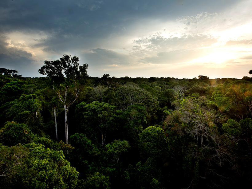
A Simplified Model of Water Vapor Exchange in the Amazon

Aaron Sidder, freelance science writer by Aaron Sidder 27 March 20195 September 2023

Evapotranspiration is the exchange of water vapor between land and the atmosphere, and it is hard to measure and model. A new study shows promise for its estimation over large, vegetated landscapes.

A historic photo shows the damage of the 1903 Heppner Flood in Oregon
Posted inResearch Spotlights

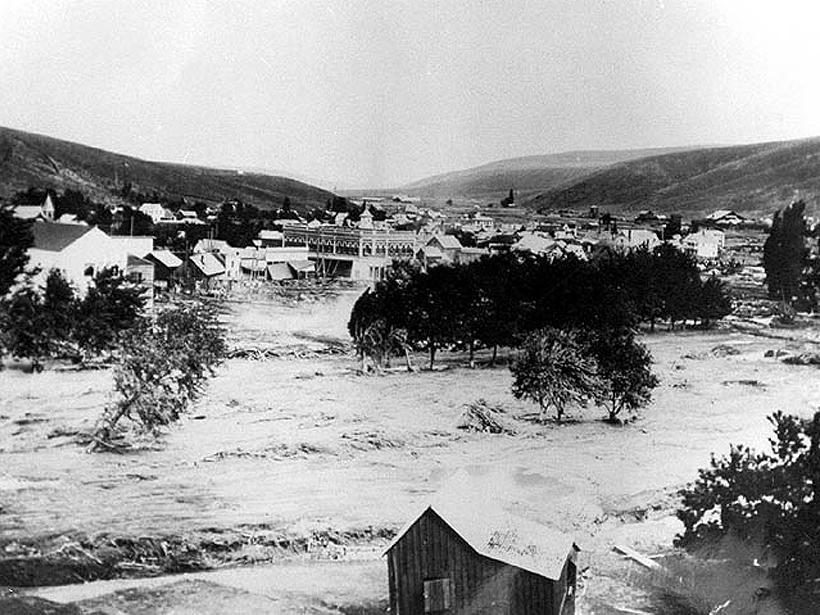
The Meteorological Culprits Behind Strange and Deadly Floods

Aaron Sidder, freelance science writer by Aaron Sidder 4 February 201918 February 2022

A new study examines how unusual meteorology interacted with topography and other local conditions to generate some of the most devastating floods in American history.

Slope streaks on Mars
Posted inEditors' Vox

Revisiting Enigmatic Martian Slope Streaks

by A. Bhardwaj, L. Sam, F. J. Martín‐Torres and M-P. Zorzano 15 January 201921 June 2023

Slope streaks of different sizes and shapes are a common feature on the surface of Mars, but scientists disagree about the mechanisms for their formation and development.

Posts pagination

Newer posts 1 … 8 9 10 11 12 … 14 Older posts
Over a dark blue-green square appear the words Special Report: The State of the Science 1 Year On.

Features from AGU Publications

Research Spotlights

As Wildfires Increase in the West, So Does Suppression Spending

10 June 202610 June 2026
Editors' Highlights

Soil Biogeochemistry Models Omit Key Processes Due to Geographic Bias

16 June 202616 June 2026
Editors' Vox

Small-Scale Indian Ocean Dynamics Underpin Marine Ecology and Climate

4 June 20263 June 2026
Eos logo at left; AGU logo at right

About Eos
ENGAGE
Awards
Contact

Advertise
Submit
Career Center
Sitemap

© 2026 American Geophysical Union. All rights reserved Powered by Newspack