• About
  • Sections
  • Topics
    • Climate
    • Earth Science
    • Oceans
    • Space & Planets
    • Health & Ecosystems
    • Culture & Policy
    • Education & Careers
    • Opinions
  • Projects
    • Postcards From the Field
    • ENGAGE
    • Editors’ Highlights
    • Editors’ Vox
    • Eos en Español
    • Eos 简体中文版
    • Print Archive: 2015–2025
  • Science Policy Tracker
  • Blogs
    • Research & Developments
    • The Landslide Blog
  • Newsletter
  • Submit to Eos
  • AGU.org
  • Career Center
  • Join AGU
  • Give to AGU
  • About
  • Sections
  • Topics
    • Climate
    • Earth Science
    • Oceans
    • Space & Planets
    • Health & Ecosystems
    • Culture & Policy
    • Education & Careers
    • Opinions
  • Projects
    • Postcards From the Field
    • ENGAGE
    • Editors’ Highlights
    • Editors’ Vox
    • Eos en Español
    • Eos 简体中文版
    • Print Archive: 2015–2025
  • Science Policy Tracker
  • Blogs
    • Research & Developments
    • The Landslide Blog
  • Newsletter
  • Submit to Eos
Skip to content
  • AGU.org
  • Career Center
  • Join AGU
  • Give to AGU
Eos

Eos

Science News by AGU

Support Eos
Sign Up for Newsletter
  • About
  • Sections
  • Topics
    • Climate
    • Earth Science
    • Oceans
    • Space & Planets
    • Health & Ecosystems
    • Culture & Policy
    • Education & Careers
    • Opinions
  • Projects
    • Postcards From the Field
    • ENGAGE
    • Editors’ Highlights
    • Editors’ Vox
    • Eos en Español
    • Eos 简体中文版
    • Print Archive: 2015–2025
  • Science Policy Tracker
  • Blogs
    • Research & Developments
    • The Landslide Blog
  • Newsletter
  • Submit to Eos

Mississippi River

A map of the dead zone in the Gulf of Mexico in 2018 depicts low-oxygen areas in red, orange, and yellow off the coast of Louisiana.
Posted inNews

Gulf Dead Zone Looms Large in 2019

Mary Caperton Morton, Science Writer by Mary Caperton Morton 11 July 201927 January 2023

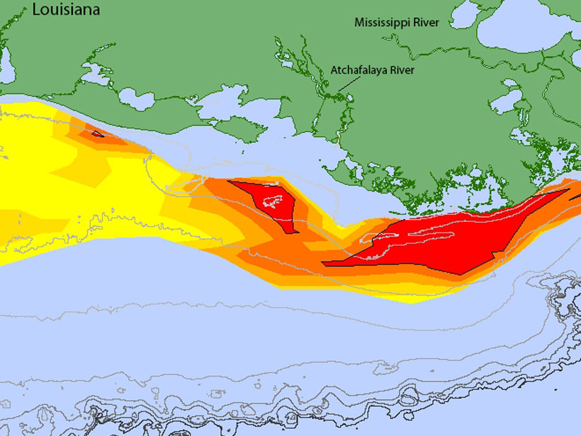
A new forecast predicts widespread hypoxia after a wet Midwest spring.

Seated man in a hard hat assesses sediment patterns in a dug trench
Posted inNews

Secrets from the New Madrid Seismic Zone’s Quaking Past

Rachel Crowell, Science Writer by Rachel Crowell 9 April 20198 December 2022

High-resolution lidar topography reveals a long history of ancient earthquakes.

The Mississippi River with the Fort St. Philip Crevasse complex shown to the right.
Posted inFeatures

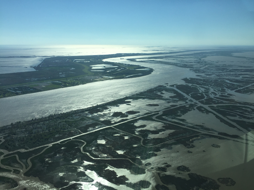
Rethinking the River

by A. S. Kolker, A. M. Dausman, M, A. Allison, G. L. Brown, P. Y. Chu, K. de Mutsert, C. E. Fitzpatrick, J. R. Henkel, D. Justic, B. A. Kleiss, E. McCoy, E. Meselhe and C. P. Richards 19 June 201819 September 2023

The Mississippi River and its delta and plume provide insights into research-informed approaches to managing river-dominated coastal zones.

The 1927 flood on the Lower Mississippi River was one of the most destructive in U.S. history.
Posted inResearch Spotlights

Reimagining a Fatal Flood

Kate Wheeling, freelance science writer by Kate Wheeling 17 March 20162 March 2023

Researchers use high-resolution simulations to reexamine the rainfall events that led to one of the most destructive floods in U.S. history.

Posts pagination

Newer posts 1 2
A view of a bridge, with the New Orleans skyline visible in the distance between the bridge and the water. A purple tint, a teal curved line representing a river, and the text “#AGU25 coverage from Eos” overlie the photo.

Features from AGU Publications

Research Spotlights

Our Ocean’s “Natural Antacids” Act Faster Than We Thought

30 January 202630 January 2026
Editors' Highlights

Cows, Coal, and Chemistry: The Role of Photochemistry in Methane Budget

27 January 202623 January 2026
Editors' Vox

Bridging the Gap: Transforming Reliable Climate Data into Climate Policy

16 January 202616 January 2026
Eos logo at left; AGU logo at right

About Eos
ENGAGE
Awards
Contact

Advertise
Submit
Career Center
Sitemap

© 2026 American Geophysical Union. All rights reserved Powered by Newspack