• About
  • Sections
  • Topics
    • Climate
    • Earth Science
    • Oceans
    • Space & Planets
    • Health & Ecosystems
    • Culture & Policy
    • Education & Careers
    • Opinions
  • Projects
    • Postcards From the Field
    • ENGAGE
    • Editors’ Highlights
    • Editors’ Vox
    • Eos en Español
    • Eos 简体中文版
    • Print Archive: 2015–2025
  • Science Policy Tracker
  • Blogs
    • Research & Developments
    • The Landslide Blog
  • Newsletter
  • Submit to Eos
  • AGU.org
  • Career Center
  • Join AGU
  • Give to AGU
  • About
  • Sections
  • Topics
    • Climate
    • Earth Science
    • Oceans
    • Space & Planets
    • Health & Ecosystems
    • Culture & Policy
    • Education & Careers
    • Opinions
  • Projects
    • Postcards From the Field
    • ENGAGE
    • Editors’ Highlights
    • Editors’ Vox
    • Eos en Español
    • Eos 简体中文版
    • Print Archive: 2015–2025
  • Science Policy Tracker
  • Blogs
    • Research & Developments
    • The Landslide Blog
  • Newsletter
  • Submit to Eos
Skip to content
  • AGU.org
  • Career Center
  • Join AGU
  • Give to AGU
Eos

Eos

Science News by AGU

Support Eos
Sign Up for Newsletter
  • About
  • Sections
  • Topics
    • Climate
    • Earth Science
    • Oceans
    • Space & Planets
    • Health & Ecosystems
    • Culture & Policy
    • Education & Careers
    • Opinions
  • Projects
    • Postcards From the Field
    • ENGAGE
    • Editors’ Highlights
    • Editors’ Vox
    • Eos en Español
    • Eos 简体中文版
    • Print Archive: 2015–2025
  • Science Policy Tracker
  • Blogs
    • Research & Developments
    • The Landslide Blog
  • Newsletter
  • Submit to Eos

MODIS

A satellite view of the Gap Fire in southern California, taken August 31, 2016.
Posted inResearch Spotlights

Fighting Fire with Satellite Data

by S. Witman 21 November 20165 September 2023

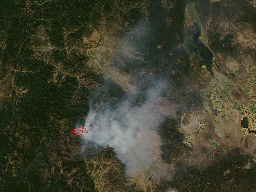
As climate change worsens wildfire impact, scientists use satellites to study climate-fire interactions.

Tobago 2015 Sargassum beaching
Posted inFeatures

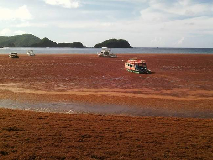
Sargassum Watch Warns of Incoming Seaweed

by C. Hu, B. Murch, B. B. Barnes, M. Wang, J.-P. Maréchal, J. Franks, D. Johnson, B. Lapointe, D. S. Goodwin, J. M. Schell and A. N. S. Siuda 2 September 20164 January 2024

The Sargassum Watch System processes satellite data and feeds results to a Web portal, giving decision makers timely information on seaweed location and warnings for potential beaching events.

Posted inResearch Spotlights

Insights into Long-Standing Bias in Cloud Property Retrieval

by David Shultz 28 June 20165 September 2023

A new framework provides a more comprehensive view of how subpixel variations can create biases in a commonly used method of analyzing cloud properties with satellites.

Posted inResearch Spotlights

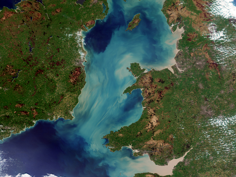
Satellites Reveal Dynamics of Suspended Mineral Particles

by Terri Cook 18 February 20165 September 2023

A case study of the Irish Sea evaluates the use of ocean color data to measure the optical properties of sedimentary particles in offshore waters.

Posts pagination

Newer posts 1 2
A view of a bridge, with the New Orleans skyline visible in the distance between the bridge and the water. A purple tint, a teal curved line representing a river, and the text “#AGU25 coverage from Eos” overlie the photo.

Features from AGU Publications

Research Spotlights

Denitrification Looks Different in Rivers Versus Streams

16 January 202616 January 2026
Editors' Highlights

ALMA’s New View of the Solar System

16 January 202616 January 2026
Editors' Vox

Bridging the Gap: Transforming Reliable Climate Data into Climate Policy

16 January 202616 January 2026
Eos logo at left; AGU logo at right

About Eos
ENGAGE
Awards
Contact

Advertise
Submit
Career Center
Sitemap

© 2026 American Geophysical Union. All rights reserved Powered by Newspack