Source: Journal of Geophysical Research: Biogeosciences
Smokey Bear, the cuddly mascot of the U.S. Forest Service, has spent the past 70 years warning the American public against playing with matches. But although human carelessness may be the spark for some wildfires, several complex factors fan their flames.
Over the past few decades, research shows that global climate change is confounding the Forest Service’s ability to prevent and put out wildfires. Drier landscapes and warmer overall temperatures contribute to conditions that fuel fires. Climate can even affect lightning strikes, which ignite fires. As a result, fire seasons last longer, and individual fires are more frequent, more severe, and larger.
This evolution has immediate, real-world implications. For example, last year, more than half of the Forest Service’s budget was spent fighting fires. There were about 50,000 wildfires, affecting more than 36,000 square kilometers in total.
To further explore the relationship between climate and wildfires, Freeborn et al. compared 12 years of climatological data pertaining to fire danger, including daily atmospheric and fuel moisture conditions, with corresponding satellite observations of wildfires in the continental United States.
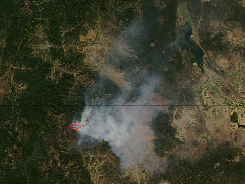
Although fire records from the Forest Service and the U.S. Geological Survey contain the dates on which fires were discovered and their ultimate size, satellites provide a more complete picture of past and ongoing wildfires. Polar-orbiting satellites pass by each point on the globe multiple times per day, collecting updated information with each flyover. By detecting the amount of radiation emitted from hot spots and reflected back from Earth’s surface, the Moderate Resolution Imaging Spectroradiometer (MODIS), a sensor on board two of NASA’s polar-orbiting satellites, provides insight into wildfire intensity, size, and movement.
Using MODIS data, the team was able to match up daily weather conditions taken from fire danger indices with detailed characteristics of wildfires (or lack thereof) burning in a given region as observed via satellite. The link between changes in fire danger conditions and resulting wildfires varied from region to region, the researchers found. They also noticed that weather conditions during wildfires affect seasonal duration, spatial extent, and combustion intensity and have an impact on the overall magnitude of annual fire activity.
The study showed how MODIS data can be used to supplement agencies’ fire reports, breaking down annual fire statistics into more informative subcategories such as seasonal duration, average daily fire growth, average daily heat release, and fuel load consumption. It further demonstrated an advanced technique for predicting whether a wildfire is likely to occur and its potential burning characteristics on the basis of environmental conditions. By building on this technique, researchers can continue to better inform wildfire management policy. (Journal of Geophysical Research: Biogeosciences, doi:10.1002/2016JG003617, 2016)
—Sarah Witman, Freelance Writer
Citation:
Witman, S. (2016), Fighting fire with satellite data, Eos, 97, https://doi.org/10.1029/2016EO063039. Published on 21 November 2016.
Text © 2016. The authors. CC BY-NC-ND 3.0
Except where otherwise noted, images are subject to copyright. Any reuse without express permission from the copyright owner is prohibited.