• About
  • Sections
  • Topics
    • Climate
    • Earth Science
    • Oceans
    • Space & Planets
    • Health & Ecosystems
    • Culture & Policy
    • Education & Careers
    • Opinions
  • Projects
    • ENGAGE
    • Editors’ Highlights
    • Editors’ Vox
    • Eos en Español
    • Eos 简体中文版
    • Print Archive
  • Blogs
    • Research & Developments
    • The Landslide Blog
  • Newsletter
  • Submit to Eos
  • AGU.org
  • Career Center
  • Join AGU
  • Give to AGU
  • About
  • Sections
  • Topics
    • Climate
    • Earth Science
    • Oceans
    • Space & Planets
    • Health & Ecosystems
    • Culture & Policy
    • Education & Careers
    • Opinions
  • Projects
    • ENGAGE
    • Editors’ Highlights
    • Editors’ Vox
    • Eos en Español
    • Eos 简体中文版
    • Print Archive
  • Blogs
    • Research & Developments
    • The Landslide Blog
  • Newsletter
  • Submit to Eos
Skip to content
  • AGU.org
  • Career Center
  • Join AGU
  • Give to AGU
Eos

Eos

Science News by AGU

Support Eos
Sign Up for Newsletter
  • About
  • Sections
  • Topics
    • Climate
    • Earth Science
    • Oceans
    • Space & Planets
    • Health & Ecosystems
    • Culture & Policy
    • Education & Careers
    • Opinions
  • Projects
    • ENGAGE
    • Editors’ Highlights
    • Editors’ Vox
    • Eos en Español
    • Eos 简体中文版
    • Print Archive
  • Blogs
    • Research & Developments
    • The Landslide Blog
  • Newsletter
  • Submit to Eos

MODIS

Satellite imagery of Alaska’s coastline. Fans of gray and brown silt appear stacked on top of each other in the blue ocean.
Posted inNews

Coastlines Around the World Are Losing Sediment

by J. Besl 12 December 202412 December 2024

A new tool maps coastal sediments on the basis of water color. It shows that 75% of the world’s coastlines may be losing suspended sediment.

Multiple wildfires burning in Siberia, seen from space
Posted inResearch Spotlights

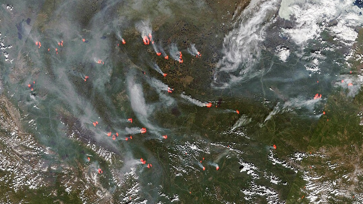
Arctic Warming Is Driving Siberian Wildfires

by Nathaniel Scharping 19 September 202419 September 2024

Increased temperatures and drought are leading to more wildfires. And wildfire smoke aerosols can suppress precipitation, drying out soils and further increasing fire risk.

A drone shot of the Philippines’ Cordillera Central mountain range. The tops of the mountains are green with forest, but much of the land has been cleared and covered with buildings.
Posted inNews

Shallower Clouds Hang More Often over Lost Forests

by Kristel Tjandra 13 December 202317 January 2024

Two decades of satellite data show that deforestation in Southeast Asia has led to widespread low-lying clouds that might affect regional climate.

Close-up of a flowering lilac shrub.
Posted inNews

Leaves Are Springing Up Earlier Along the Appalachian Trail

by Kate Hull 14 December 20225 September 2023

Satellite images of lustrous new leaves reveal changes that will have cascading effects on diverse ecosystems in the eastern United States.

A line of controlled fire burns across a dry grassland in South Africa.
Posted inNews

Zooming In on Small Fires in Africa

Lakshmi Supriya, Science Writer by L. Supriya 2 April 20215 September 2023

By analyzing high-resolution satellite images, researchers found that fires burning in Africa were undercounted by as much as 80%.

Smoke plumes spread west from the Camp Fire in Northern California and the Hill and Woolsey Fires in Southern California on 9 November 2018, as seen in this image captured by the Moderate Resolution Imaging Spectroradiometer (MODIS) on NASA’s Terra satellite.
Posted inScience Updates

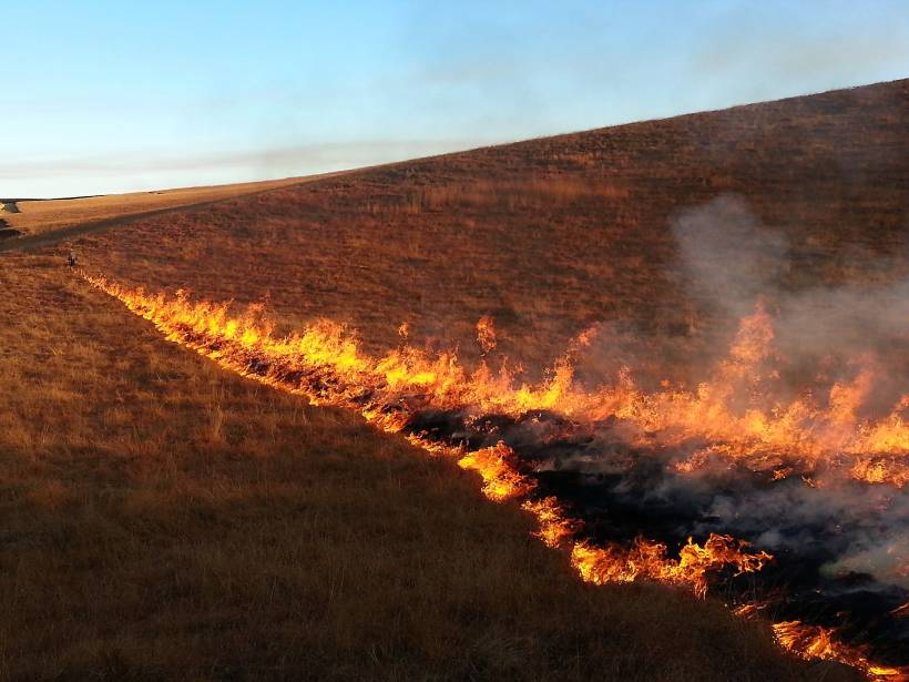
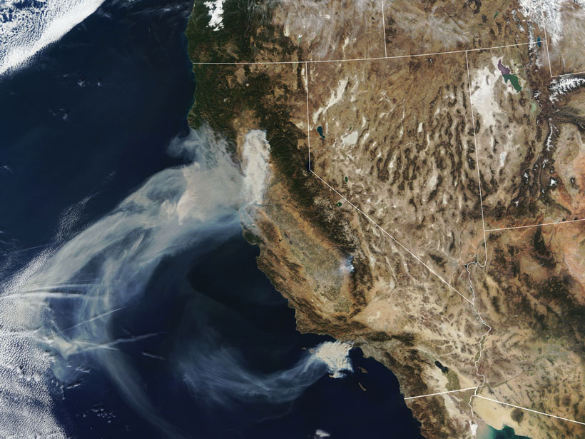
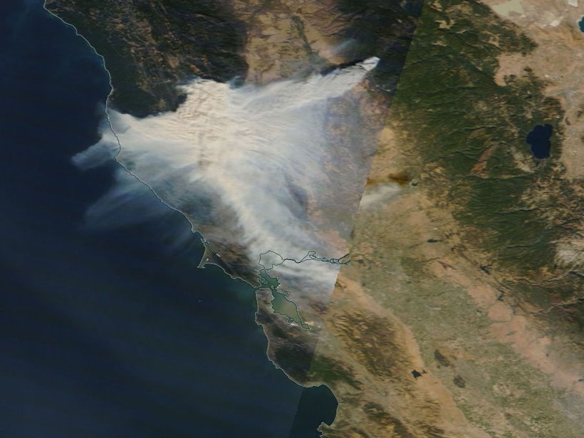
A Global Perspective on Wildfires

by R. Kahn 27 January 20205 September 2023

Satellites provide global-scale data that are invaluable in efforts to understand, monitor, and respond to wildfires and emissions, which are increasingly affecting climate and putting humans at risk.

Satellite image of a fire in Northern California
Posted inNews

New Eyes on Wildfires

Jon Kelvey, Science Writer by Jon Kelvey 30 April 20195 September 2023

Onboard machine learning and compact thermal imaging could turn satellites into real-time fire management tools to help officials on the ground.

Twilight in the Tapajós National Forest, seen from an observation tower
Posted inResearch Spotlights

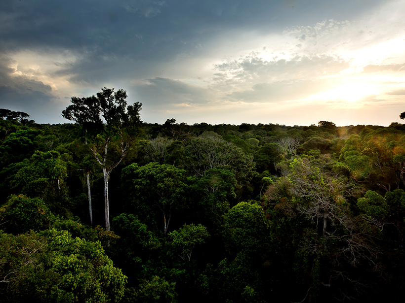
A Simplified Model of Water Vapor Exchange in the Amazon

Aaron Sidder, freelance science writer by Aaron Sidder 27 March 20195 September 2023

Evapotranspiration is the exchange of water vapor between land and the atmosphere, and it is hard to measure and model. A new study shows promise for its estimation over large, vegetated landscapes.

Wildfire in Greenland
Posted inNews

Greenland Fires Ignite Climate Change Fears

JoAnna Wendel, freelance science writer and illustrator by JoAnna Wendel 11 August 20175 September 2023

The fires are stoking worries about the vast island’s thawing permafrost.

A partial frame from a movie showing land cover change across the United States, created by Descartes Labs.
Posted inNews

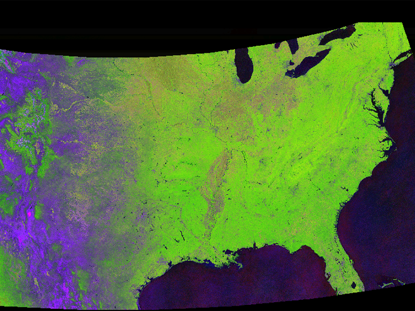
Tracking Global Change with a Cloud-Based Living Atlas

Aaron Sidder, freelance science writer by Aaron Sidder 19 December 20165 September 2023

With their feet in the cloud, Descartes Labs is pushing the limit of how we study the Earth with satellite images.

Posts pagination

1 2 Older posts
A view of a Washington, D.C., skyline from the Potomac River at night. The Lincoln Memorial (at left) and the Washington Monument (at right) are lit against a purple sky. Over the water of the Potomac appear the text “#AGU24 coverage from Eos.”

Features from AGU Publications

Research Spotlights

Deforestation Is Reducing Rainfall in the Amazon

19 May 202519 May 2025
Editors' Highlights

Bringing Storms into Focus

19 May 202515 May 2025
Editors' Vox

Decoding Crop Evapotranspiration

6 May 20256 May 2025
Eos logo at left; AGU logo at right

About Eos
ENGAGE
Awards
Contact

Advertise
Submit
Career Center
Sitemap

© 2025 American Geophysical Union. All rights reserved Powered by Newspack