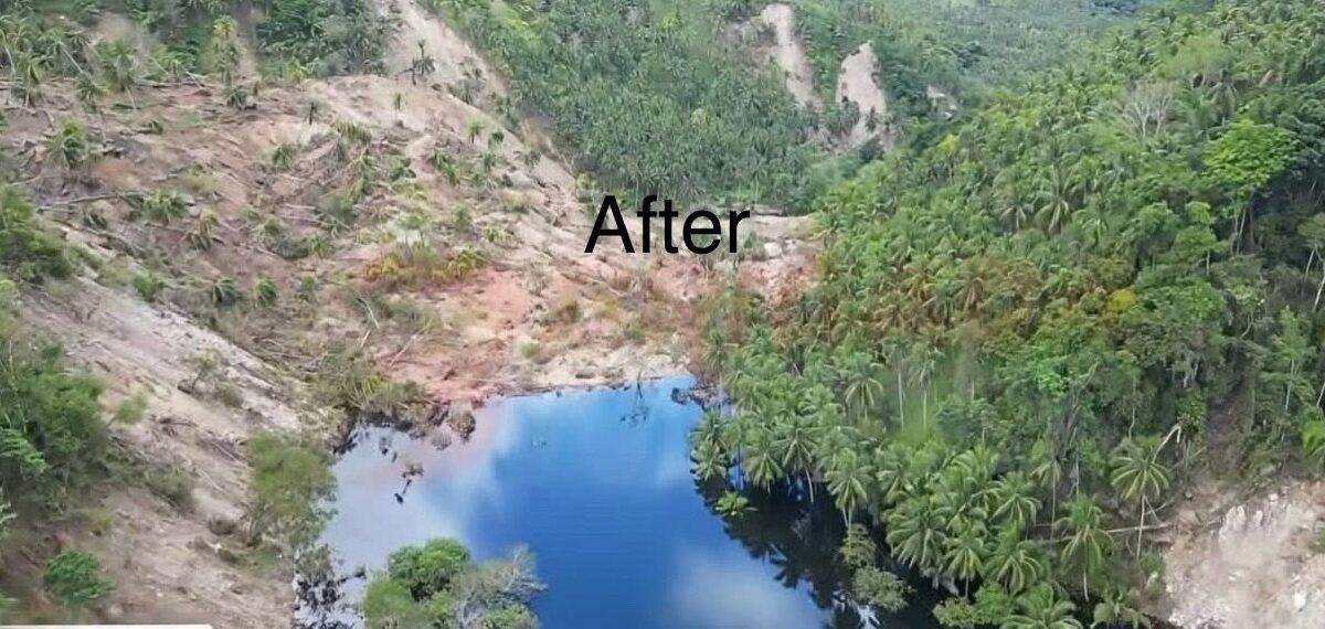
A significant “quake lake” has developed in a remote area of the Philippines, threatening four communities located downstream. In the aftermath of the 8 June 2026 M=7.8 earthquake in the Philippines, a major challenge has developed in the Jose Abad Santos region of Mindanao. Here, a landslide has blocked the valley between barangays (villages) San […]
Philippines

Posted inThe Landslide Blog
The Operation L!STO disaster preparedness manual for landslides
In the Philippines, an incredibly useful manual has been published that guides local government agencies in preparing for and responding to landslides. The Philippines has a long term landslide problem, with most events being triggered by either rainfall associated with typhoons or by earthquakes. However, the Philippines is also proactively trying to manage the losses […]
Posted inThe Landslide Blog
An update on landslides from the 8 June 2026 M=7.8 earthquake offshore Mindanao in the Philippines
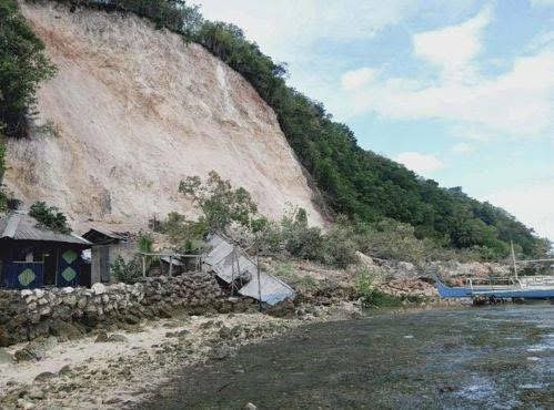
It is now clear that more than half the fatalities from last week’s earthquake in the Philippines were caused by landslides. In the areas of the Philippines affected by the 8 June 2026 M=7.8 earthquake offshore Mindanao, operations have shifted from rescue to recovery. Inquirer has an interesting report about information provided by an official […]
Posted inThe Landslide Blog
Reports of landslides triggered by the 8 June 2026 M=7.8 earthquake offshore Mindanao in the Philippines
To date news reports suggest two fatal landslides with a combined toll of 17 people. There are various news reports trickling in about the landslides triggered by the 8 June 2026 M=7.8 earthquake offshore Mindanao in the Philippines. As usual, the remote locations of many of the landslides means that the information is a bit […]
Posted inThe Landslide Blog
Potential landslides and liquefaction from the 8 June 2026 M=7.8 earthquake offshore Mindanao in the Philippines
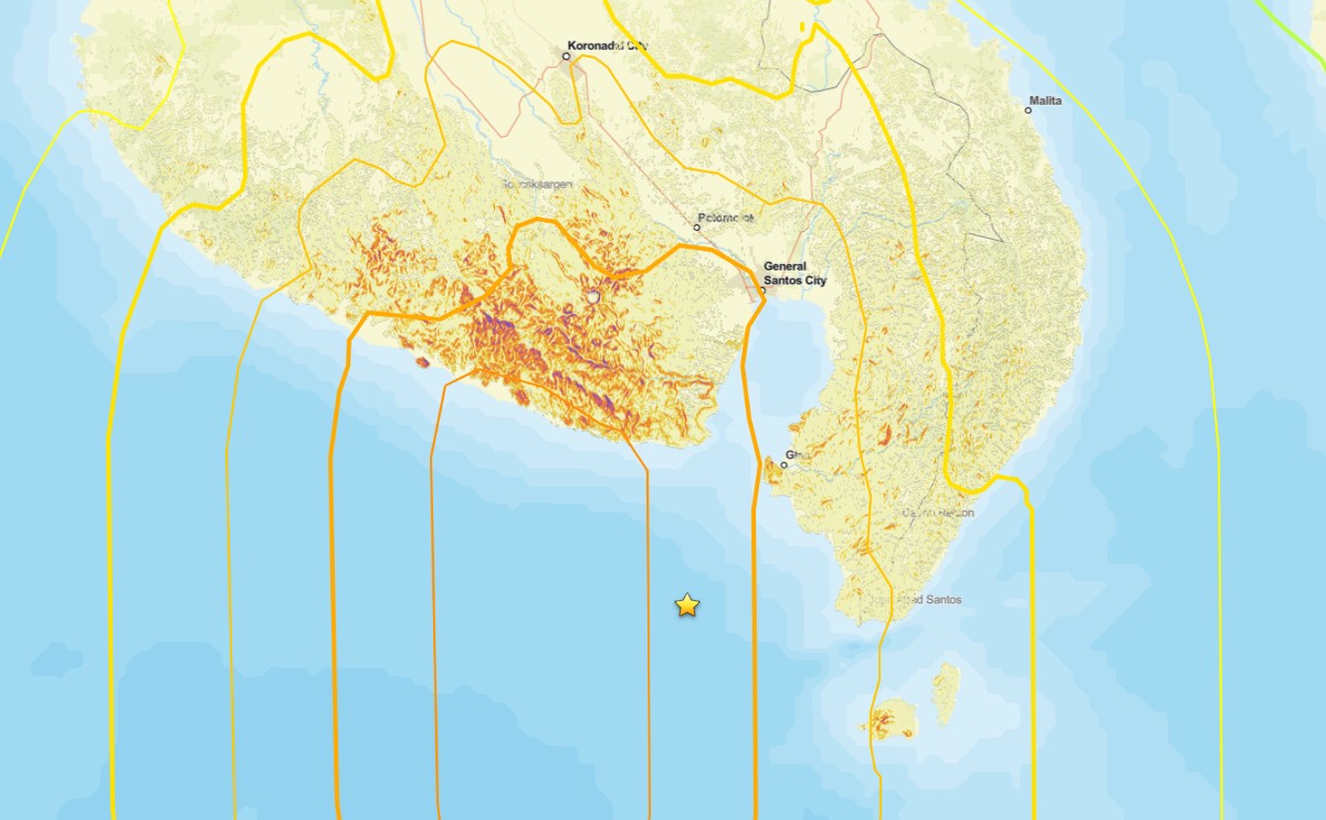
Initial analyses suggest that the earthquake this morning has the potential to have triggered significant numbers of landslides and areas of liquefaction. At the time of writing, the impacts of the M=7.8 earthquake that occurred offshore the south coast of Mindanao in the Philippines remain unclear. Initial reports in the local press suggest 15 fatalities […]
Posted inThe Landslide Blog
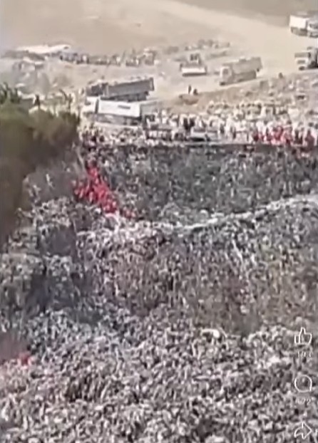
The 20 February 2026 garbage landslide at Rodriguez, Rizal in the Philippines
Three people were killed in a major failure at a privately owned garbage dump on Friday. Earlier reports of 50 deaths are now believed to have been erroneous. On 20 February 2026, the Philippines suffered another major garbage landslide, following the tragic events that occurred at Binaliw in Cebu on 8 January 2026, which killed […]
Posted inThe Landslide Blog
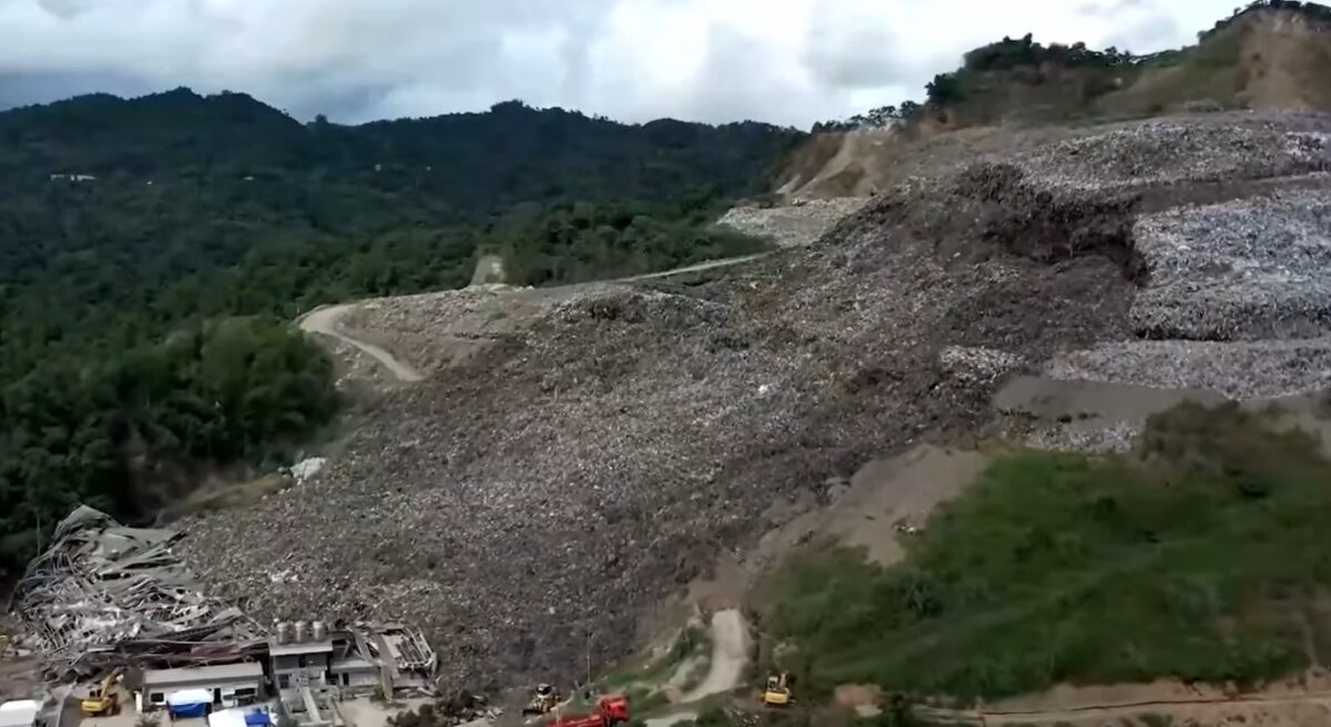
Binaliw: the massive garbage landslide in Cebu City, the Philippines
Recovery operations continue for the 36 victims of the 8 January 2026 garbage landslide in the Philippines. Recovery operations are continuing at the site of the 8 January 2026 landslide at Binaliw in Cebu, the Philippines. At the time of writing, it is reported that the bodies of eight victims have been recovered, whilst 28 […]

Posted inNews
A Cryobank Network Grows in the Coral Triangle
As the ocean becomes increasingly inhospitable for corals, researchers in the Coral Triangle are turning to cryopreservation to freeze, thaw, and save the region’s hundreds of coral species.

Posted inEditors' Highlights
Seismotectonic Update of the Philippines-Taiwan Region
Using more than two decades of data, scientists find that the Philippine and Taiwan subduction region is controlled mainly by shallow seismicity and low magnitude earthquakes.
Posted inThe Landslide Blog
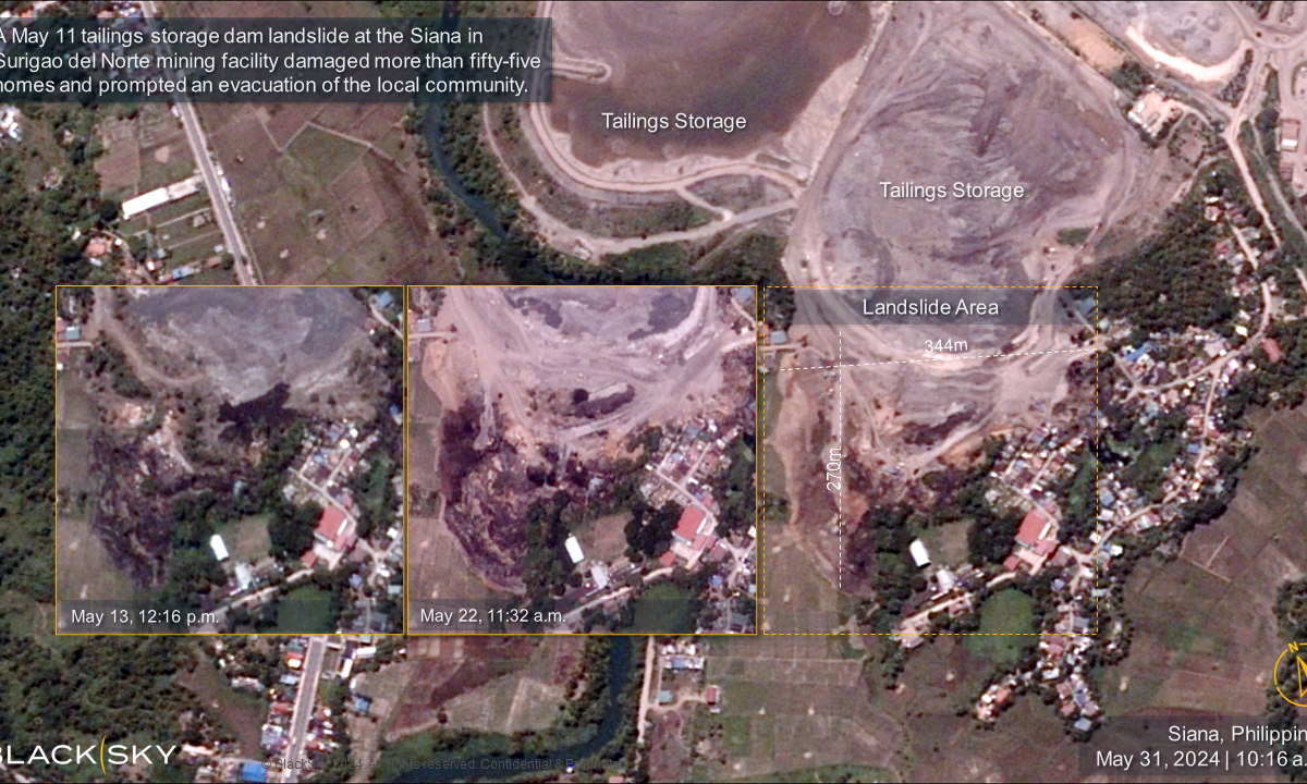
New satellite imagery of the 11 May 2024 tailings failure at Siana in Surigao del Norte, Philippines
The Landslide Blog is written by Dave Petley, who is widely recognized as a world leader in the study and management of landslides. Just under a month ago, I wrote about the tailings failure at the Siana gold mine in Surigao del Norte, Philippines. Capella Space captured good radar imagery of the site. We now […]