
The Landslide Blog is written by Dave Petley, who is widely recognized as a world leader in the study and management of landslides.

On 6 February 2024, a large landslide struck the mining village of Masara in in Maco town, Davao de Oro in the Philippines. As of the time of writing, it had been confirmed that 68 people have been killed, with a further 51 people reported to be missing. There is no prospect of survival for any of those who remain buried, although a small child was rescued after being missing for 60 hours. Such a rescue is highly unusual.
The best set of images that I have seen have been posted to Facebook by Wander Rider, and then retweeted by geologist Nathan Veracruz:-
The landslide was probably triggered by heavy rainfall. Nathan has tweeted information about the ten day period leading up to the failure:-
The landslide appears to have initiated reasonably high on the hillside in deeply weathered soils with quite a complex structure. Unfortunately, the landslide has directly hit the village at the foot of the slope.
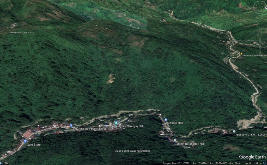
I believe that the location of the landslide is [7.3918, 126.0259]. This is a Google Earth image of the site:-
There are clear signs of instability in the slope that ultimately failed. Vegetation grows quickly in the Philippines, so looking back at the archive in Google Earth is instructive. This image, from April 2017, shows substantial landsliding on the slope:-
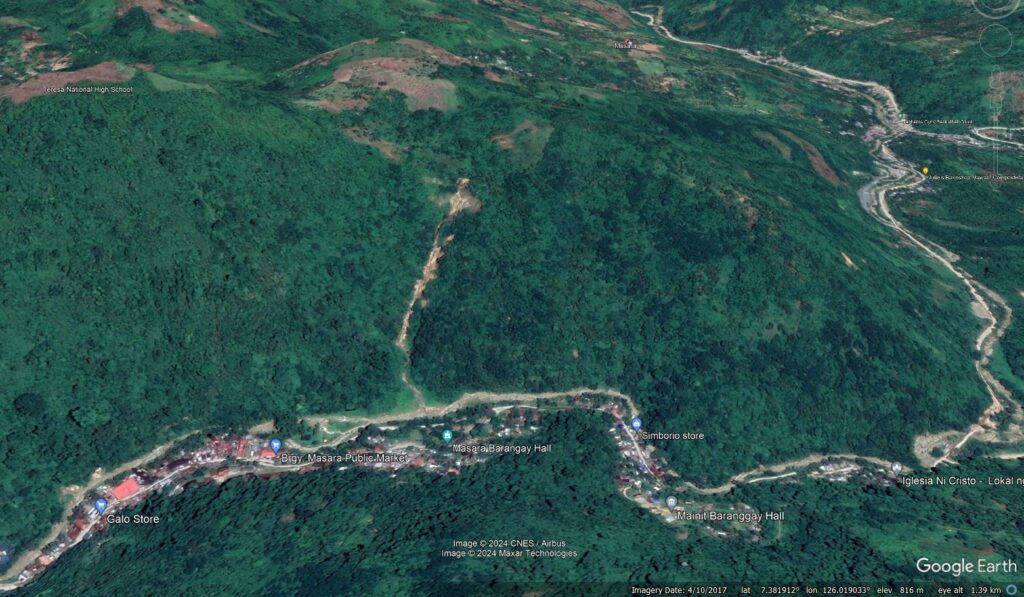
Thus, it could be argued that there were warning signs to indicate that Masara was at substantial level of risk. Turning those warning signs into meaningful action remains a huge challenge around the world. Failure to do so results in tragedies like this.