
Overview:
Drone footage shows extensive numbers of landslides, reportedly in the area of Barangay Mudan.
The Landslide Blog is written by Dave Petley, who is widely recognized as a world leader in the study and management of landslides.

On 17 November 2023 at 4:14 pm local time, an Mw=6.8 earthquake struck the the area of Sarangani in Davao Occidental in the Philippines. The epicentre was located offshore at a depth of 63 km, according to PHIVOLCS. This is an area of high seismic risk that has a hilly topography, meaning that coseismic landslides were likely.
The national disaster agency in the Philippines, the NDRRMC, has a series of situation reports online about this event. As of the time of writing it reports nine fatalities and 16 people injured, with about 1,500 houses damaged. News reports indicate that at least two of the deaths occurred as a conssequence of a landslide.
Interestingly. ABC-CBN News has posted drone footage to Youtube showing extensive landslides after the earthquake:-
This is reported to be in the area of Barangay Mudan in Glan, Sarangani Province. Wikimapia places Barangay Mudan at [5.8700, 125.2708]. The topography would seem to correspond to that seen in the video, but the precise location is unverified:-
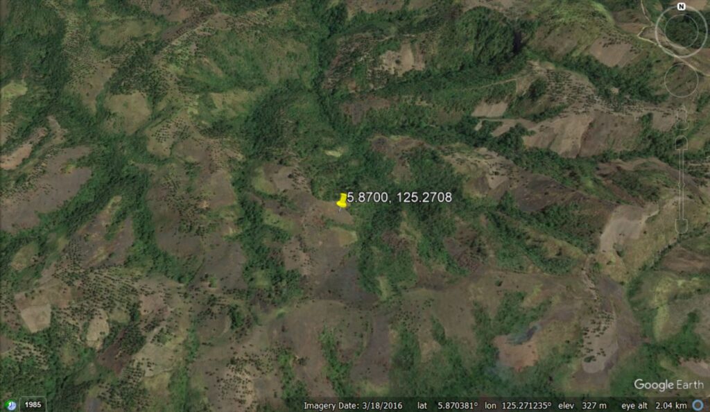
ABS CBN News reports that the two landslide-induced fatalities occurred in Barangay Mudan, and that local people have been advised to evacuated the site. The report describes widespread landslides in the area.
The drone footage does not provide sufficient perspective to provide a definitive interpretation of these landslides, and sadly there is no Planet Labs imagery captured since the earthquake. It does appear that a substantial number of landslides have been triggered at Barangay Mudan, however. In a humid, tropical climate, these will inevitably cause long term problems.