Guiding principles and strategies for solving local water availability problems in India have emerged from collaborations involving water users, water experts, and water solutions providers.
precipitation
Posted inResearch Spotlights
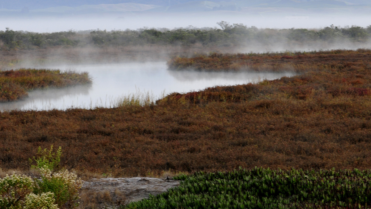
Atmospheric Rivers Help Coastal Wetlands Build Up Sediment
Accounting for these storms and flooding can help experts predict and respond to rising sea levels.

Posted inENGAGE, News
El granizo que colapsó a la Ciudad de México
Cuando una granizada intensa golpeó la capital de México la semana pasada, los ciudadanos se empezaron a preguntar si el cambio climático podría ser la causa. Pero, ¿es esa la pregunta que nos debemos hacer?
Posted inEditors' Highlights
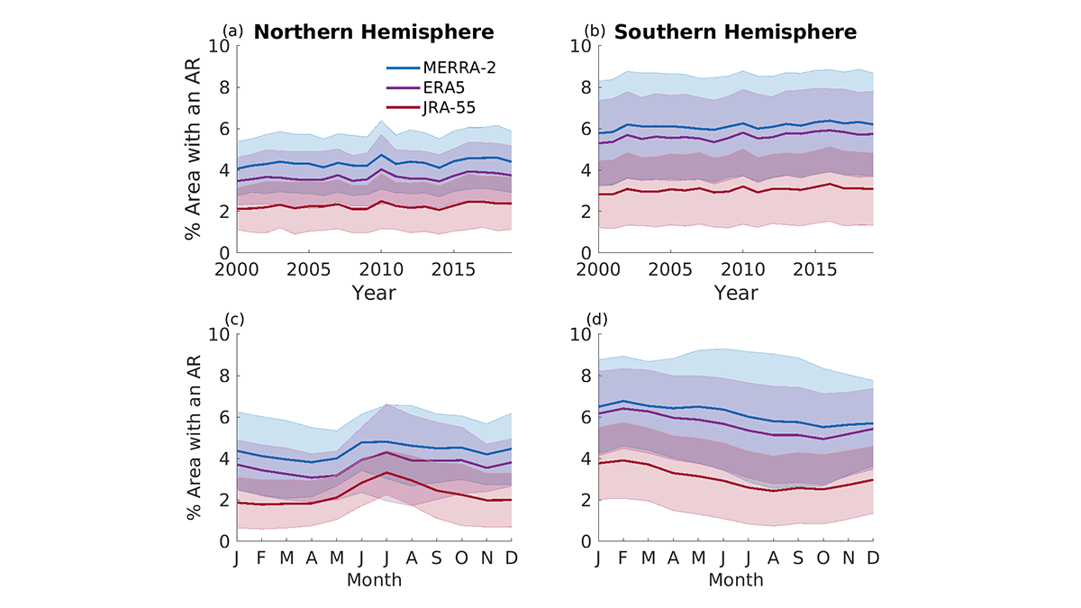
Comparing Methods for Analysis of Atmospheric Rivers
Results from the Atmospheric River Tracking Method Intercomparison Project (ARTMIP) describe the similarity and difference of using eleven detection algorithms and three reanalysis products.
Posted inEditors' Highlights
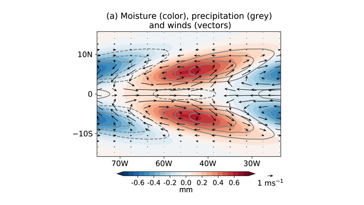
New Western Hemisphere Moisture Mode
A new study presents the first evidence of the existence of an intraseasonal westward-propagating moisture mode over the Western Hemisphere.

Posted inENGAGE, News
A Hail of a Night in Mexico
When a severe hailstorm hit Mexico’s capital last week, citizens began to wonder whether climate change could be the cause. But is that the right question to ask?

Posted inEditors' Highlights
Radar Diagnosis of the Thundercloud Electron Accelerator
Altitude-resolved S-band radar observations of graupel are used to decipher thunderstorm ground enhancements in surface electric field and gamma ray flux.

Posted inResearch Spotlights
Small Catchments Sustain Silicon Signatures Following Storms
Watersheds have unique patterns of silicon export due to differences in subsurface water routing and biogeochemical reactions.

Posted inEditors' Vox
Mountains Undergo Enhanced Impacts of Climate Change
As climate change persists, amplified temperature increases in mountains and changes in precipitation will diminish snow and ice.
Posted inEditors' Highlights
Melting Layer Characteristics of Cyclones
Dual‐frequency Precipitation Radar observations reveal the characteristics and microphysical processes of the melting layer in cyclone precipitation over the western North Pacific.