Source: Earth and Space Science
Ground-based early warning systems for flooding are frequently washed away or damaged by floods, as in the case of the Babai River during the August 2014 event. Therefore, proper use of satellite-based rainfall estimates (SREs) is critical at the time of failure of gauge data. However, relying on these SRE products requires a prior performance evaluation with respect to the gauge data. Also, gauge data frequently suffer from data gaps.
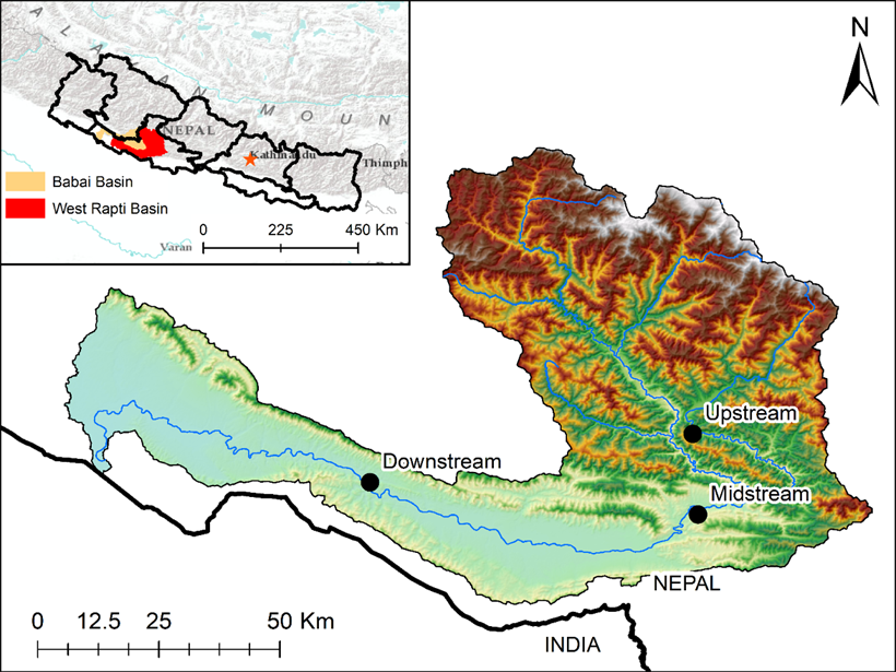
Talchabhadel et al. (2021) demonstrate the applicability of well-performing SRE products to fill gauge data gaps and correct the poor performing SRE products with the information of the gauge data on an hourly scale. Their study took a representative case in the West Rapti River basin, Nepal, for an extreme weather event of August 2014.
Application of SREs is a good head start in data-scarce regions. Furthermore, the methodology and findings are scalable in the areas of flood management in Nepal and beyond.
Citation: Talchabhadel, R., Nakagawa, H., Kawaike, K., Yamanoi, K., Musumari, H., Adhikari, T. R., & Prajapati, R. [2021]. Appraising the potential of using satellite-based rainfall estimates for evaluating extreme precipitation: A case study of August 2014 event across the West Rapti River Basin, Nepal. Earth and Space Science, 8, e2020EA001518. https://doi.org/10.1029/2020EA001518
—Jonathan H. Jiang, Editor, Earth and Space Science
Text © 2021. The authors. CC BY-NC-ND 3.0
Except where otherwise noted, images are subject to copyright. Any reuse without express permission from the copyright owner is prohibited.