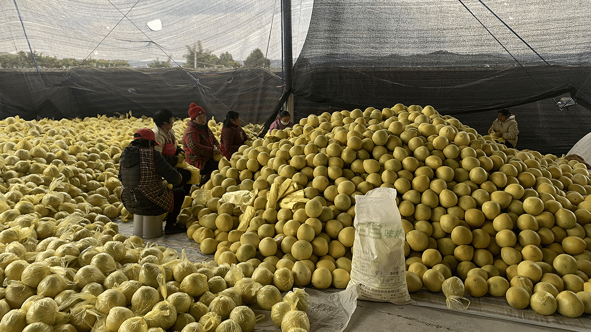
Data centers powering artificial intelligence consume significant amounts of water, highlighting the need for greater transparency regarding water use in both existing and planned facilities.
Sustainable Development Goals (SDGs)
Posted inEditors' Vox
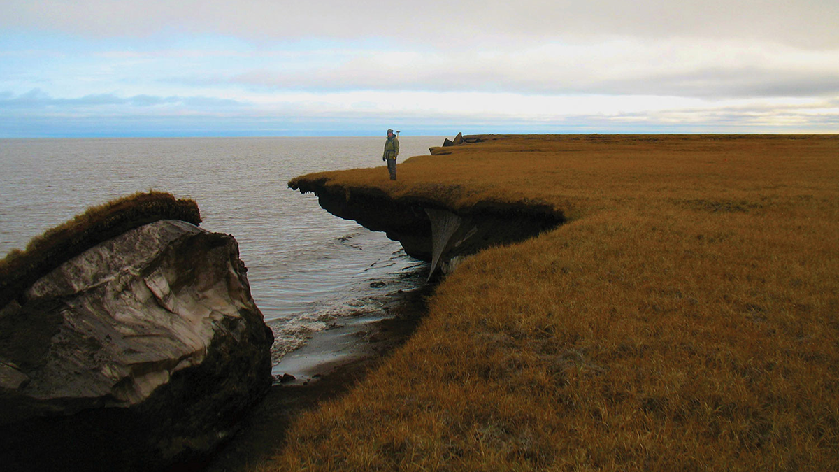
How Frozen Ground Controls Water in a Warming World
Frozen ground acts like a hidden underground dam. As it thaws, water pathways shift, changing rivers, wetlands, ecosystems, and infrastructure across cold regions.
Posted inEditors' Highlights
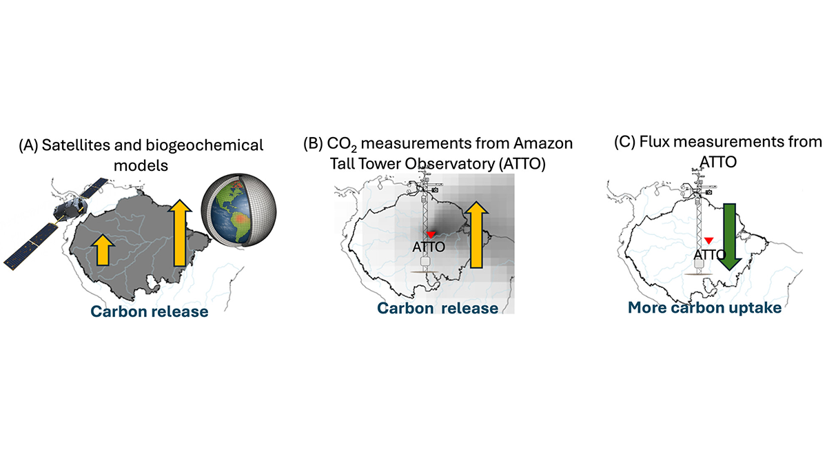
Severe 2023 Drought: Sinking Carbon Sink in the Amazon
The Amazon forest has been a reliable carbon sink, soaking up some of humanity’s carbon emissions, but a severe drought in 2023 adds to growing concern that this ecosystem service is at risk.
Posted inEditors' Vox
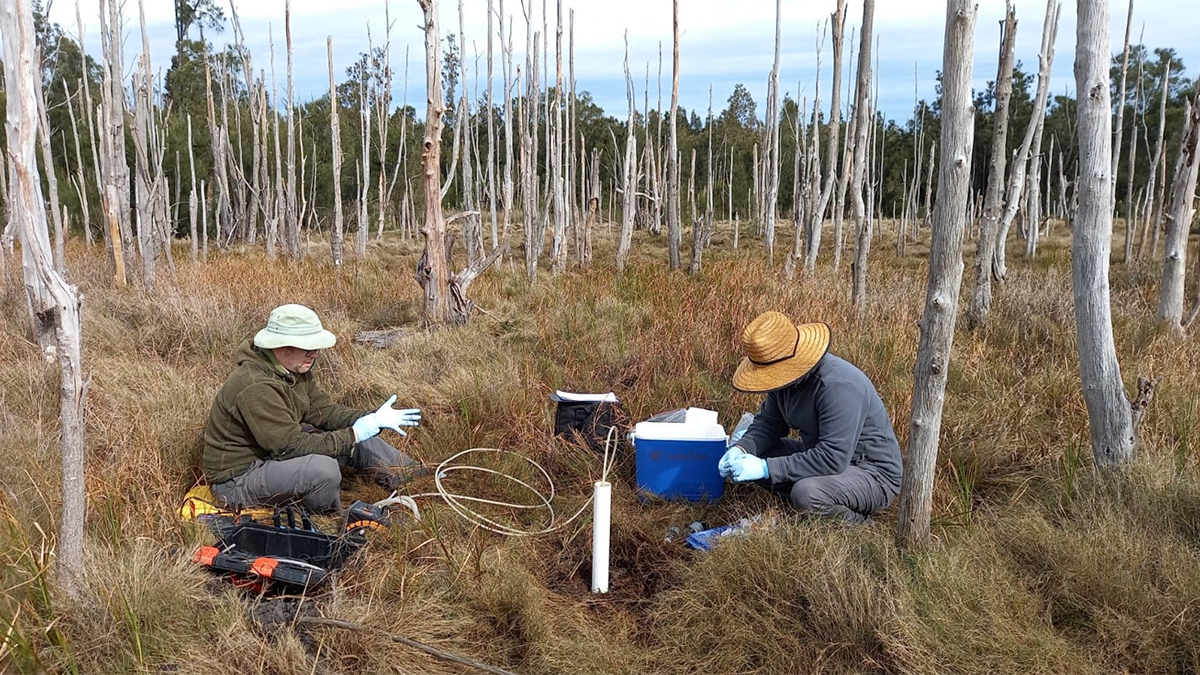
Coastal Wetlands Restoration, Carbon, and the Hidden Role of Groundwater
Coastal wetland restoration offers major carbon benefits, and understanding groundwater processes helps explain how these ecosystems store carbon over the long term.
Posted inEditors' Highlights
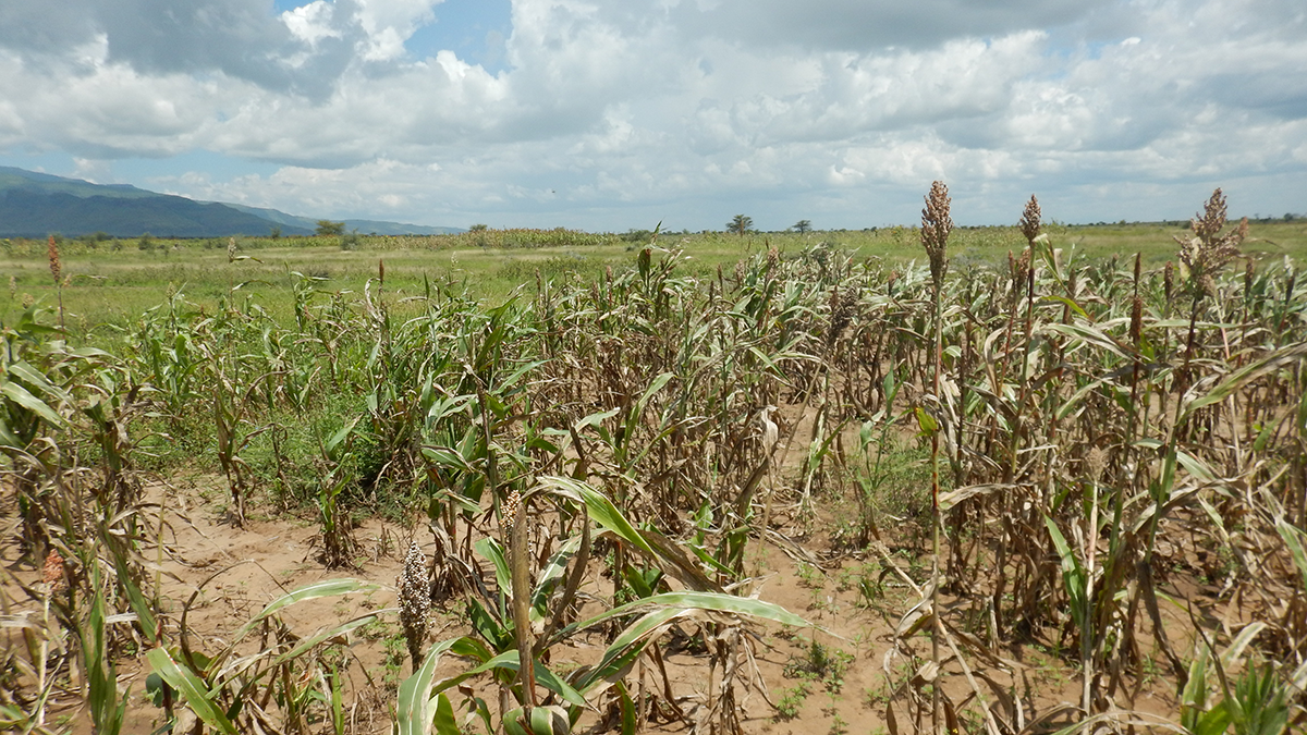
How Satellite Data Helped Avoid Hunger from Drought
Satellites detecting anomalies of the spectral reflectance of crops in Uganda successfully foretold imminent crop failure and automatically triggered timely governmental disaster relief.
Posted inEditors' Highlights
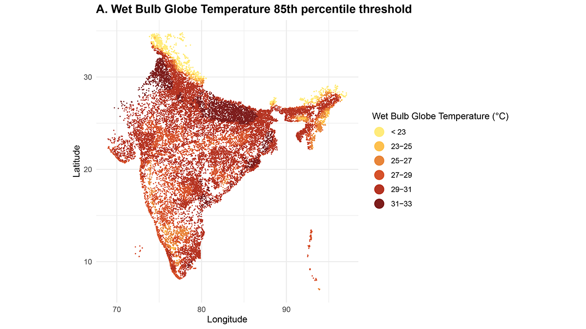
Heatwaves Increase Home Births in India
Heatwaves in India are associated with increased home births, with differential susceptibilities across regions and populations, threatening maternal and newborn health.
Posted inEditors' Highlights
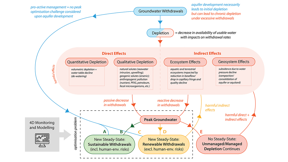
Avoiding and Responding to Peak Groundwater
A new review shows how rising demand, shrinking supplies, and policy decisions together shape when groundwater use peaks and what can be done to avoid long-term depletion.
Posted inNews
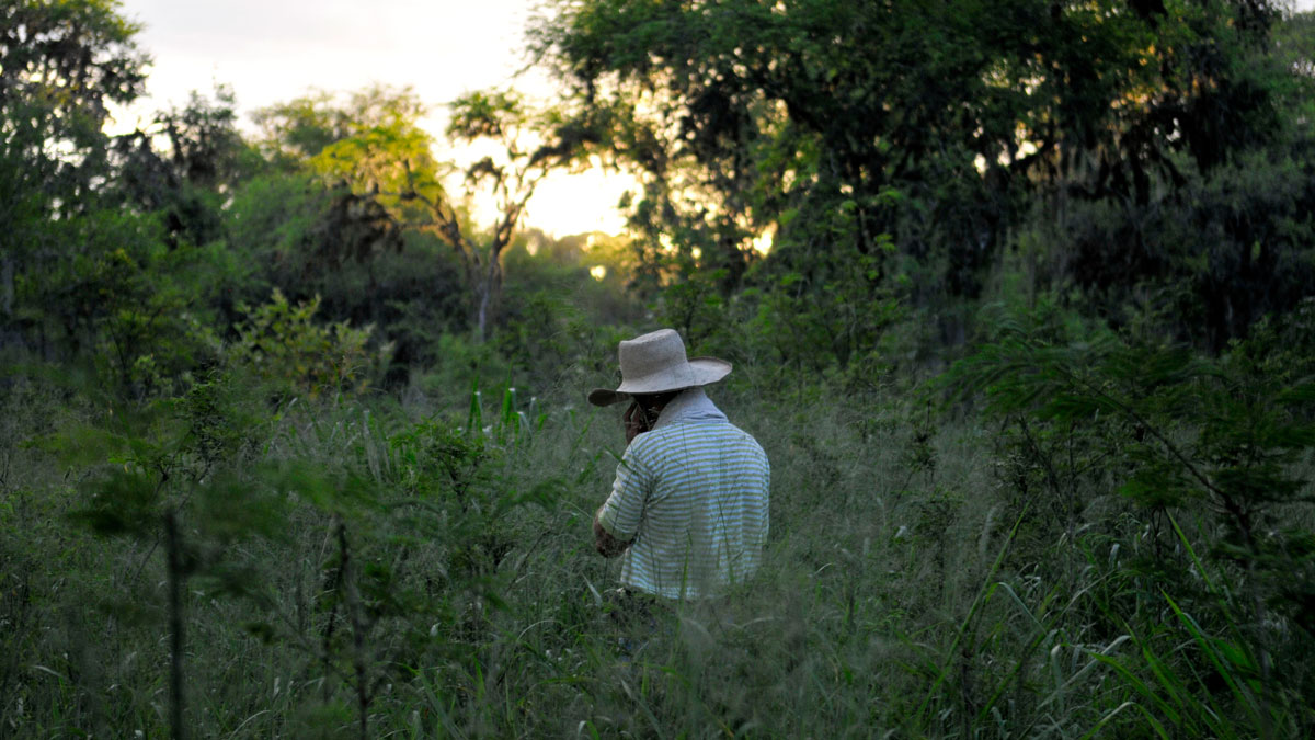
REDD+ Results and Realities
A new study examines the efficacy of REDD+ projects in reducing deforestation and raises questions about the carbon credits the initiative relies on.
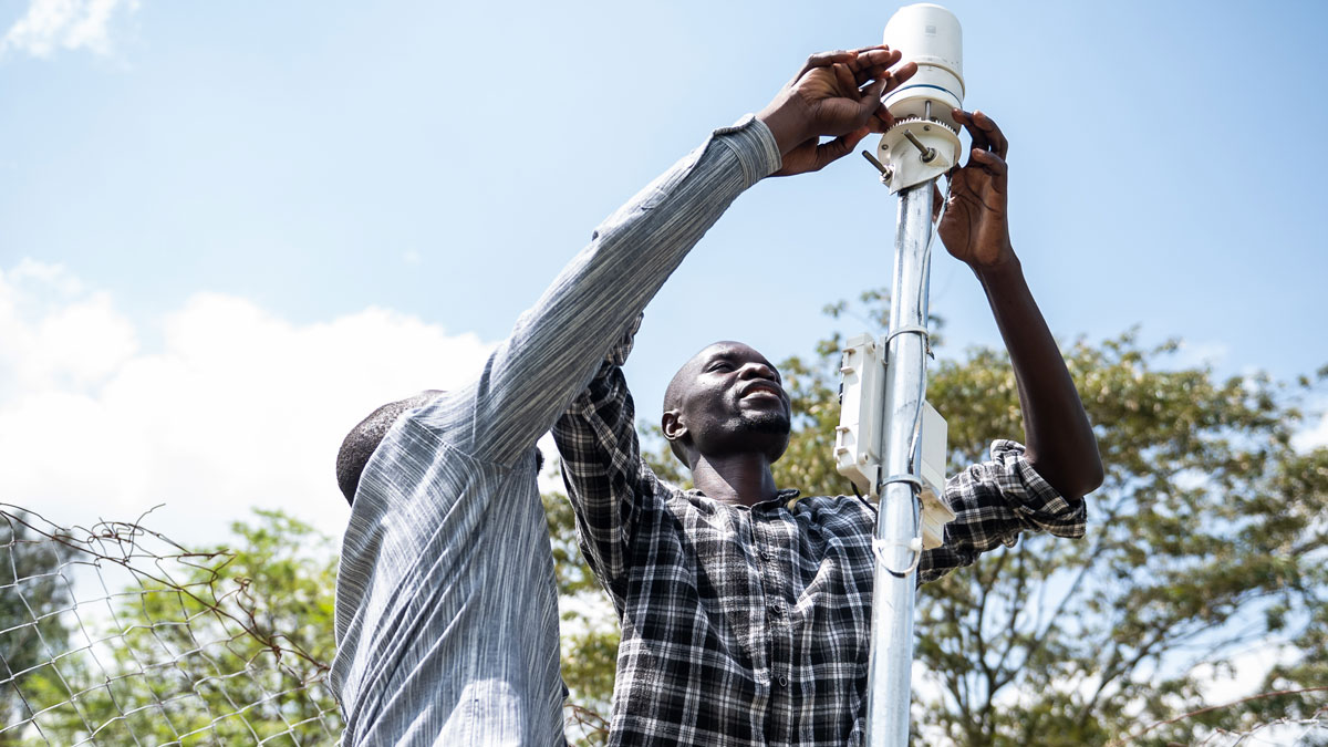
Posted inFeatures
Building Better Weather Networks
A lack of weather data often leaves African communities vulnerable. Convergent efforts to improve observational networks throughout the continent are slowly filling the gaps.