• About
  • Special Reports
  • Topics
    • Climate
    • Earth Science
    • Oceans
    • Space & Planets
    • Health & Ecosystems
    • Culture & Policy
    • Education & Careers
    • Opinions
  • Projects
    • Postcards From the Field
    • ENGAGE
    • Editors’ Highlights
    • Editors’ Vox
    • Eos en Español
    • Eos 简体中文版
    • Print Archive: 2015–2025
  • Policy Tracker
  • Blogs
    • Research & Developments
    • The Landslide Blog
  • Newsletter
  • Submit to Eos
  • AGU.org
  • Career Center
  • Join AGU
  • Give to AGU
  • About
  • Special Reports
  • Topics
    • Climate
    • Earth Science
    • Oceans
    • Space & Planets
    • Health & Ecosystems
    • Culture & Policy
    • Education & Careers
    • Opinions
  • Projects
    • Postcards From the Field
    • ENGAGE
    • Editors’ Highlights
    • Editors’ Vox
    • Eos en Español
    • Eos 简体中文版
    • Print Archive: 2015–2025
  • Policy Tracker
  • Blogs
    • Research & Developments
    • The Landslide Blog
  • Newsletter
  • Submit to Eos
Skip to content
  • AGU.org
  • Career Center
  • Join AGU
  • Give to AGU
Eos

Eos

Science News by AGU

Support Eos
Sign Up for Newsletter
  • About
  • Special Reports
  • Topics
    • Climate
    • Earth Science
    • Oceans
    • Space & Planets
    • Health & Ecosystems
    • Culture & Policy
    • Education & Careers
    • Opinions
  • Projects
    • Postcards From the Field
    • ENGAGE
    • Editors’ Highlights
    • Editors’ Vox
    • Eos en Español
    • Eos 简体中文版
    • Print Archive: 2015–2025
  • Policy Tracker
  • Blogs
    • Research & Developments
    • The Landslide Blog
  • Newsletter
  • Submit to Eos

Tectonics

Visit the journal.

A wide, flat area of tan-colored earth, with mountains in the distance. In the foreground, a paler, gray-colored substance appears to overlay the ground. Streaks of the tan-colored ground are visible beneath the gray substance.
Posted inResearch Spotlights

Tracing Millions of Years of Geologic Stress in the Andean Plateau

by Nathaniel Scharping 15 July 202415 July 2024

Paleostress modeling shows how a region of the Andean Plateau was uplifted and formed beginning more than 20 million years ago.
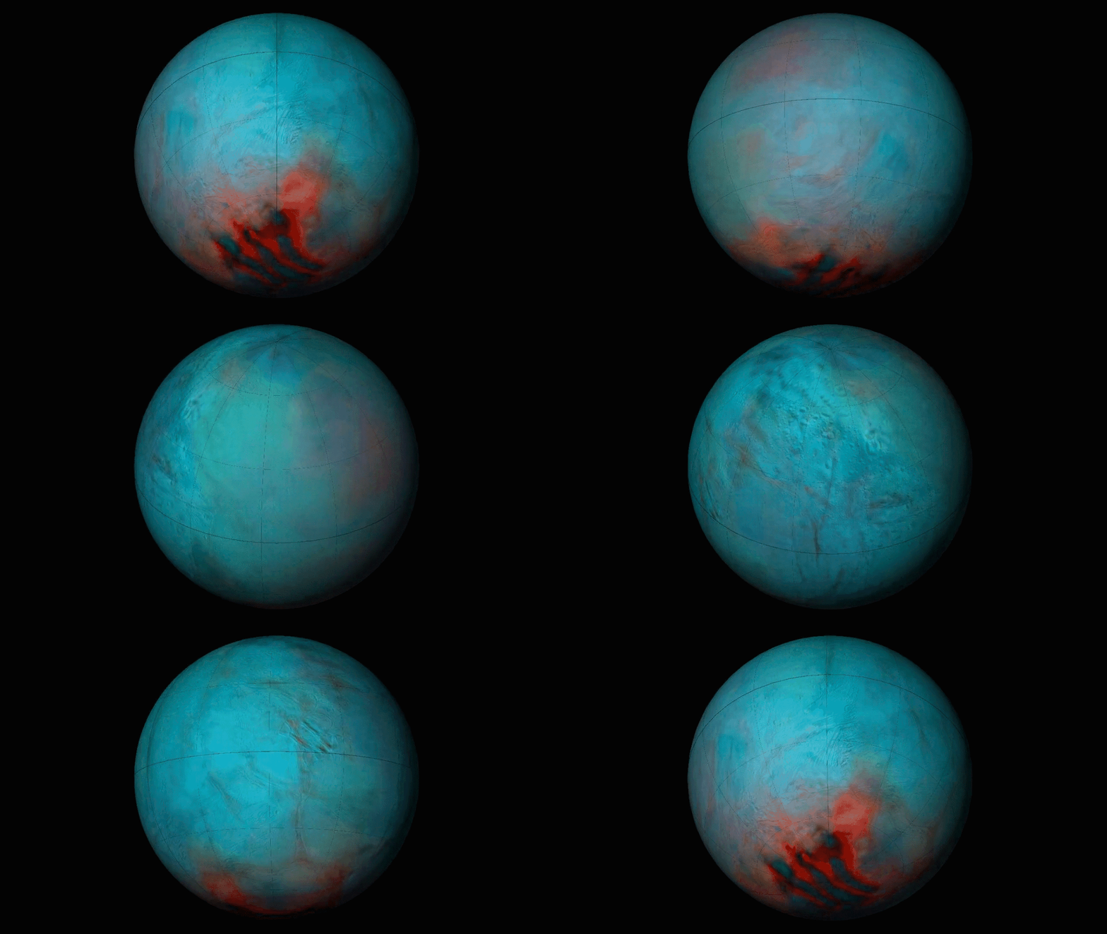
A global thermal map of Enceladus.
Posted inNews

Strike-Slip Faults Could Drive Enceladus’s Jets

Kimberly M. S. Cartier, News Writing and Production Intern for Eos.org by Kimberly M. S. Cartier 29 April 202429 April 2024

The back-and-forth motion could also reshape surface geology at the moon’s south pole.

A mountain with alternating stripes of greenery and bare beige rock. There is a point in the middle of the rock where the stripes change direction, indicating a fault propagation fold.
Posted inResearch Spotlights

Uncovering Earthquake Evidence in Azerbaijan’s Greater Caucasus Mountains

by Rebecca Owen 27 March 202418 June 2024

A new study unearths geological evidence that corroborates historical accounts of large earthquakes along the Kura fold-thrust belt.
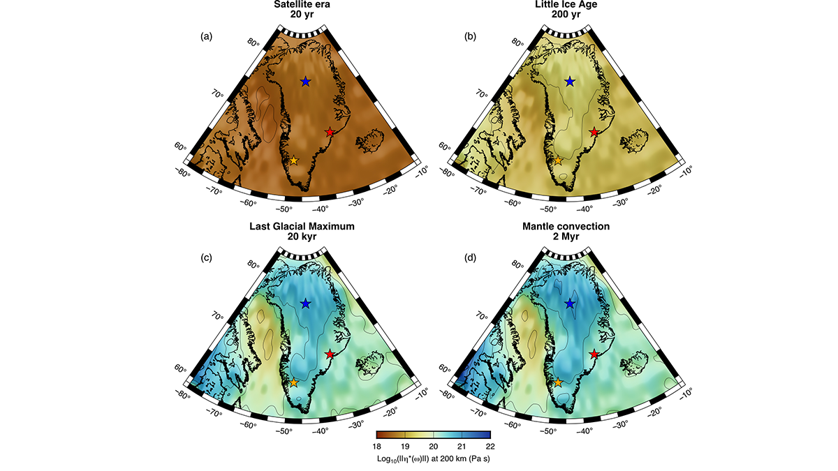
Image depicting Viscosity estimates for the mantle underneath Greenland.
Posted inEditors' Highlights

4D Viscosity Constraints from Greenland 

by Thorsten Becker 28 March 202311 April 2023

The mantle’s resistance to flow appears different for glacial and plate tectonic timescales but this behavior can be reconciled with new thermo-mechanical models of the asthenosphere.

Photo of the Apennine Mountains in Italy.
Posted inEditors' Highlights

Topography Along the Apennines Reflects Subduction Dynamics

by Duna Roda-Boluda 15 March 202313 March 2023

Topography and exhumation vary strongly along the Apennines, reflecting the geometry of the Moho and different geodynamic mechanisms.

A vineyard growing on a mountain slope with several other mountains visible in the background
Posted inResearch Spotlights

Scientists Decipher the Seismic Dance of the Southern Alps

by Morgan Rehnberg 20 January 202320 January 2023

Most of the Alps are considered tectonically dead, but according to new research, the southeastern region—home to prosecco wine—is very much alive.
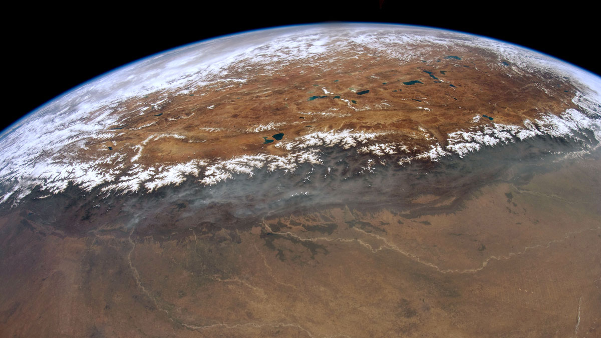
白雪覆盖的山峰排列在青藏高原的南部边缘。
Posted inResearch Spotlights

研究揭示尼泊尔西部喜马拉雅港湾状地形的形成

Sarah Derouin, Science Writer by Sarah Derouin 19 October 202219 October 2022

研究人员通过热运动学研究发现,沿着板块汇聚界面大型逆冲断层在中下部地壳深处的地壳物质堆叠塑造了高原的生长和区域水系的发育。

Posted inEditors' Highlights

A Really Big (Global) Splash at Chicxulub

by Tom Parsons 12 October 202213 October 2022

What caused a tsunami 30,000 times more powerful than the December 26, 2004 Indian Ocean tsunami? A new modeling study says this was one of the results from the Cretaceous Chicxulub asteroid impact.
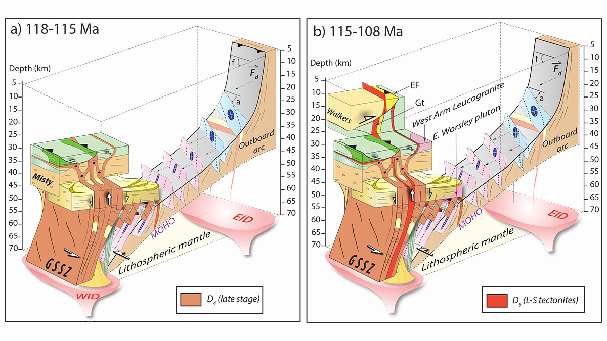
Two block diagrams that show how the George Sound shear zone (GSSZ) grew through the crust in space and time.
Posted inEditors' Highlights

Feedbacks Between Deformation and Magmatism as Shear Zones Grow

by Alexis Ault 29 September 202228 September 2022

New research reveals how the presence and absence of magmatism governs how shear zones initiate, grow, and reactivate to connect lower and upper crustal deformation.

Snow-covered peaks line the southern edge of the Tibetan plateau.
Posted inResearch Spotlights

Uncovering the Formation of the Western Nepal Embayment

Sarah Derouin, Science Writer by Sarah Derouin 24 August 202219 October 2022

Using thermokinematics, researchers have found that crustal accretion along the megathrust at mid-lower crustal depths shapes plateau growth and regional drainage development.

Posts pagination

Newer posts 1 2 3 4 … 6 Older posts
Over a dark blue-green square appear the words Special Report: The State of the Science 1 Year On.

Features from AGU Publications

Research Spotlights

Extreme Heat May Drive Asthma Risk in Baltimore, Especially at Night

12 August 202612 August 2026
Editors' Highlights

How Fluid Mixing due to Kelvin-Helmholtz Instabilities Really Works

13 August 202613 August 2026
Editors' Vox

Introducing Research Letters in Paleoceanography and Paleoclimatology

12 August 202610 August 2026
Eos logo at left; AGU logo at right

About Eos
ENGAGE
Awards
Contact

Advertise
Submit
Career Center
Sitemap

© 2026 American Geophysical Union. All rights reserved Powered by Newspack