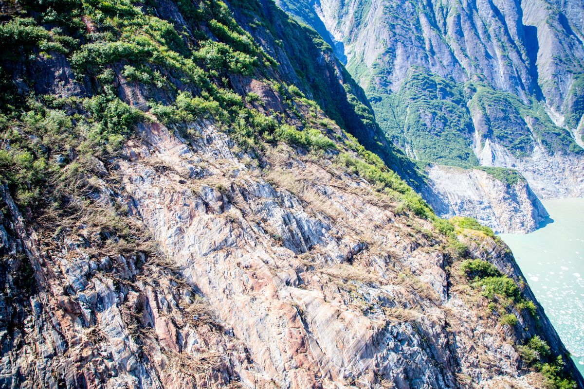
A wonderful new paper on the huge Tracy Arm landslide and tsunami will have profound but challenging implications for the management of risk in an age of increased tourism and rapid climate change. The journal Science has published an excellent new paper (Shugar et al. 2026) that examines the extraordinary 10 August 2025 landslide and […]
tsunamis & storm surges
Posted inNews
The Forensics of a Skyscraper-Sized Tsunami
A landslide in Tracy Arm Fjord in Alaska created the second-largest tsunami on record. A new analysis links this abrupt event to the retreat of a glacier and, ultimately, to climate change.
Posted inNews
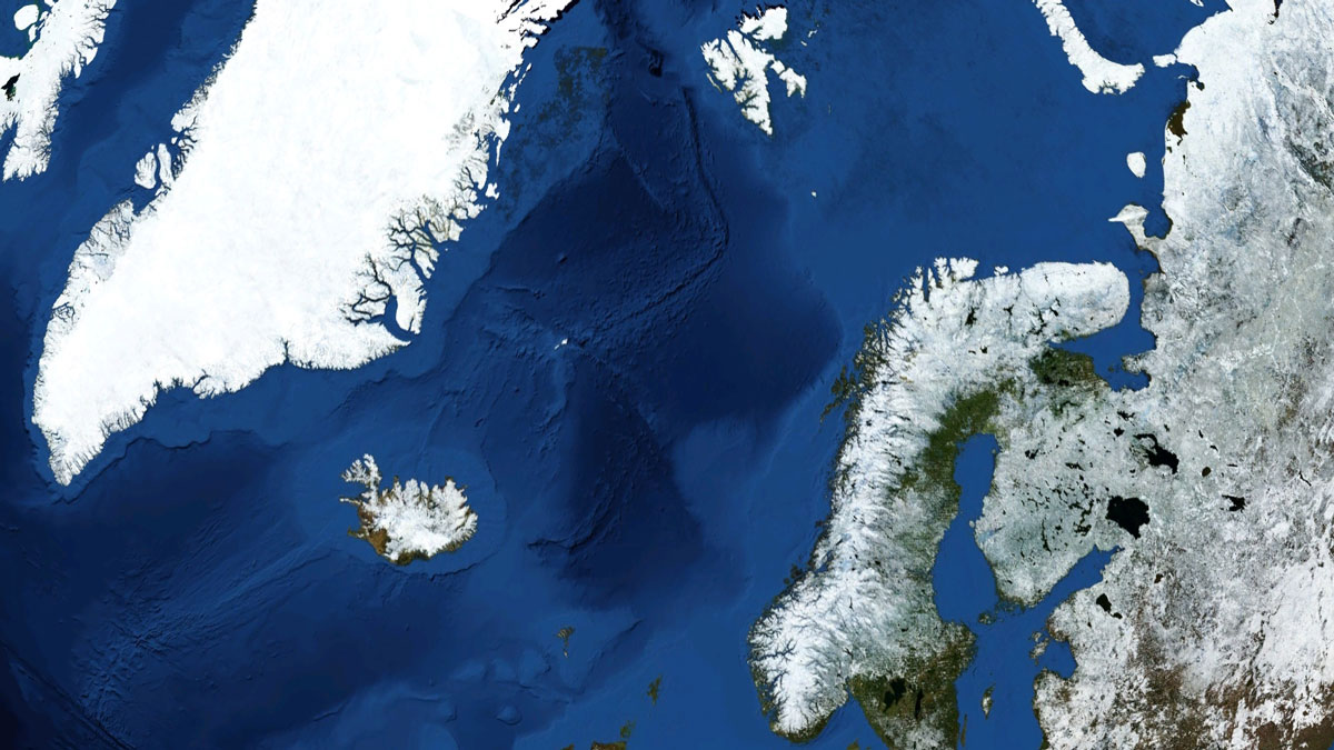
New Eyes on One of the Planet’s Largest Submarine Landslides
Researchers have mapped the ancient Stad Slide off the coast of Norway to better understand what triggered it, and the hunt is on for the tsunami it might have unleashed.
Posted inOpinions
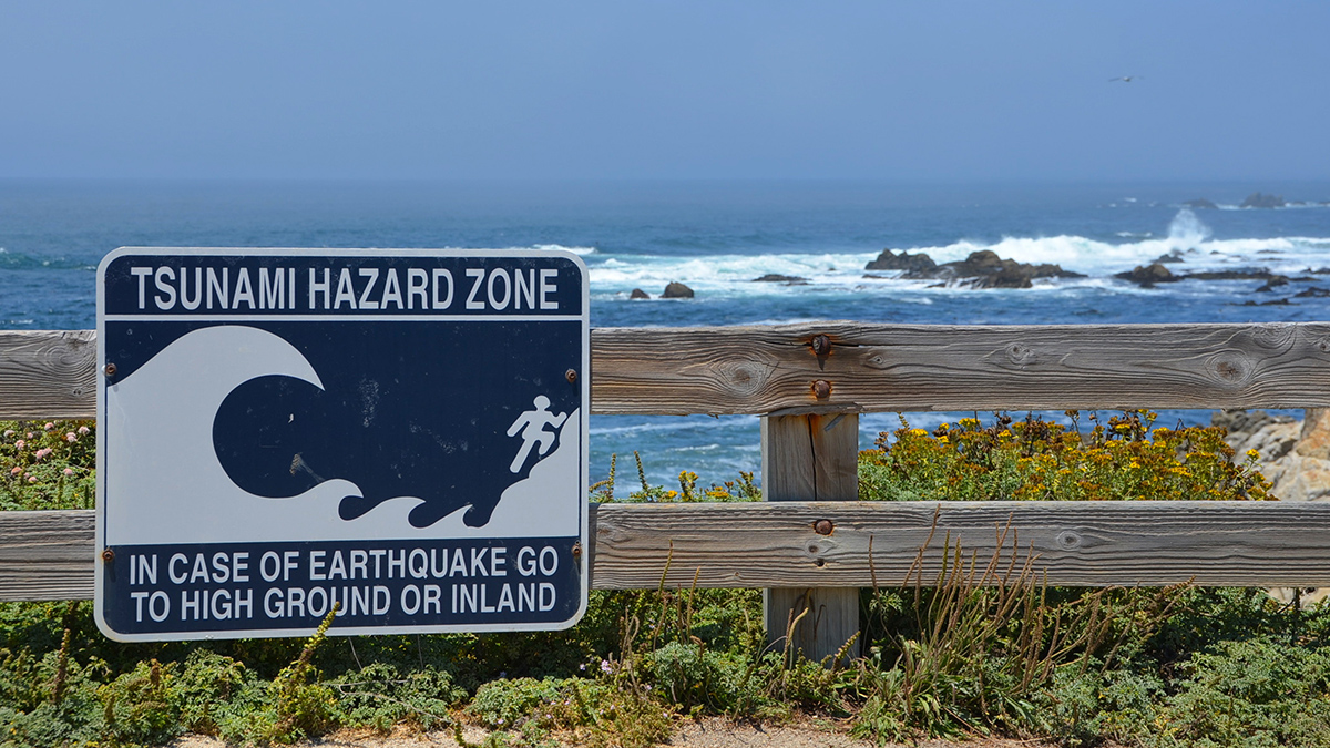
When Should a Tsunami Not Be Called a Tsunami?
It’s time to redefine the term so it more clearly conveys meaningful risks to coastal communities and prompts them to act when needed.
Posted inThe Landslide Blog
The giant Tupaasat rock avalanche in South Greenland
A new paper describes a rock avalanche in Greenland about 10,900 years BP that had a volume of over 1 billion cubic metres and that travelled almost 16 kilometres. A fascinating paper (Pedersen et al. 2026) has just been published in the journal Geomorphology that describes a newly-discovered ancient rock avalanche in Greenland. This landslide, […]

Posted inThe Landslide Blog
The 22 May 1960 earthquake-induced landslides and tsunami at Lake Rupanco in Chile
Reconstruction of landslides on the banks of Lake Rupanco in Chile, triggered by the 22 May 1960 Mw-9.5 earthquake, suggests that a slope failure with a volume of 161 million cubic metres triggered a tsunami with a maximum amplitude of 33.3 metres. About 120 people were killed. A very interesting paper (Quiroga et al. 2025) […]
Posted inThe Landslide Blog
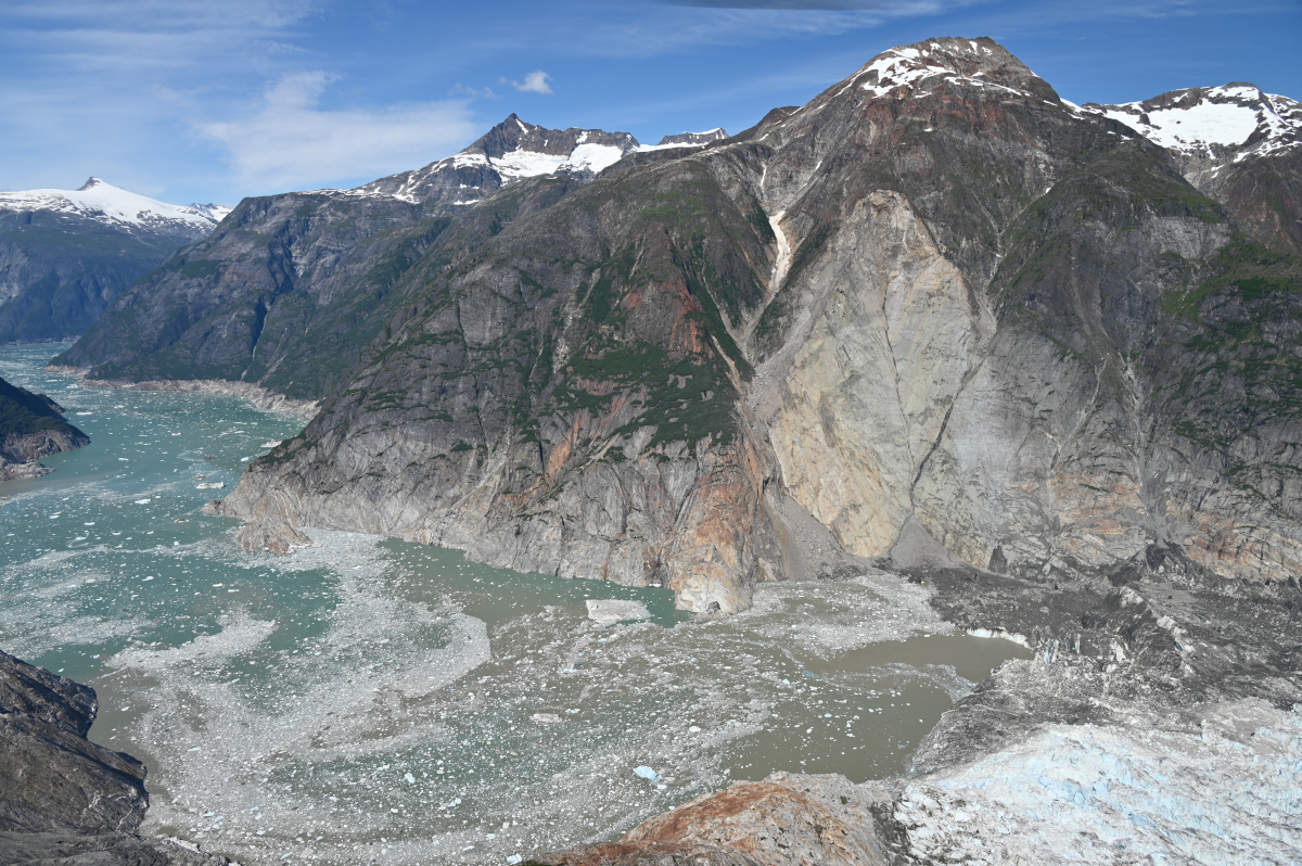
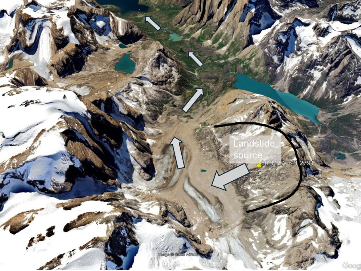
Updates from the Alaska Earthquake Center regarding the 10 August 2025 landslide
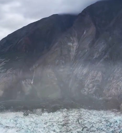
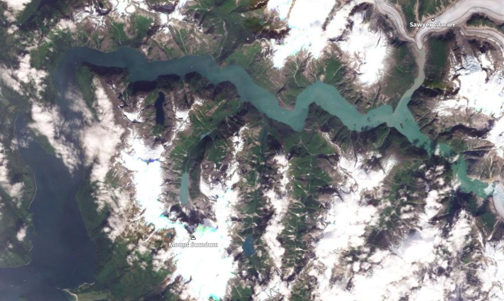
The location of this major event has now been identified. It was a major rock slope failure that ran out across the South Sawyer Glacier. The Alaska Earthquake Center has now provided a detailed update about the 10 August 2025 landslide that occurred in the area of Tracy Arm. This work has been led by […]
Posted inThe Landslide Blog
A likely large, tsunamigenic landslide in Tracy Arm inlet, Alaska on 10 August 2025
Seismic data and eye-witness reports of a displacement wave point to a large landslide at 5:30 am. On 10 August 2025, at 5:30 am local time, the Alaska Earthquake Center detected a seismic signal that was almost certainly generated by a landslide. They have posted the record of the seismic signal to Twitter. Their posting […]
Posted inResearch & Developments
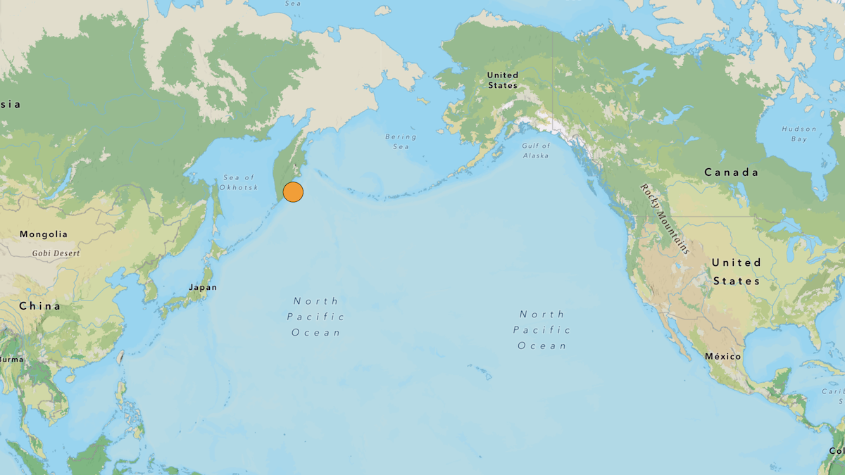
Magnitude-8.8 Earthquake Strikes Western Pacific
One of the strongest earthquakes ever recorded struck off the eastern coast of Russia’s Kamchatka Peninsula Wednesday morning local time. Initially pegged at a magnitude-8.0, the quake was eventually upgraded to a magnitude-8.8. Adjusted magnitude estimates are not unusual for large earthquakes as more data become available.
Posted inNews
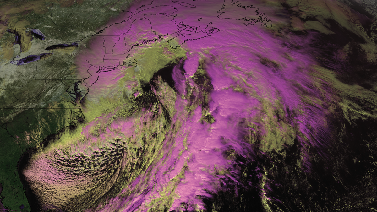
New Research Shows More Extreme Global Warming Impacts Looming for the Northeast
One new study identifies a 17% increase in the destructive potential of the strongest nor’easters, while another bolsters links between Arctic ice melt and dangerous blizzards.