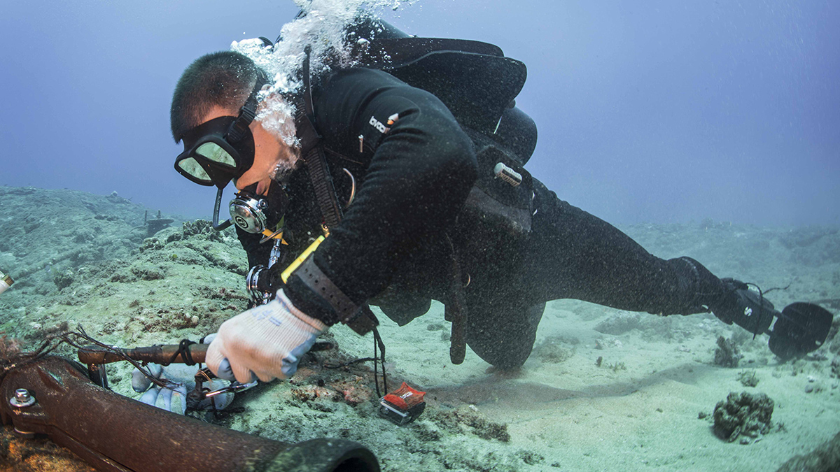
A new device enables existing submarine cable networks to measure deep-sea movements. It could ultimately help improve tsunami warnings and climate monitoring.
tsunamis & storm surges
Posted inThe Landslide Blog
The 22 November 1815 Gejer Bali disaster
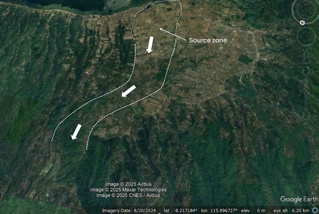
A new paper (Faral et al. 2025) provides details of a seismically-triggered landslide cascade and tsunami that killed up to 12,000 people. On 22 November 1815, a very significant landslide disaster occurred in Bali, in what is now Indonesia, killing between 10,000 and 12,000 people. A very interesting new paper (Faral et al. 2025) in […]

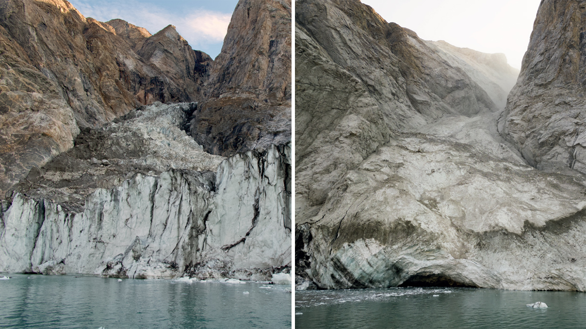
Posted inNews
New Satellite Adds Evidence of an Earth-Shaking Wave
A tsunami struck a fjord in East Greenland in 2023, ringing seismometers for nine straight days. A new satellite study provides the first observational evidence of the waves.
Posted inThe Landslide Blog
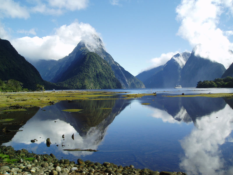
Risk-to-life from a coseismic landslide-triggered tsunami in Piopiotahi/Milford Sound, Aotearoa/New Zealand
The Landslide Blog is written by Dave Petley, who is widely recognized as a world leader in the study and management of landslides. On 9 December 2019, a small phreatic eruption occurred on Whakaari/White Island in Aotearoa/New Zealand at a time when there were 47 people, most of whom were tourists, on the site. Tragically, […]
Posted inEditors' Highlights
T-waves May Improve Tsunami Early Warning Systems
A unique acoustic wave related to the generation of tsunamis could be used to enhance early warning systems.

Posted inEditors' Highlights
120 Years of Geodetic Data on Kīlauea’s Décollement
A new study explores the deformation and stress changes of Kīlauea’s décollement from 1898 to 2018 by collating an unprecedented 120 years of geodetic data.
Posted inNews
Finding the Frequency of a Fjord
A massive tsunami churned up a mysterious 9-day noise in East Greenland. As the climate warms, more fjords may start singing.

Posted inEditors' Highlights
Seismotectonic Update of the Philippines-Taiwan Region
Using more than two decades of data, scientists find that the Philippine and Taiwan subduction region is controlled mainly by shallow seismicity and low magnitude earthquakes.

Posted inThe Landslide Blog
The 7 August 2024 Pedersen Lagoon landslide and tsunami
The Landslide Blog is written by Dave Petley, who is widely recognized as a world leader in the study and management of landslides. At about 5 am local time on 7 August 2024, a large landslide occurred on the rock slopes above Pedersen Lagoon in Alaska, triggering a local tsunami. Whilst this major event is […]

Posted inEditors' Highlights
Dual Tsunami Generation from Atmospheric and Oceanic Sources
The 2022 Tonga volcanic eruption generated waves that propagated across the Pacific Ocean. A new analysis of sea level measurements is used to dissect the difference in wave components from two sources.