Source: Water Resources Research
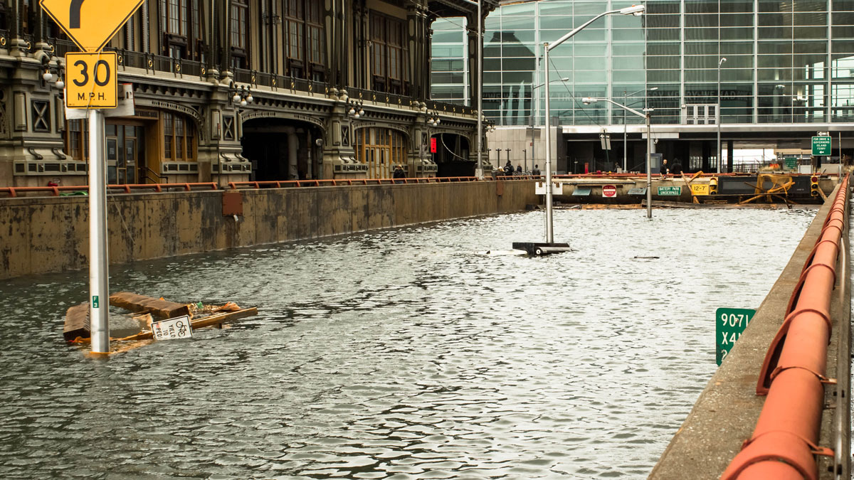
As climate change continues to warm the planet, scientists expect natural hazards such as flooding to increase. Urban flooding can be caused by extreme precipitation events, storm surges, or high tides, with dangerous and expensive consequences for public health and infrastructure.
Urban flooding hazards are complicated by the heterogeneity of cities—various types of land use, development, surfaces, and drainage systems can all change how water moves. Flooding can be localized to areas as specific as a block or a street corner and change quickly, making it difficult to monitor hyperlocal floods distributed across a city in real time. Crowdsourced flood reports from citizens (such as social media posts) are helpful during such events, but the coverage and accuracy can be spotty given that they require human witnesses to register events. Some water level sensors present logistical challenges. For example, pressure sensors installed in sewers are susceptible to damage and require frequent maintenance. Existing camera-based sensing sometimes requires high power or provides low-quality images.
In a new study, Mydlarz et al. present their design for a low-cost, accurate, and robust flood sensor that can be deployed throughout cities.
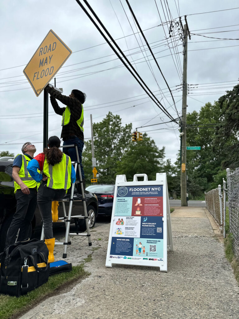
The solar-powered sensors are part of a project called FloodNet, a New York City cooperative developing a combination of hardware, open-source software, visualization, and community engagement tools to provide real-time and quantitative flood information to various stakeholders, including city agencies, community members, and researchers. The sensors can be easily mounted to street sign poles or walls, and they measure water depths with better than 25-millimeter accuracy using an ultrasonic range finder. The sensors transmit the data to a central server every minute using a Long Range Wide Area Network (LoRaWAN) or a cellular network, allowing them to be installed independently of existing network infrastructure. The total cost of each sensor is around $200.
The researchers created a public-facing data dashboard that allows community members and city agency personnel to visualize the data in close to real time and to access historical data. Alerts can be triggered to warn community members and emergency responders when floods are detected.
To date, the team has deployed 87 FloodNet sensors across all five boroughs of New York City, which recorded 360 flood events between October 2020 and May 2023. The team is now fine-tuning data analysis tools and flood detection thresholds and expanding the sensor network. They noted that their aim is to release flood data to stakeholders in real time, with the goal of making that data meaningful for actionable use. (Water Resources Research, https://doi.org/10.1029/2023WR036806, 2024)
—Sarah Derouin (@Sarah_Derouin), Science Writer