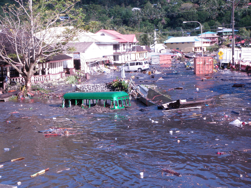
A next-generation network of seismic and wave sensors in the southwestern Pacific will warn coastal residents of an approaching tsunami before they see the wave.
tsunamis & storm surges
Posted inFeatures
Seismic Sensors in Orbit
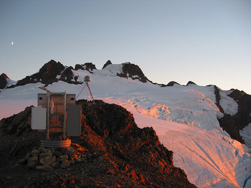
Navigation satellites are enabling high-precision, real-time tracking of ground displacements, supplementing traditional methods for monitoring and assessing earthquakes.

Posted inNews
Hurricanes Hit Puerto Rico’s Mangroves Harder Than Florida’s
The scale and pattern of damage to the Puerto Rican forests suggest a complex interplay between wind, land, and sea.

Posted inNews
Sea Caves Hold Clues to Ancient Storms
Sediments dug up from sea caves help reconstruct past climate, contributing to better storm predictions.

Posted inNews
The Hazard Cascade That Led to the Anak Krakatau Landslide
Researchers used a combination of ground and space-based measures to look for warning signs for the flank collapse at Anak Krakatau in 2018, which triggered a tsunami that killed hundreds.
Posted inNews
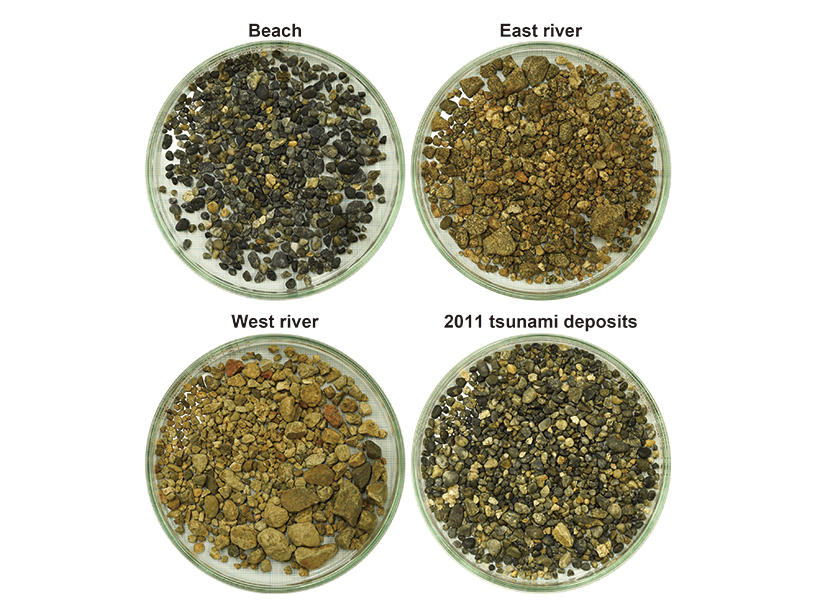
Gravel Gives Clues to the Strength of Paleotsunamis
The roundness of sediment deposits may shed light on how big tsunamis were in the past and how to evaluate hazards in the future.
Posted inAGU News
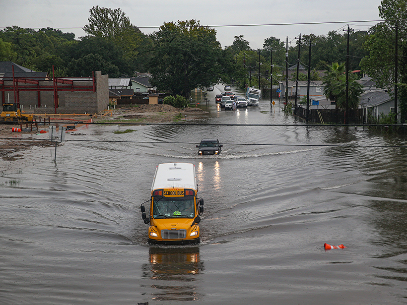
AGU Releases Report to Address Flooding in Communities
The Surging Waters report shows how science empowers us to mitigate the impacts on people and property in communities around the United States.

Posted inNews
Meteotsunami Spotted for the First Time in the Persian Gulf
The Persian Gulf, a region with high-end resorts and oil-related infrastructure dotting its shorelines, was hit in 2017 by weather-induced waves that rolled roughly a kilometer inland.

Posted inEditors' Highlights
Lomonosov: The Crater That Started a Martian Mega Tsunami
Three billion years ago, on Mars, the shores of an ocean may have been flooded by a mega-tsunami. Now the crater left by the bolide impact that probably triggered the tsunami has been identified.

Posted inNews
Ceramics Trace a 14th Century Indonesian Tsunami
Archaeological evidence suggests that communities on the northern coast of Sumatra devastated by a tsunami roughly 600 years ago opted to rebuild in the same area, a process repeated in 2004.