A rainfall-induced landslide at Burutsi is now known to have killed 28 people.

At about 1 am local time on 13 January 2026, a large landslide occurred at Burutsi village, which is located in the Kashebere area of Walikale Territory, Democratic Republic of Congo. Local news reports indicate that 28 people were killed in the 17 houses that were destroyed. A further 20 people were injured. The search and rescue operation has now been completed.
The precise location of Burutsi is not yet clear, but Kashebere is located at [-1.31207, 28.67374]. Some reports suggest that the road to the west of Kashebere was buried in the landslide, and indeed Google Maps shows this as being closed at the time of writing.
Detailed information about this serious landslide is difficult to obtain as this area of DR Congo is being affected by an ongoing conflict between armed groups. But this image has been posted on the Kabalisolo website:-
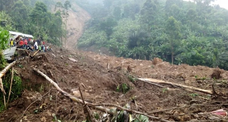
This image appears to show a very steep failure surface, with a landslide mass that is a mixture of regolith and some incorporated boulders. It is notable that the area is densely forested. This is a Google Earth image of a part of the area to the west of Burutsi:-
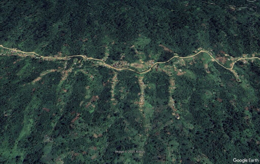
It is interesting to note that houses lie in the small valleys that are at right angles to the road. It is easy to see how a landslide occurring at the head of one of these valleys and then running down to the road could bury multiple houses.
We will await decent satellite imagery to try to pin down this event in more detail.