It is reported that 51 people have been killed by a series of debris flows in Kenya, triggered by heavy rainfall.

On 31 October 2025, heavy rainfall triggered a series of large landslides in the vicinity of Chesongoch in Elgeyo Marakwet County, Kenya. To date, 26 people are known to have been killed and it is believed that a further 25 are missing, although continued heavy rainfall has led to a suspension of the rescue efforts.
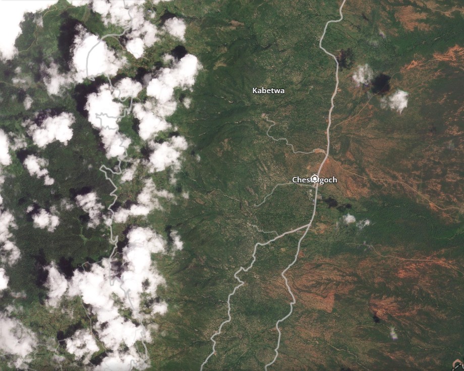
Chesongoch is located at [1.12864, 35.64426]. Immediately to the west lies the Elgeyo Escarpment, a part of the Great Rift Valley.
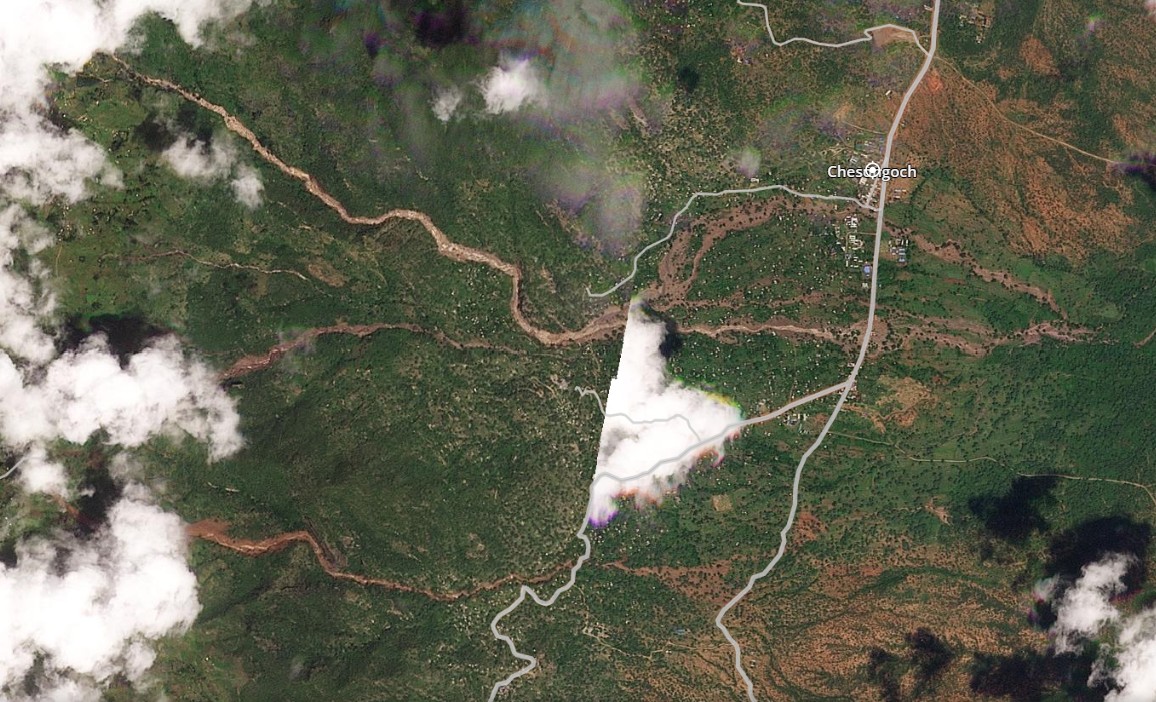
This is a Planet satellite image of the area captured on the day of the landslides, but before the rainfall arrived:-
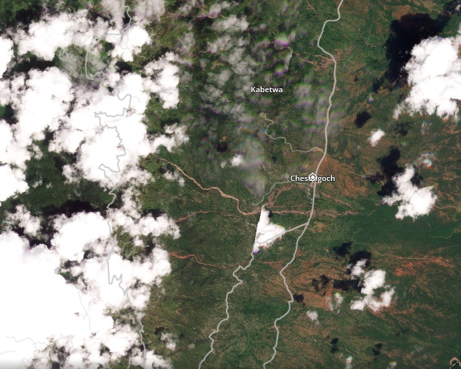
And here is the same area on 3 November 2025, after the disaster:-
And here is a slider to allow comparison:-


Note that the post-disaster image is a composite of two images taken at different times on 3 November, which is why there is a cloud with an apparently strange linear edge in the centre of the image.
The post-event image shows a series of large channelised debris flows that have started on the Elgeyo Escarpment and travelled towards the east. The precise number is unclear (there are further examples to the north of the area covered by the image) because of the cloud, but there are at least five complexes in the area. These are likely to have started as shallow failures on the higher slopes, and there is considerable evidence of them eroding their channels. This is the area around Chesongoch itself, for example:-
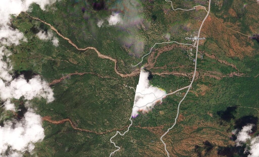
Note that on the lower slopes, some of the debris flows have escaped from the channel to flow across the open hillslopes. It is likely that this accounts for some of the fatalities.
We will need to await better imagery to understand fully the initiation of these landslides, but this is a very cloudy area.
On Sunday, a further landslide hit the area, striking the town of Kipkenda [0.76202, 35.54115] to the south of Chesongoch. It is reported that two people were killed.
In April 2020, this area was affected by another series of debris flows, killing 15 people.
Reference
Planet Team 2024. Planet Application Program Interface: In Space for Life on Earth. San Francisco, CA. https://www.planet.com/