
The Landslide Blog is written by Dave Petley, who is widely recognized as a world leader in the study and management of landslides.

In Wales, Storm Bert brought extremely heavy rainfall over the weekend, triggering extensive flooding and a number of landslides. The most serious failure appears to have occurred at Cwmtillery in Blaenau Gwent, where a slip affected an abandoned coal waste tip.
I have posted before about the ongoing concern about these waste piles in South Wales, and the lack of willingness from the UK national government to take responsibility for their remediation, which has left the devolved government of Wales with an unmanageable risk. This latest failure will increase concerns.
The location of the failure is, I believe [54.7447, -3.1297]. The site has been identified as Category D coal tip – this is the highest category in terms of risk. The Athena Picture Agency has an excellent Tweet of images of the site:-
This includes in picture 2 a good overview of the failure.
Now, it is important to emphasise that this is not an Aberfan type of landslide – the scale is vastly different for a start – but I do not want to trivialise the impact on the local community.
To understand the landslide, it is useful to take a look at this Google Earth image of the location. I have chosen an image from 2013, as the vegetation was lower at that point:-
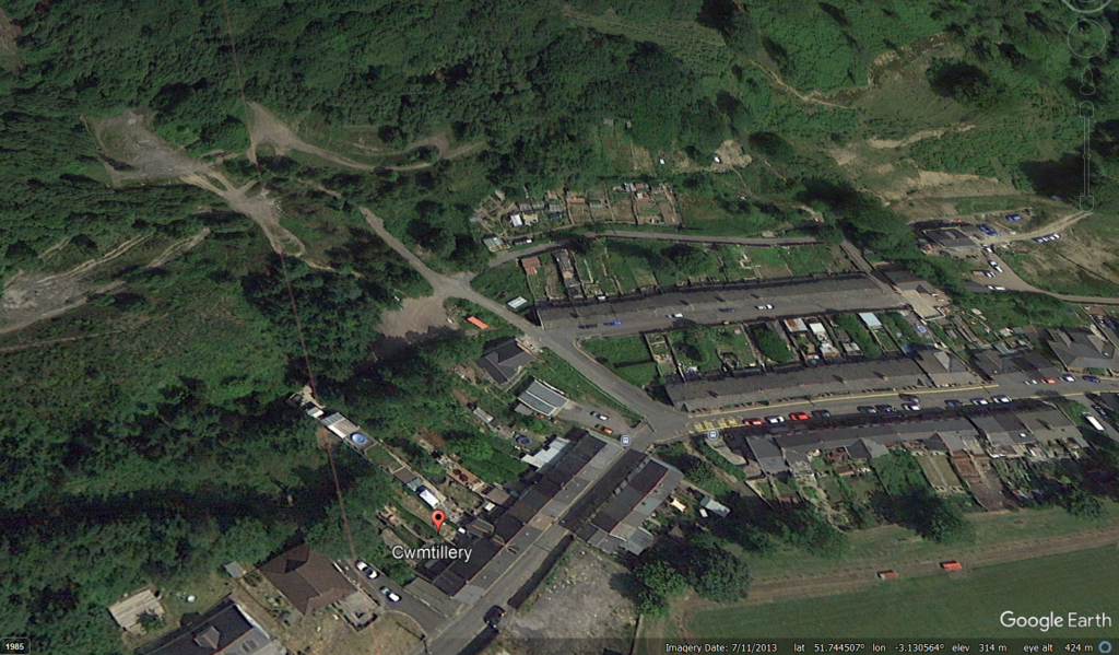
The landslide appears to have originated on the downslope side of the track towards the top of the Google Earth image, near to the 180 degree bend. The waste has then flowed directly downslope, with some entrainment of debris en route.
Work will now be underway to understand the failure, but it is likely to be a combination of a steeper slope associated with the track, and drainage issues (perhaps water from the intense rainfall flowed along the track and was focused into the slope). It will be interesting to see whether any of the drains (if present) became blocked or were simply overwhelmed. Note the broken blue pipe at the top of the landslide scar in the Athena image.
This event will serve to raise the profile once again of the hazard associated with these legacy coal tips (and this is not a problem that is unique to the UK). It will be interesting to see whether the Labour national government is willing to take responsibility for the remediation. Until that occurs, and work is undertaken across all of the Category D tips, we are likely to see more of these events in South Wales, which are an uncomfortable reminder of the tragedy of 1966.