Yukon Geological Survey
Contributors: Derek Cronmiller, Theron Finley, Panya Lipovsky, Jan Dettmer
A guest post featuring images and a commentary of landslides in Yukon Territory in Canada triggered by the 6 December 2025 M=7.0 Hubbard Glacier Earthquake.

The 6 December 2025 Mw=7.0 Hubbard Glacier Earthquake in the St. Elias Mountains of Yukon caused widespread mass wasting activity in an area near Mt. Logan, Canada. On 12 December 2025, the Yukon Geological Survey completed an overview flight of the area to collect photographs and document seismically induced activity in the region. Based on the preliminary USGS finite fault model, the earthquake rupture appears to have been shallow, with approximately 2 m of slip occurring at ~6 km depth but no evidence of earthquake surface rupture was identified. However, we documented extensive surface effects including more than 200 landslides, many snow and ice avalanches, and widespread damage to glaciers throughout the area.
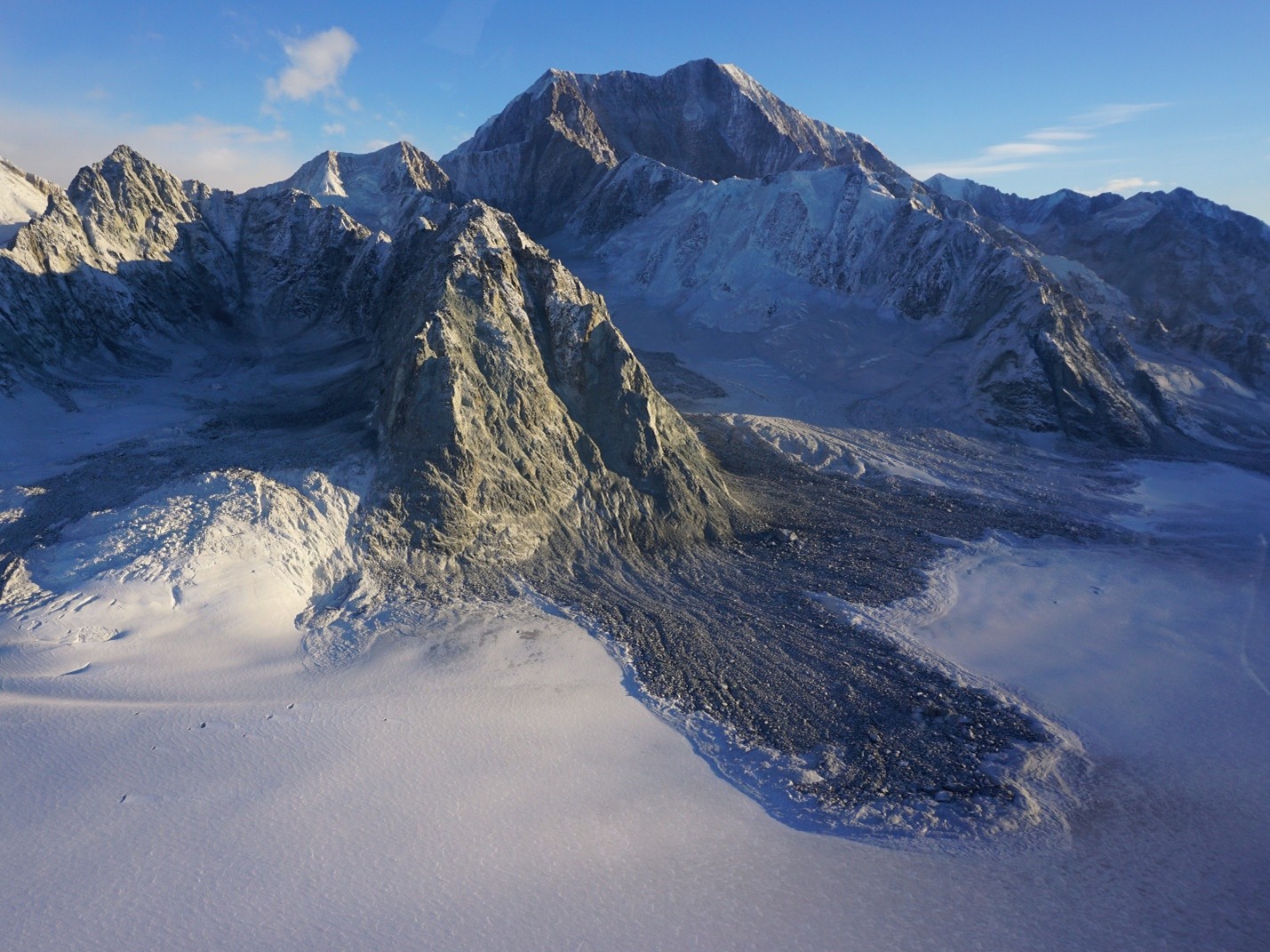
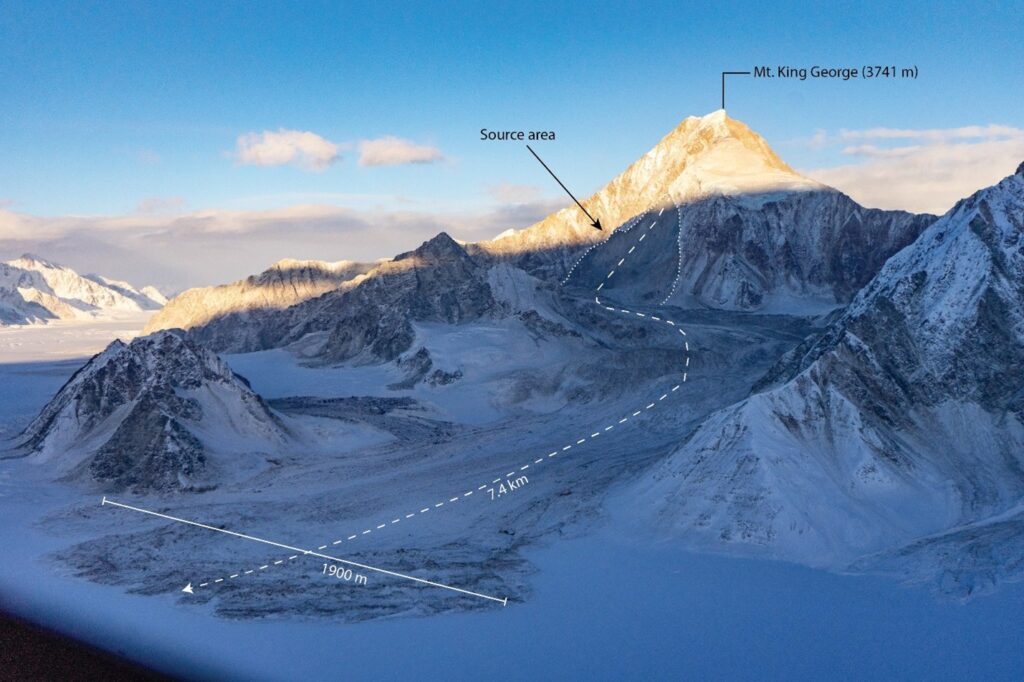
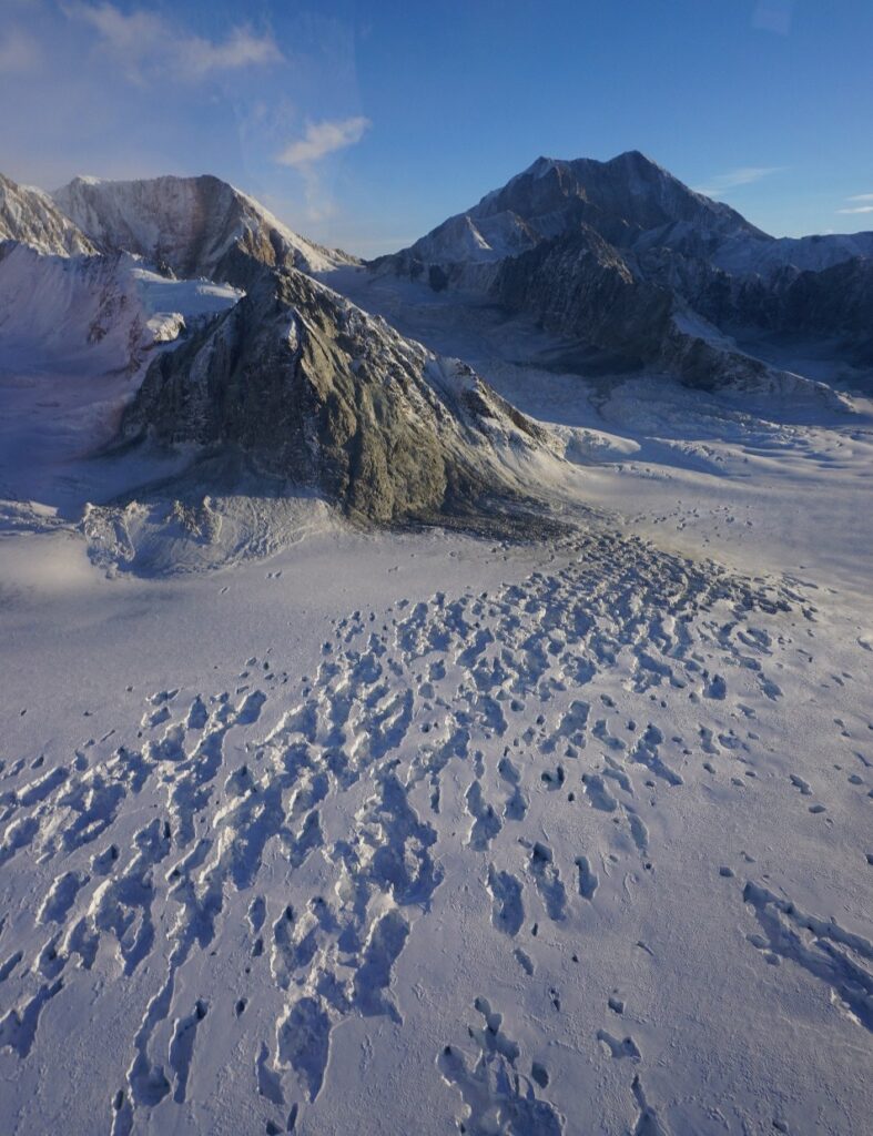
Landslide activity was concentrated on the Mt King George massif, where rock–ice avalanches and rockfall were the most common failure types. Based on preliminary earthquake relocations, the King George massif directly overlies a portion of the fault rupture and rises to a height of 3,741 m, approximately 1,900 m above the surrounding Hubbard Glacier.
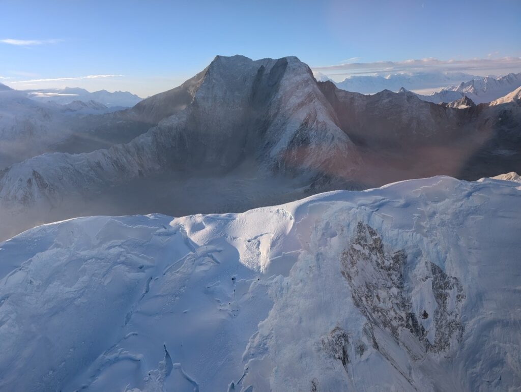
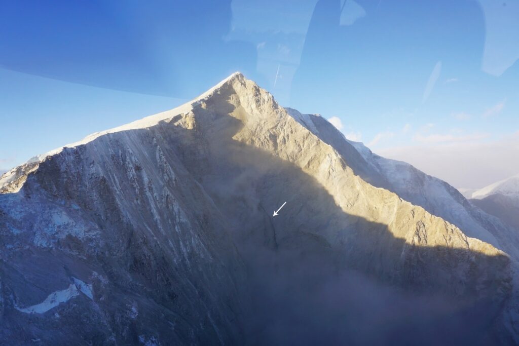
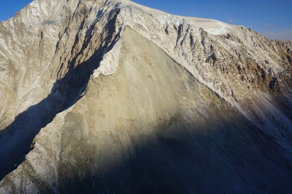
Landslide activity continued for several days after the main earthquake, likely due to a combination of aftershocks and progressive failure of slopes that were damaged by the earthquake or destabilized by earlier landsliding. At least one rock avalanche occurred between 11 and 12 December as constrained by Landsat imagery. At the time of the overview flight, slide scars on the east and northeast sides of Mt King George remained active, with ongoing rockslides and rockfall producing large dust clouds. The large slide scar on the east face of Mt King George appeared to have liquid water flowing down its centre, suggesting either discontinuous permafrost within the massif or significant heating associated with slope failure.
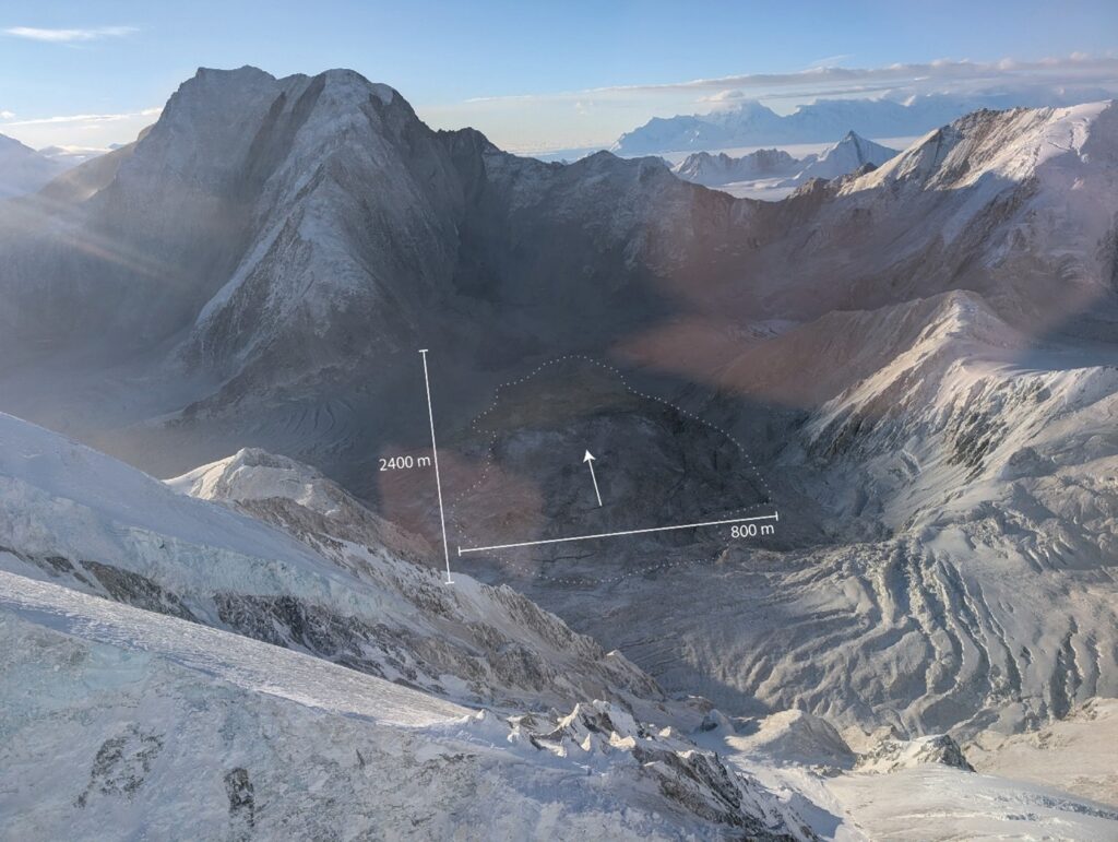
The largest observed landslide was a rock and ice avalanche produced by a partial collapse of the southwest ridge of Mt King George. The basal failure surface occurred along a southwest-dipping planar discontinuity oriented subparallel with the pre-existing slope of the south flank of the ridge . The crown of the slide originated at approximately 3,000 m above sea level and descended roughly 1,300 m along a tributary glacier before coming to rest on the Hubbard Glacier, approximately 7.4 km from the source area. This corresponds to an overall travel angle of approximately 10 degrees. Such high mobility is typical of rock avalanches on glaciers (c.f. Evans and Clague 1988), where movement is enhanced by the low-friction surface of the glacier, entrainment of snow and ice, and by water inputs generated through frictional melting (Sosio et al., 2012).
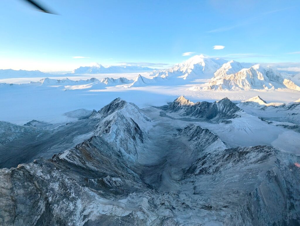
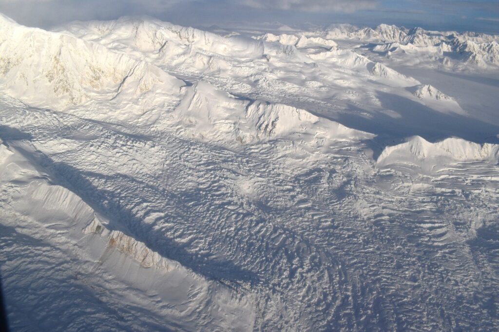
Snow avalanches were common on all aspects and were triggered in a more extensive region than landslides. Some of the largest snow avalanches occurred on the north and east aspects of Mt King George and McArthur Peak (a sub-peak of Mt Logan) and produced plumes that in some cases extended 2-3 km across the glacier at the base of the slopes where they initiated. Damage to glaciers was also extensive; the collapse of snow bridges and seracs on icefalls was widespread on the Hubbard Glacier and adjacent tributaries. A partial collapse of a glacier occurred between Mt King George and Mt Queen Mary, an area immediately above many of the most intense aftershocks. This portion of glacier is covered by debris from a rock avalanche off the NE face on Mt King George which may have contributed to its failure. The most intensely affected area is in a popular recreation zone of Kluane National Park and may have significant impact on the objective hazards skiers and mountaineers face in the region over the coming years.

All photos provided courtesy of the Government of Yukon.
References:
Evans, S. G., & Clague, J. J. 1988. Catastrophic rock avalanches in glacial environments. In Proceedings of the Fifth International Symposium on Landslides, 2, pp. 1153–1158. Lausanne, Switzerland.
Sosio R., Crosta, G.B., Chen, J.H. and Hungr, O. 2012. Modelling rock avalanche propagation onto glaciers. Quaternary Science Reviews 47, 23–40