Post based on material kindly provided by Professor Douglas H. Clark of the Geology Department at Western Washington University. Many thanks to Doug for providing this information.
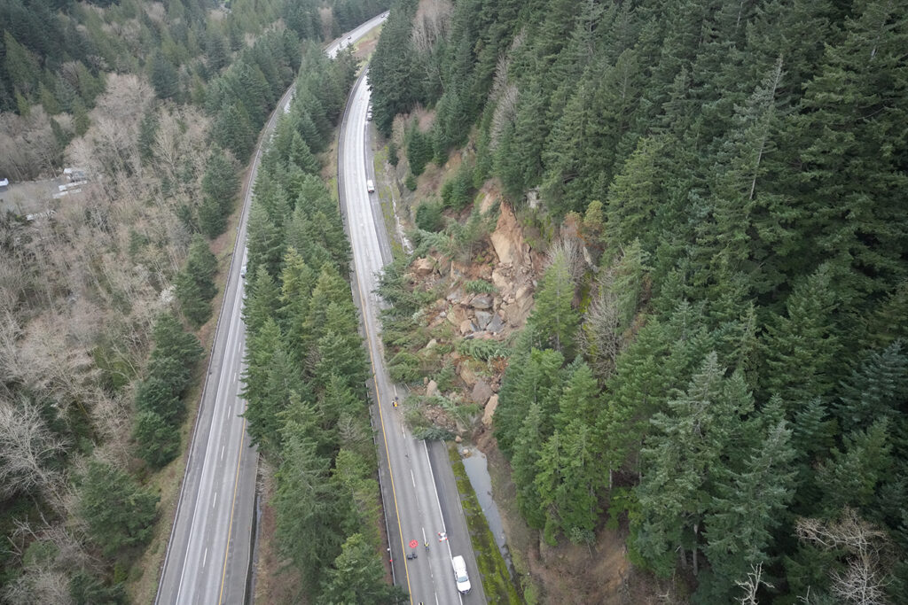
On 19 March 2026, a c.2000 cubic metre rockslide blocked the northern bound lanes of Interstate 5 near to Bellingham, WA. The road will not fully reopen until later this week.

On 19 March 2026, a substantial rockslide occurred that blocked Interstate 5 just south of Bellingham in Washington State. The landslide blocked the north-bound half of the freeway, which is still closed; the Washington DOT has a decent description of it. Fortunately no one was killed by the failure. The road is not expected to full reopen until 16 April 2026. The landslide is at about [48.69293, -122.44423].
There is an excellent gallery of images of the rockslide on the Cascadia daily site. This image, from the WSDOT blog, shows the aftermath of the landslide:-
KOMO news has a good drone video of the clean up operation:-
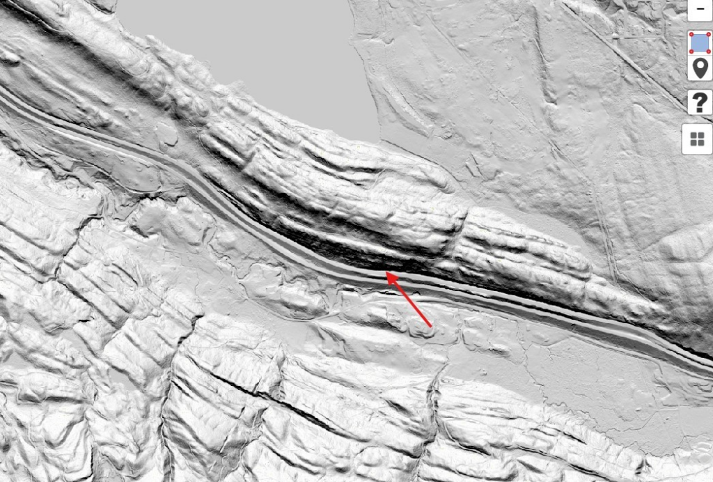
The geologic context for the rockfall is that this section of I-5 was cut into the south side of a steep ridge of Miocene Chuckanut Formation, a thick deposit of freshwater sandstones interbedded with thinner shales and coal beds. As a local Geotech geologist, Dan McShane notes in his blog site, the sandstone in this area is steeply dipping away from the freeway, but prominent joint sets in the sandstone beds (presumably related to their tortuous folding) cause the roadcuts along this section to be particularly susceptible to rockfall failures. Smaller rockfalls along this stretch caused the DOT to cut the slope back from the freeway to create a rockfall collection zone. Lidar from the Washington DNR lidar portal shows the near-vertical, north-dipping bedding in the bedrock well (red arrow shows approximate location of the slide):-
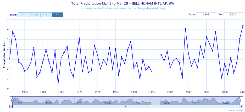
A local meteorology prof at University of Washington noted that this March was the wettest March on record (since before the freeway was built) in Bellingham, which almost certainly contributed to the failure:
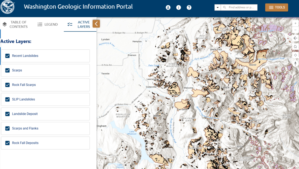
Although this particular slide-prone area was largely created by the freeway construction, the Chuckanut Formation has been the source of thousands of historic and prehistoric landslides in the area, including some truly massive valley-blocking landslides further to the east in the Cascade foothills (e.g. https://www.flickr.com/photos/wastatednr/51148697281/). The shear number of landslides in the county is truly impressive (many involving the Chuckanut Formation):