
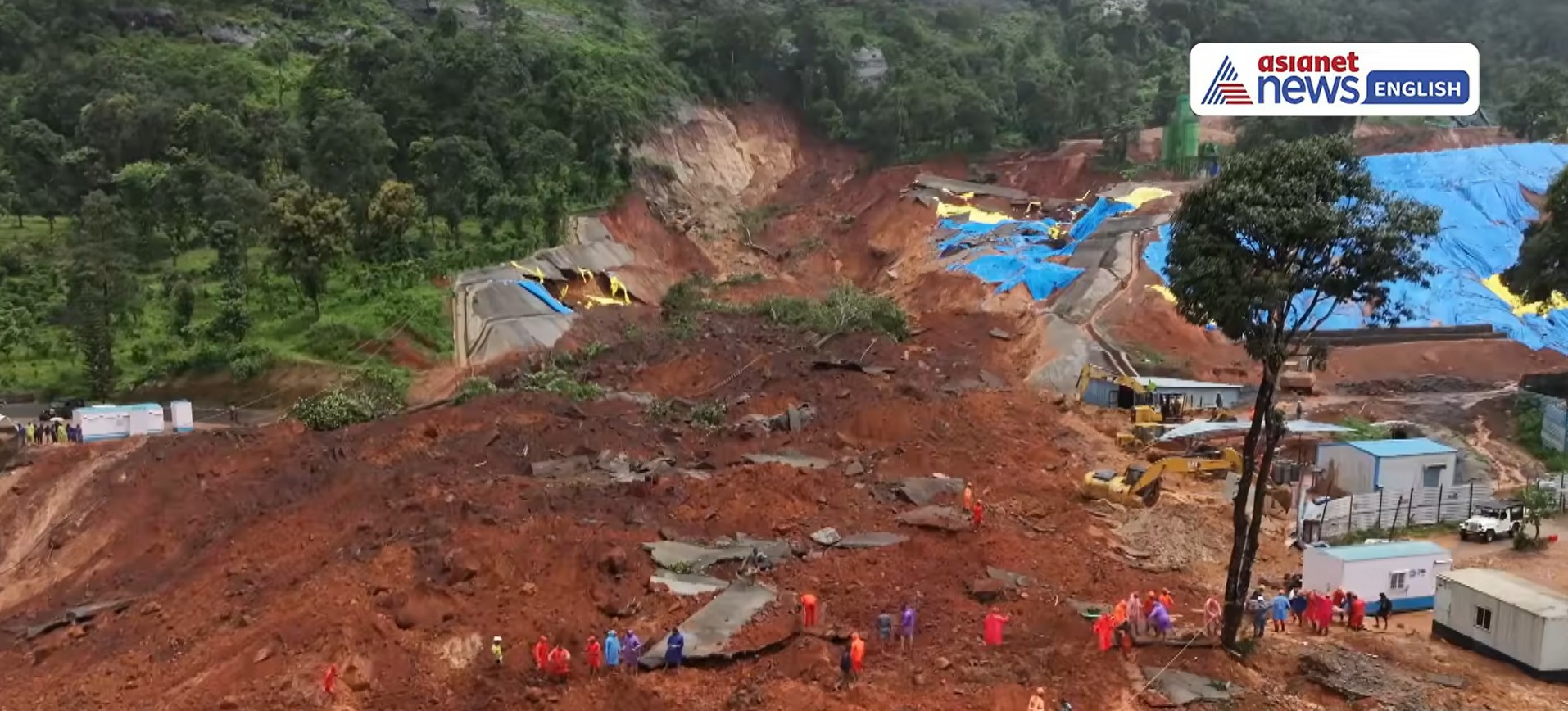
A major landslide triggered by monsoon rainfall killed eight people this week. The failure occurred at the site of works for a new road tunnel – there is speculation that poor handling of excavated materials may have been the cause. Imagery suggests that the event might have been slightly more complex, though.
On 7 July 2026, the Kalladi landslide was triggered by heavy rainfall in Wayanad District, Kerala, India. Eight people were killed and ten were injured in a landslide that has attracted considerable attention in India and beyond.
The site of the landslide was the construction site for a major road tunnel project, known as the Wayanad Tunnel or the Anakkampoyil-Kalladi-Meppadi tunnel road (a variety of other names are also used).
The landslide was caught on an extraordinary, dramatic video that is on Youtube:-
The video shows some very lucky escapes, and probably some who were less fortunate. It also shows that the landslide occurred during heavy rainfall and that it was very mobile.
The location of the landslide was [11.52184, 76.13315]. Interestingly, Google Maps has this image of the site before the failure, collected in April of this year:-
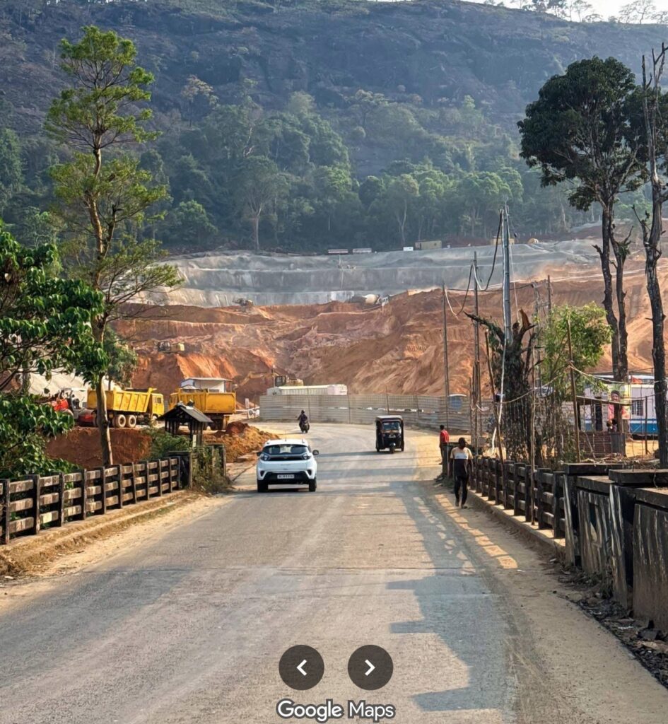
Note the reinforced (shotcrete?) wall in the background, with forest on the slopes above, and the large volume of dumped, loose material in the middle distance.
Youtube also has a drone video of the aftermath of the landslide:-
In the media there has been a great deal of speculation that this landslide was caused by poor management of excavated material – in effect, that this is a fill slope type failure. Indeed, the Deccan Herald has this quote:-
“Kerala Minister T Siddique on Tuesday said the incident at the Kalladi tunnel project site was not a natural landslide but a ‘man-made landslide’ caused by the unscientific dumping of excavated earth.”
I do not dispute the notion that this was a manmade disaster, nor that poor management of excavated soil played a role by contributing liquefiable material into the landslide. But I also find this still from the video quite interesting:-
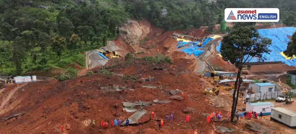
The remains of the shotcrete wall can be seen on either side of the landslide scar, and pieces of the wall are visible in the debris too. But the crown of the landslide appears to extend beyond the site of the wall, with a planar surface on the left side of the scar. There is also some possible evidence of rotation on the right side of the scar.
I wonder therefore whether this is actually a failure in the slope behind the shotcrete wall perhaps caused by the build up of pore pressure due to poor drainage? The failure of this portion of slope may then have created an undrained loading situation on the excavated materials, driving liquefaction and the high mobility landslide.
The Kalladi landslide needs a proper, forensic investigation – I am only speculating – and once again lessons need to be learnt. I have highlighted on numerous occasions that too many infrastructure projects in the mountains of India involve grossly inadequate slope management.