
Overview:
Satellite and terrestrial images are casting light on the Shovi landslide in Georgia.
The Landslide Blog is written by Dave Petley, who is widely recognized as a world leader in the study and management of landslides.

More information is becoming available about the catastrophic 3 August 2023 Shovi landslide in Georgia. Note that whilst many reports indicated that it occurred on 4 August, the previous day now seems to be the correct date. The National Environment Agency of Georgia has posted an initial report about the event online via its Facebook page. The report can be downloaded as a PDF. It is in Georgian, but Google Translate works well. This is a key section from the report, automatically translated:
“On the basis of the field research carried out in the valley, it was established that west of the Buba glacier, there was a collapse of a rocky mass, which, after coming into motion, collided with the glacier, causing the collapse of a certain part of it, which may have led to the overflow of subglacial waters, after which the resulting flow began to move at a high speed in the bed of the valley.“
It strongly supports the hypothesis outlined by Dan Shugar, which I built upon in my earlier post about this landslide.
Meanwhile, the Mazar blog has posted an article about this landslide, including high resolution imagery of the site. Dan Shugar has tweeted some of the images, which are slightly affected by cloud:-
At the moment, the images that have been posted online do not seem to include the all important source area, but this may come with time.
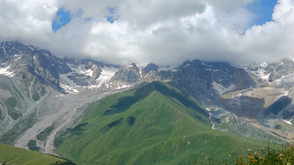
Meanwhile, I was contacted by Heidi Declercq, who was in the area at the time of the landslide, and is indeed still there at the time of writing. Heidi has kindly provided some images that she took of the site, about 90 minutes after the disaster occurred. She has kindly agreed that I can post them here.
The image below shows a panorama of the area, providing an insight into the nature of the terrain. The landslide occurred in the valley on the right side of the image:-

This second image, a zoom in on the first, provides more detail of the landslide itself, again in the valley on the right side:
The images show the emergence of the landslide at the head of the valley (the source is hidden from view), and the spread of the flow, plus entrainment of glacial debris from the valley floor. At the bottom right of the image, the likely transition point from rock avalanche to debris flow is captured. These are remarkable images, so thank you to Heidi.
Meanwhile, the confirmed number of fatalities in the landslide is now 21, with a further 12 people still missing. Recovery operations continue.