The Landslide Blog is written by Dave Petley, who is widely recognized as a world leader in the study and management of landslides.

It is unsurprising that the news cycle has mostly moved on from the 3 April 2024 Hualien earthquake in Taiwan. On the ground, activity continues to deal with the aftermath of the many landslides triggered by the earthquake, with a particular focus on Taroko National Park. The road through the gorge, Highway 8, which links the east and west costs of Taiwan, remains closed and is likely to remain in that state until at least July.
Meanwhile, operations continue to recover the remains of the last two victims of the landslides. The people involved were a Singaporean couple who were residents of Australia, Neo Siew Choo and Sim Hwee Kok, who were hiking on the beautiful Shakadang Trail in Taroko National Park when the earthquake struck. They were seen on the trail prior to the earthquake, so it is assumed that they were struck by a landslide somewhere on the path. The situation is devastating for the families of those lost.
I have taken a look at the Planet Labs imagery from the site. This is an image that was collected on 11 April 2024:-
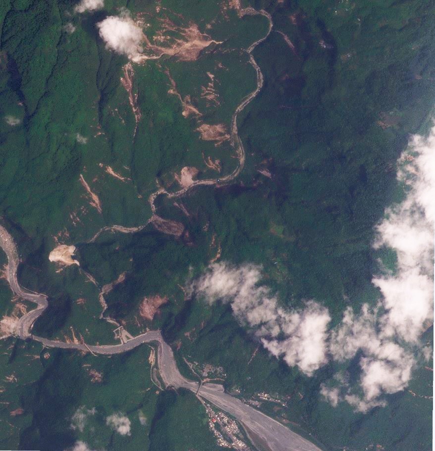
The main Liwu River through Taroko runs from the west of the image towards the south east. The Shakadang Trail is in the valley that joins the main channel from the north, running approximately north-south through the image. There is a series of large landslides in this area – note for example the large landslide in the centre left of the image.
This the same area, captured in a Planet Labs image of 17 April 2024:-
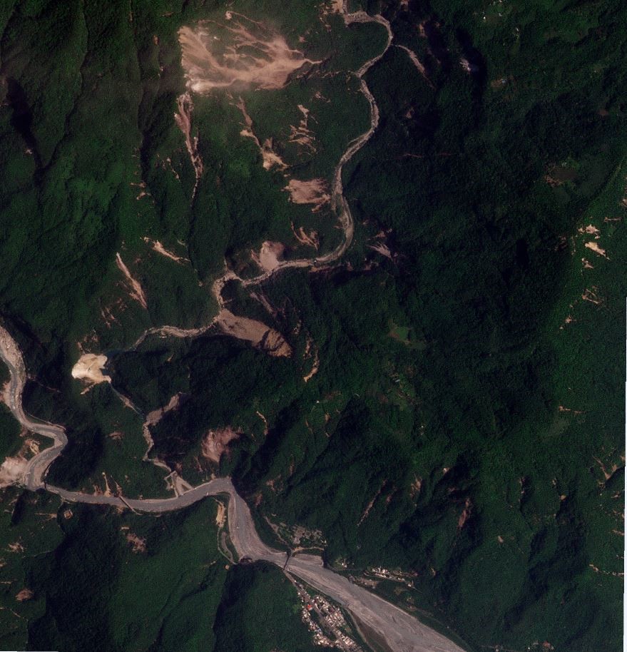
The landslide complex in the north of the image shows active rockfall activity, including the generation of a cloud of dust. But note also the landslide in the centre left of the image, which has clearly further developed.
The images illustrate the perils of the recovery operations. The landslides remain highly active, in part driven by the energetic aftershock sequence. The area has also suffered recent rainfall, which will also have had an effect. These rockslides are likely to involve many large boulders, which will only be movable with heavy equipment and/or with blasting. Such operations along the Shakadang Trail will be very challenging given the terrain.
Meanwhile, the earthquake has sadly claimed another victim. A 17 year old student has died from head injuries that he received when he was struck by a rock in Taroko Gorge. At the time of the earthquake he was en route to work in one of the hotels.
Reference
Planet Team (2024). Planet Application Program Interface: In Space for Life on Earth. San Francisco, CA. https://www.planet.com/